
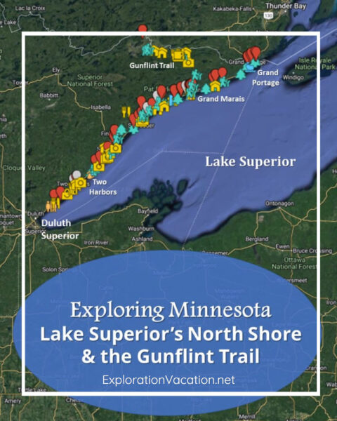
The North Shore is Minnesota’s most spectacular landscape. Further inland, the Gunflint Trail offers gorgeous lakes and hiking trails at the edge of the Boundary Waters wilderness area.
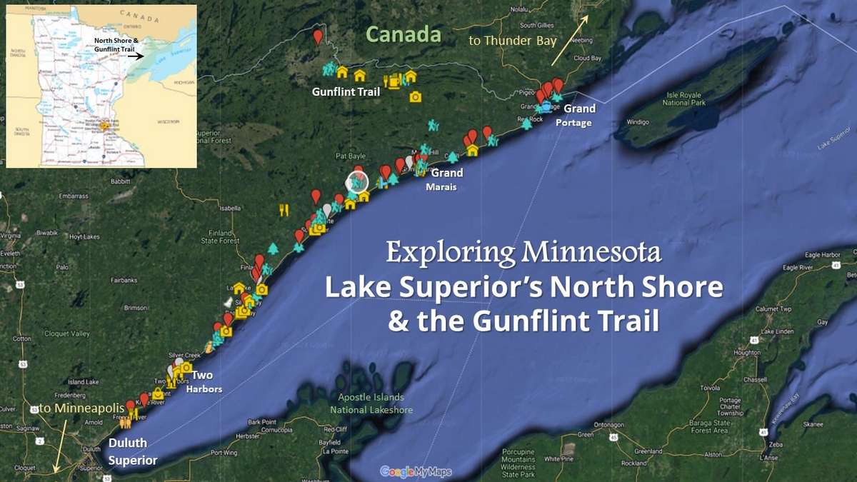
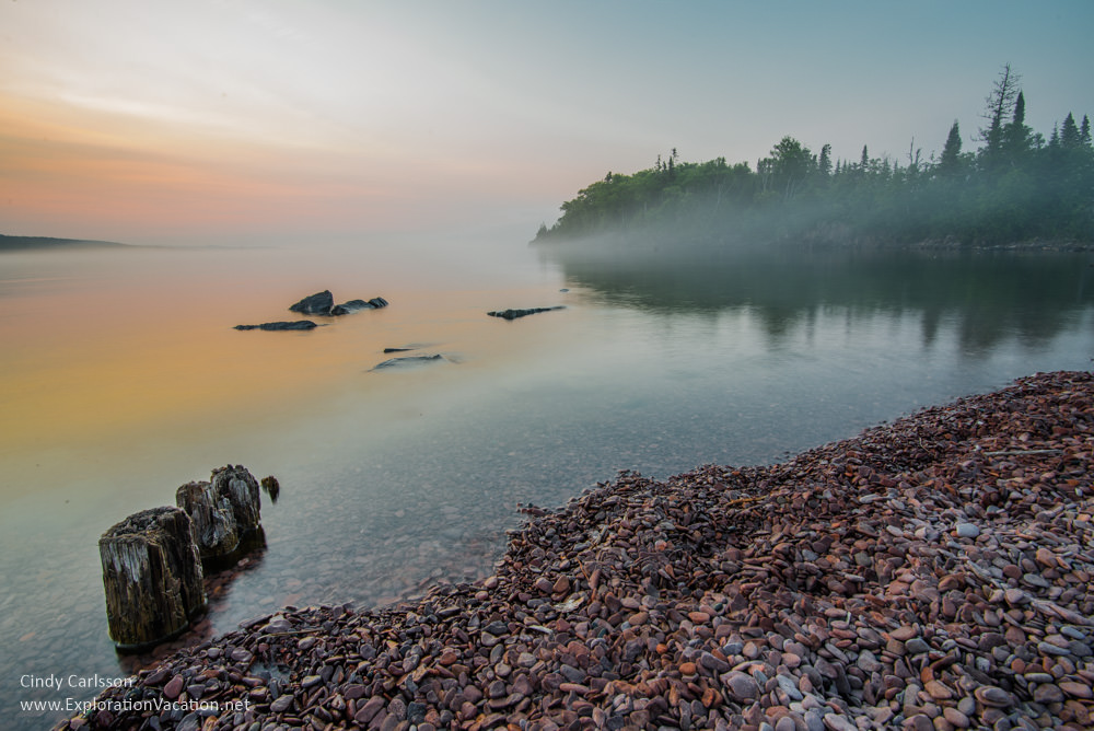
The easternmost part of Minnesota snuggles between the north shore of Lake Superior, the Boundary Waters Canoe Area, and Canada. It’s an area of dramatic cliffs, rocky beaches, pine-covered hills, clear lakes, and stunning vistas.
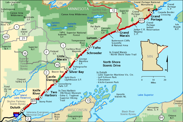
State highway 61 is a Scenic Byway and the main route through the region, with small cities, state parks, and tourist services along the route as it winds north from Duluth along Lake Superior to the Canadian border.
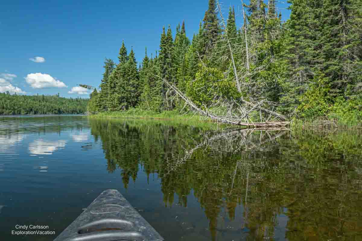
Inland, the Gunflint Trail leads through wetlands and atmospheric lakes to the watery wilderness of the Boundary Waters Canoe Area.
Although most visitors come during summer and fall, the North Shore is popular for outdoor activities throughout the year. For example, mushers and spectators alike come for the John Beargrease Sled Dog Marathon in the depth of winter.

Cyclists will find a mix of scenic trails, including sections of the paved Gitchi-gami Trail. There’s more on biking below.
And hikers can spend days exploring Minnesota one foot at a time on the Superior Hiking Trail
The following guide to exploring Minnesota’s North Shore and the Gunflint Trail lists things to do and see along the route. It includes favorite sights along the route, as well as a few spots to eat, drink, and shop.
Exploring Duluth
Duluth might be Minnesota’s favorite summer weekend get-away.
Minnesota’s largest northern city and a busy international port, this popular tourist destination was once a rather dreary industrial city. While it retains an active port and related industrial activity, Duluth also boasts amenities that draw hordes of tourists during the summer and fall.
While many visitors are content to wander canal park and watch the ships pass under the lift bridge, there is a lot of history, art, and culture for those looking for more to do.
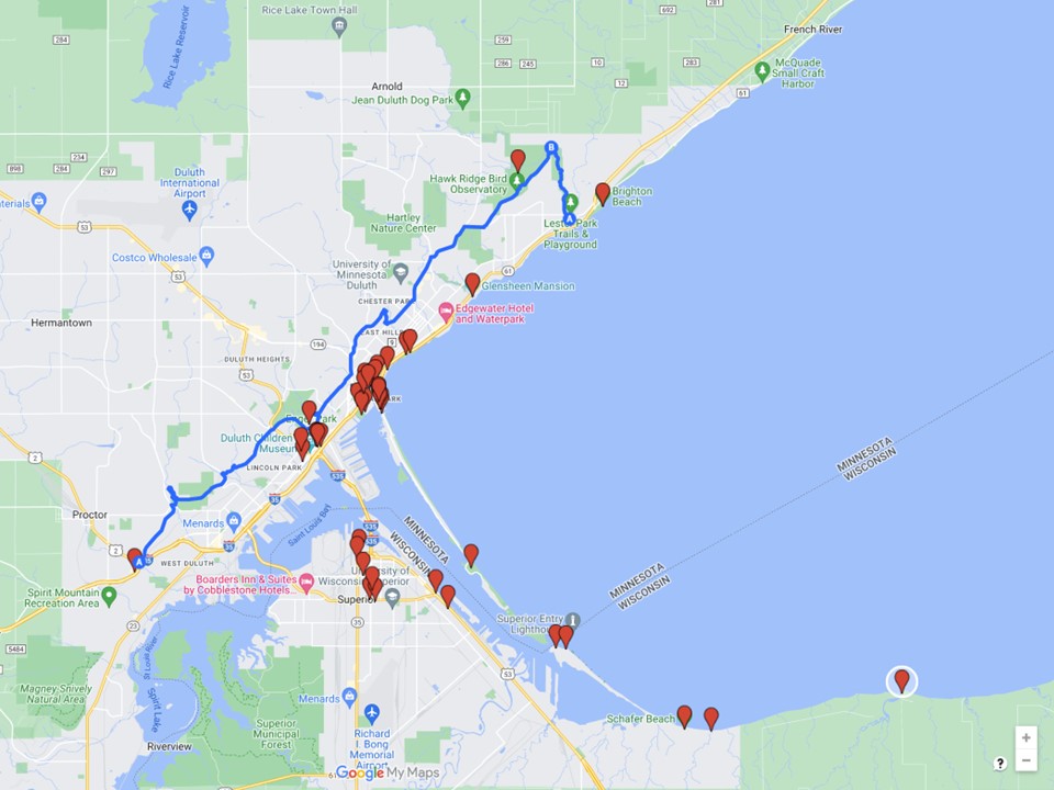
Click here or on the map to go to ExplorationVacation’s interactive Google planning map
Keep reading to find out more about all you can do in Duluth!
Show more to explore in Duluth
Canal Park and the Lakewalk
When Duluth was booming, the area that is now Canal Park was filled with warehouses and other industrial infrastructure. Once a wealthy city, by the 1970s many of Duluth’s most important industries had closed and the area around the harbor was pretty desolate – actually, the whole city was rather desolate, with a declining economy and what looked to be a bleak future.
All that began to change in the 1980s, when the city started reclaiming the waterfront as an entertainment district. An entertainment and convention center (the DECC) was built along one end of the lakefront. More importantly, antique shops, bars, and restaurants began to locate in Canal Park.
At the same time, the city began work on the Lakewalk – the 4.2mile walking/biking/skating path along the shoreline from the DECC, through Canal Park, past the Fitger’s brewing complex (now housing a brewpub, restaurants, and shops), through Leif Erikson Park and on into the rose garden.

This green strip along the shoreline provides easy access to all of the city’s lakeshore amenities, but it also the perfect place to wander and watch the lake.
Bayfront Park, the Great Lakes Aquarium and the DECC
Bayfront Festival Park marks the southern end of the lakefront entertainment district. Largely an open area with a large permanent stage, the park is home to events throughout the year. The park is often used for outdoor concerts and music events (including the long-running Bayfront Blues Festival), athletic events, and the brightly lit Bentleyville Christmas display (be prepared for loud obnoxious music when the link opens). There isn’t a better place to take in a show on a lovely day.

The Great Lakes Aquarium features exhibits on watery habitats nearby (Isle Royal and the Baptism and St. Louis Rivers) and around the world (the Amazon), along with art exhibits and various other educational offerings. I haven’t been here, so don’t have any first-hand information on the aquarium or its programs.
The DECC is simply a convention center like many other convention centers. It hosts conferences, concerts, and events of all sizes and is the main venue for big name entertainment in the city. It’s a bit of a hike from the DECC to either Canal Park or downtown, although a skyway connection allows visitors to comfortably reach downtown hotels and restaurants no matter what the weather. There are no restaurants or hotels at the DECC itself.
Canal Park
Canal Park, located at along the shipping canal at the foot of the aerial lift bridge, is the heart of the waterfront area. This is where most of the city’s hotels, restaurants, and tourist shopping can be found. It’s also the place to go to watch the ships (called Lakers) enter and exit the port.
Recommended spots for shopping along Canal Park include the shops of the Dewitt-Seitz building (including art galleries, a women’s clothing store, a cooking and cookware shop, and the smoked meats and fish of Northern Waters Smokehaus), the Duluth Pack store, and Siiviis (formerly and generally still referred to as Sivertson Gallery just like their Grand Marais gallery). There is also a nice antique mall.
There are a number of restaurants in the area, all are fine. Stop for lunch (or goodies for the road) at Northern Waters. Grandma’s may not have the most exciting food in town, but it has a patio in back (not always open) that overlooks the canal and lift bridge, while Angie’s patio has views across Canal Park. Vikre Distillery by the bridge has wonderful concoctions and a lovely appetizer platter.
Aerial Lift Bridge and Shipping Canal
Duluth’s Aerial Lift Bridge is a city icon. In operation since 1905, the bridge provides land access to the spit of land known as Park Point without impeding ship traffic through the canal that connects the harbor to the rest of the world. Watching giant ships (called Lakers) move through the canal below the upraised bridge is probably the number one tourist activity in Duluth. (You can find out what ships will be coming through the canal, and when, by checking the regularly published schedules.)

Visitors can also walk out to the light that marks the canal entrance.
Lake Superior Maritime Visitor Center
Located in Canal Park right by the Lift Bridge, the Lake Superior Maritime Visitor Center has exhibits that tell the story of shipping on Lake Superior.
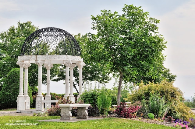
Leif Ericson Park and the Rose Garden
The Interstate highway through Duluth was one of the last pieces of the national highway system built anywhere in the country. That means it was constructed at a time when people were beginning to recognize the destructive impact of urban freeways on the surrounding community. In order to address some of these concerns, a portion of the freeway was capped and public gardens were created literally on top of the freeway.
This is Lief Ericson Park, where the wonderful gardens that overlook Lake Superior are definitely worth a stop.
Harbor cruises
If you really want to see Duluth, take a cruise tour that includes a tour of the working harbor.

The Vista Fleet offers a variety of cruises that provide an introduction to the city and its history. All provide a relaxing time out on the water.
Park Point
The Ariel Lift Bridge connects the seven-mile spit known as Park Point (its official name is Minnesota Point) to Canal Park and the rest of the city.
Park Point is largely a residential neighborhood, although today a couple of hotels have been added to the mix. The peninsula used to be lined with the tiny homes and shacks of working fisherman; today most of those original buildings are gone, first replaced simply by larger homes and then by even larger homes – some of which may serve only as summer cottages. Despite this shift, the area retains a bit of the feeling of Cape Cod, with plenty of cedar shakes and water visible on all sides.
There’s an airport at the end of the point, but there is also a large grassy park sprawling across the peninsula. It’s a popular place to swim and play even if the peninsula’s beaches extend far beyond the park, wrapping around six miles of shoreline.

A number of annual events are held on Park Point, including a spring garage sale and summer art show.
Visitors to Park Point should allow plenty of extra time, as it is possible to get “bridged” at any time as the Ariel Lift Bridge is raised to allow traffic through the canal and traffic backs up in both directions.
Downtown Duluth
Although still a bit down-at-the-heels, visitors who neglect to make the short trek up the hill to downtown Duluth are missing some great restaurants, galleries, and lots of grand historic architecture. Much of the downtown core is designated as a historic district, but little information of use to tourists seems to be available. (Duluth seems ambivalent about its trove of historic buildings. Little is done to highlight their existence and periodically one is lost to fire or simple neglect.) Unlike the city’s building stock, the city’s restaurant scene is pretty dynamic, with new restaurants regularly bursting onto the downtown scene even if they don’t always stick around very long. Downtown restaurants cover the full range, from dive bars and pubs to casual spots like Pizza Lucé to fancy upscale spots.
(For those of you who haven’t visited downtown in the past few years, it’s worth noting that the head shop is finally gone and the atmosphere downtown has improved accordingly.)
The Depot
The restored Depot is now a museum housing several exhibitions at any given time. Permanent residents include the Lake Superior Railroad Museum, Duluth Art Institute, and the Saint Louis County Historical Society.

Galleries and Shopping
The retail scene downtown has struggled for years (at least a generation), but there are some shops and galleries worth searching out. Among my favorite is Lizzards Galley, which always has a wonderful selection of art and high-end craft by local artists.
Skyline Parkway
The Skyline Parkway Scenic Byway snakes along the hillsides above Duluth. The road began to take shape as a scenic highway in 1889 and, although sections run through rather ordinary urban development, much of it runs along parks and a ridgeline that offers stunning views of the city and lake beyond. The northeastern end connects to/becomes pretty little Seven Bridges Road.
Thompson Hill Rest Area
Visitors coming from the greater MSP area can begin their tour of Skyline Parkway right off the freeway at the Thompson Hill Rest Area. Besides being a great spot to pick up maps and tourist information, the patio behind the rest area provides a good view over the city.
Enger Park
Enger Park sits on a hill above the city, which means it offers great views over the entire harbor. But if the view from the ground isn’t enough, the five-story tower that has stood on the site since 1939 offers an even more dramatic view.
Long a rather desolate spot, Enger Park today has a beautiful public garden with lots of flowers and a small Japanese garden with a peace bell from Japan.
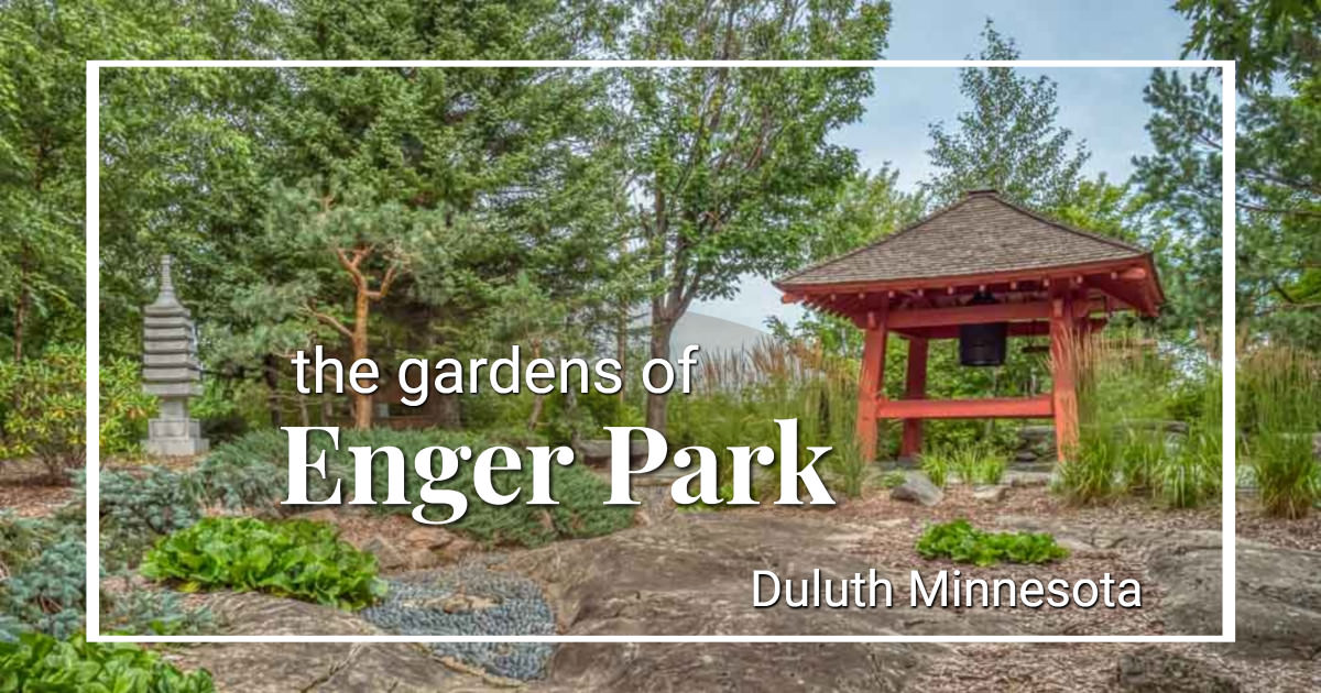
Discover the gardens of Enger Park
Hawk Ridge
Located just off Skyline Parkway, Hawk Ridge is a great spot for birders – especially in spring and fall when hundreds or even thousands of birds pass overhead each day. Various events and activities are scheduled throughout the year, but visitors are welcome any time. And there’s a good view over the city even when there aren’t many birds around.
Seven Bridges Road
At Amity Park, Skyline Parkway becomes the Seven Bridges Road. This historic route (with fully restored bridges) crosses back and forth over the cascades along Amity Creek for about 5 miles. It is a scenic, little-traveled route with a couple of spots where hiking trails connect with the road to make it perfect for exploring.
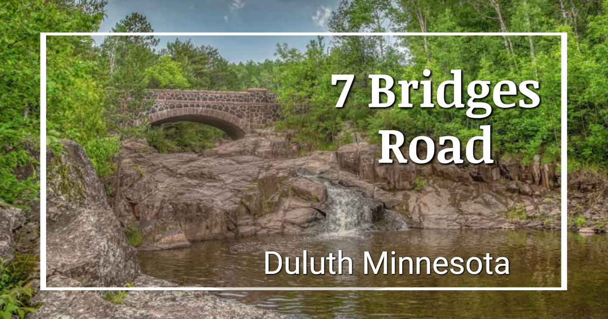
Ahead of the storm on Seven Bridges Road
Lincoln Park
Lincoln Park is an old Duluth neighborhood that fell on hard times. Today it is being revitalized as a hip spot with local shops, Bent Paddle Brewery, arts, and new residential options.
Tweed Museum
The Tweed Museum of Art at the University of Minnesota in Duluth is another spot that has been on my must-visit list for some time without my actually getting there. The museum has a collection of over 9,000 objects and puts on special exhibits that generally look fabulous.
Glensheen Mansion
I last visited the Glensheen Estate, the home of Duluth’s uber-wealthy Congdon family, years and years ago. It was an interesting enough house museum, but in those days most visitors were there to see a murder scene that docents were prohibited from mentioning. Things have changed over time.
In the aftermath of a multi-million dollar renovation, a new series of tours allows visitors to see the house from every vantage point and to peek into every room.

While the mansion is still a spectacular example of how the one percent of 1908 lived, the home’s 39 rooms and surrounding gardens are used to paint a more complete picture of that time in history. And the infamous 1977 murders are no longer a deep dark secret within the house.
Show Less
Superior, Wisconsin
Just in case there isn’t enough going on in Duluth to keep you busy, remember that there is another whole city on the other side of the harbor. I haven’t spent a lot of time as a tourist in Superior over the years, but can heartily recommend the pizza and beer at Thirsty Pagan Brewing.
Exploring Lake Superior’s North Shore
Once you leave Brighton Beach, you’re really on the North Shore.
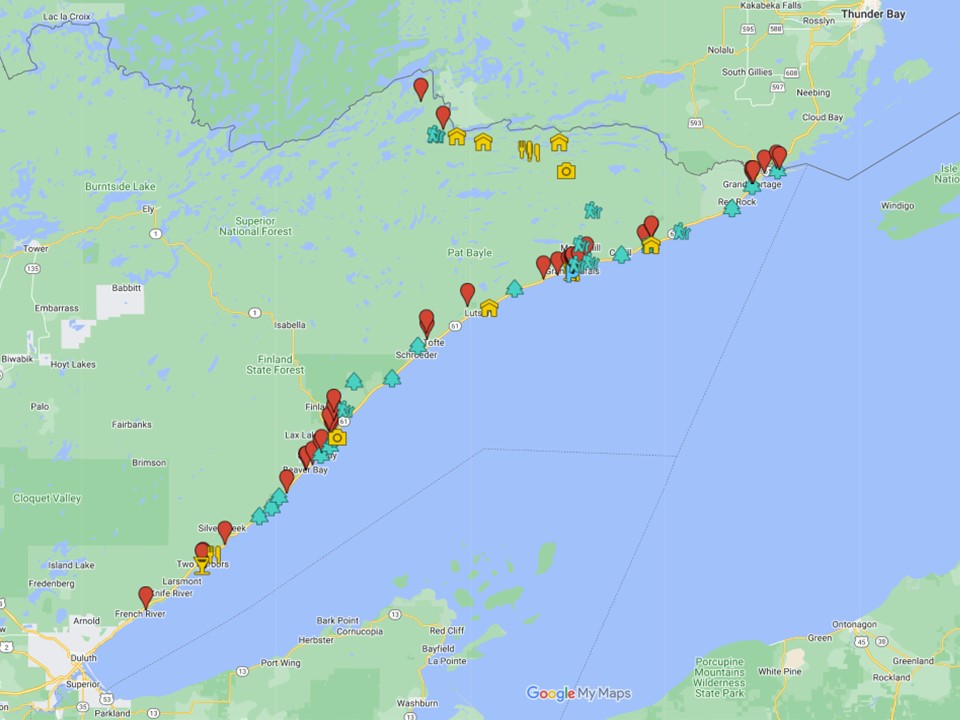
Click here or on the map to go to ExplorationVacation’s interactive Google planning map
Between Duluth and Two Harbors
As you leave Duluth you’ll come to Brighton Beach.
If you aren’t stopping the beach (which now has very limited access), you have a choice to make: take the old (two-lane) road along the shoreline or the new (four-lane) bypass inland. Sure, the bypass lets you zip up to Two Harbors in no time at all (and there aren’t significant attractions along the old section of road), but why are you up here anyway? Isn’t it to relax and enjoy the lake? This is place to start!
There are a few cafés and restaurants along the way, including the deservedly popular New Scenic Café, but mostly it is just a nice drive along the lake.
McQuade Small Craft Harbor
If you need a restroom break on your way out of or into Duluth, McQuade is a good stop. Clean, modern restrooms at one end of a large parking lot.
Water access is below the highway, so you can easily get there without having to cross a busy highway.
French River Wayside
This is a big pull-out above a long gravel beach that’s said to be good for swimming. (Keep in mind that Lake Superior is almost never warm.) But, even if you don’t get in the water, it’s a good spot to see a lot of water!
Stoney Point
If you want to extend your drive, take the (short) detour along Stoney Point Road. Along the way, stop to check out the fish shacks or hike out to the beach to watch the waves.
When you get to the point, keep an eye out for surfers when the waves are up.
The Scandinavian shop
Officially the studio and gallery of B E Nelson Design (Facebook link), featuring the artist’s handmade Nordic jewelry, accessories, and a variety of other items. Google’s directions aren’t great, but you’ll see it, as it is an very old-fashioned Nordic building. It’s well worth a quick stop to check out the building and see what’s for sale in the shop — the merchandise is as interesting as the building.
Two Harbors to Silver Bay
The next section of the route includes a number of attractions, the first of which are found right in Two Harbors. Farther along you’ll find Gooseberry and Split Rock, a couple of the state’s most popular state parks.
Show more to explore from Two Harbors to Silver Bay
Two Harbors
As indicated by its name, there are two harbors within the city. Actually, these harbors once anchored two separate communities (Agate Bay and Burlington) that became one in 1907.
Get off Highway 61 to discover a historic – and still functioning – lighthouse here too. When you are finally ready to turn your back to the lake, there is a traditional little downtown with a few nice shops just waiting for you to visit. (There are also shops along the highway.) Two Harbors has plenty of restaurants and cafés too, including an outpost of the small northern Minnesota chain Blackwoods.
Castle Danger Brewing
Truly local beer is now available in town too, now that Castle Danger Brewing has a taproom in town. We haven’t gotten there yet, but apparently the lakeside taproom provides chips and salsa to accompany their line of beers and the view. Food is can also be brought in from local restaurants.
Two Harbors lighthouse and museum
The red brick lighthouse in Two Harbors is the oldest continually working lighthouse on Minnesota’s north shore. (This implies there is an older one still operating in Canada, but I can’t figure out which one that would be. If you know, leave a note in the comments.) Today the Lake County Historical Society runs the lighthouse as a bed and breakfast, with volunteers responsible for maintaining the facility and its light. (The light itself is operated remotely from Duluth.) Three of the lighthouse buildings (including the light tower) are open for tours, but the main house is only open to overnight guests.
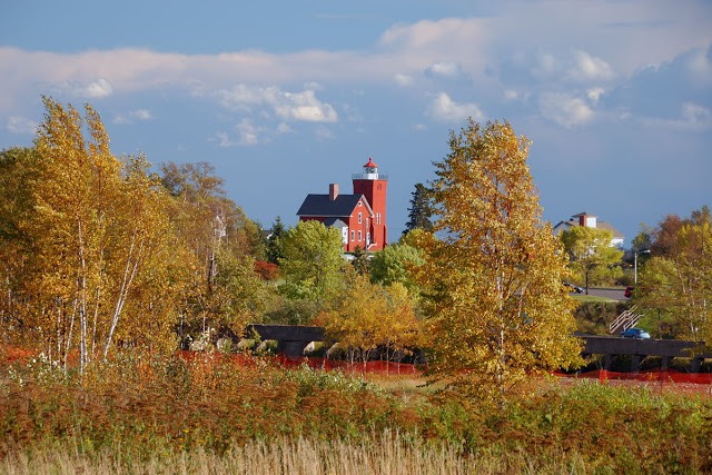
The beach below the lighthouse is perfect for walking and gawking even if you don’t visit the lighthouse itself.
The Edna G. Tugboat
The Lake County Historical Society as operates the Edna G. Tugboat museum. This was the last coal-fired steam tug on Lake Superior. It was built in 1896 and retired in 1981 after serving all but two years of that time in Two Harbors. The tugboat is listed on the National Register of Historic Places and is open for tours – or may be open for tours. She’s in rough shape and it’s unclear how long she’ll be afloat, let alone open for tours.
Watch the ships dock at Agate Bay
The Agate Bay harbor is a great place to watch a 1000 foot laker maneuver into what seems like an impossibly tiny area to load up with taconite pellets. (an ore ship that operates within the Great Lakes; salties are sea-going vessels and you’ll see far fewer of those here.) Just walk down to the breakwater for a great view. You might have to wait awhile though, while ships come in here regularly, they don’t come in very frequently.
Want to see if there are any ships in the harbor or headed that way before you arrive? As is true of the Duluth/Superior harbor, several websites offer that info. The Lake Country Chamber has a link to several of them on their Ship Watching page.
Flood Bay State Wayside
The Flood Bay wayside has a great beach for walking and marshy areas for bird watching. There’s a parking area and pit toilet, but not much else in the way of infrastructure.
Silver Creek Cliff
Highway 61 has always been scenic; it used to be a little harrowing as well, with tight curves and steep drop-offs that many drivers found intimidating. One of the most harrowing – and difficult to maintain – sections was along Silver Cliff. In 1994 that changed when a 1,344-foot tunnel through the cliff was opened to traffic.

The section of highway abandoned when the tunnel was completed is now part of the Gitchi Gami State Trail. This section trail offers pedestrians and bicyclists the incredible views that drivers on the old road had little opportunity to enjoy as they navigated the curves and fallen rock. There is a parking lot on the south side of the bridge that can be accessed by northbound traffic. To the north, the Silver Creek Cliff Wayside provides access to the parking area from either direction.
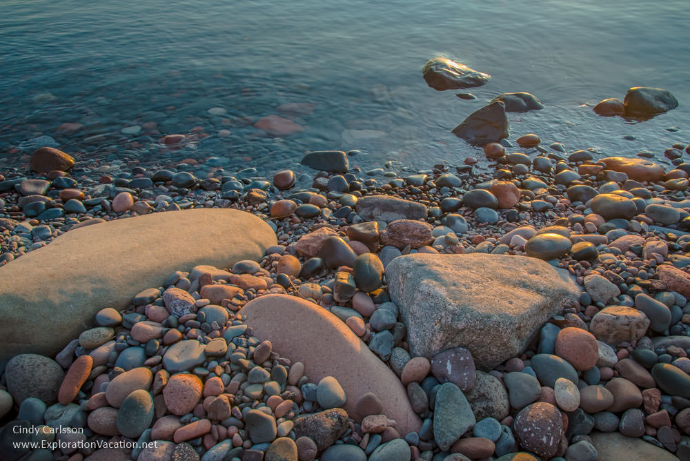
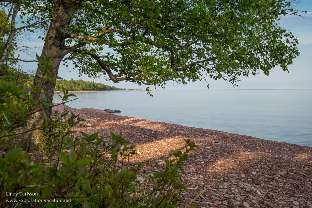
Iona’s Beach Scientific and Natural Area
Iona’s Beach Scientific and Natural Area has a wooded area with lots of native plants, but it’s best known for it’s long pink stone beach.

Access the area from the Silver Creek boat launch. The upper trail runs through the woods to Iona’s Beach. The lower trail gets there via another beach.
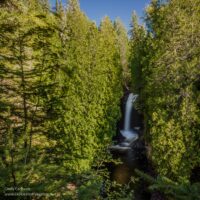
Gooseberry Falls State Park
One of Minnesota’s favorite parks, Gooseberry Falls State Park is wonderful in every season. There are easy walking paths circling the lower and middle falls, along with a path to the upper falls. The falls are also lovely in early and late winter, but trails are slippery.

There is a large visitor center near the falls. The rest of the park has lots of hiking trails, lake views, and wildlife. It is a great spot to camp.
- Gooseberry’s Upper Falls (2012)
- Early spring at Gooseberry Falls (2012)
- Spring Thaw at Gooseberry Falls (2010)
- Gooseberry Falls (2007)
Split Rock Lighthouse State Park
Split Rock State Park has a gorgeous location along Lake Superior with plenty of trails, but the real draw is the historic Split Rock Lighthouse. The park itself is open year-round, although the lighthouse itself is only open for tours during the summer and early fall. The visitor center has a very large shop and sponsors photo exhibits through the summer.
Split Rock Lighthouse overlook
This used to be a great spot to get a view of the lighthouse in the distance. However, as the trees and underbrush have grown, there’s now just one small area that still offers a view of the lighthouse. But it’s a good view.
Pebble Beach
If you want a nice pebble beach and views of the lighthouse from below, this is your spot. It’s an easy enough hike down the hill through the woods, but you do have to hike back up again.
Split Rock Lighthouse
The historic Split Rock lighthouse operated between 1910 and 1969. Today it is a museum run by the Minnesota Historical Society. It’s only open for tours in summer and early fall.
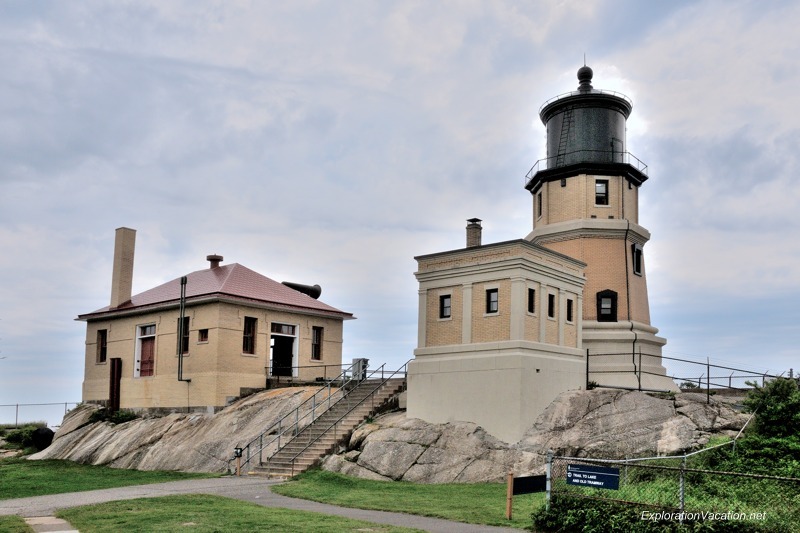
The lighthouse beacon is lit on November 10th of each year to commemorate the 29 lives lost on the Edmund Fitzgerald in 1975.
Beaver Bay
Beaver Bay is the oldest settlement on the North Shore. It’s a tiny town (with a population of 181), but there are tourist facilities here.
Beaver Bay Agate Shop
You’ll find rock shops here and there as you travel along the Lake Superior’s North Shore, but my favorite is the Beaver Bay Agate Shop. It’s very large, offers both local and international stone and stone items (and much more than just agates), and has a friendly and knowledgeable owner.
Beaver River Waterfall
The Beaver River tumbles below Highway 61 in Beaver Bay, with the falls clearly visible from the west side of the road.

Just south of the river, a parking area has a trail that goes down to the river. But the best view is from the bridge.
Show Less
Silver Bay to Grand Marais
Continuing north, there aren’t many places to stop along the road and enjoy a view of Lake Superior, but there are plenty of parks, so plan to settle in for a while!
Along the way, large resorts like Bluefin Bay and Lutsen and small towns like Tofte and Schroeder offer travelers a variety of services and dining options.
Show more to explore from Silver Bay to Grand Marais
Silver Bay
Silver Bay is a mining town, with limited options for tourists. There is an AmericInn near the Black Beach and a small motel in town. There is also basic lodging and camping just off County Highway 11 at the Lax Lake Resort. Watch for deer if you head inland here, as the town is filled with them.
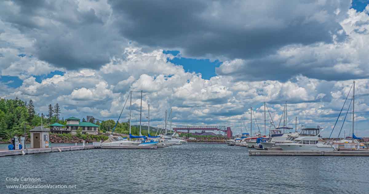
Silver Bay Marina
With its rocky coastline, the Minnesota section of Lake Superior’s North Shore has very few harbors suitable for small boats. In order to provide additional harbors, the state and U.S Corps of Engineers developed a harbor of refuge/marina program for the North Shore. The Silver Bay Marina was the first of these harbors. Located south of the city of Silver Bay, the marina offers a range of services for boaters. It also has a large public picnic area with a few facilities designed for fishermen using the public water access at one end of the site.
But most of the rest is now privately operated and not open to the public. That means no more public access to the area along the dramatic breakwater.

Sorry, but you can’t get this view from the marina anymore unless you have a boat in the Silver Bay Marina.
This is also the site of the 1905 wreck of the steamship Hesper, the remains of which still lie in 30-50 feet of water near the jetty.
Black Beach
For years at taconite processing plant dumped iron ore tailings into Lake Superior just outside Silver Bay. Over time, those tailings turned a nearby beach slate gray. Today the water is clean and cold, the surrounding cliffs are rugged and colorful, and dark beach is big. It’s a gorgeous spot for a picnic or even a dip in the lake on a really, really hot day.

Black Beach is unnaturally beautiful.
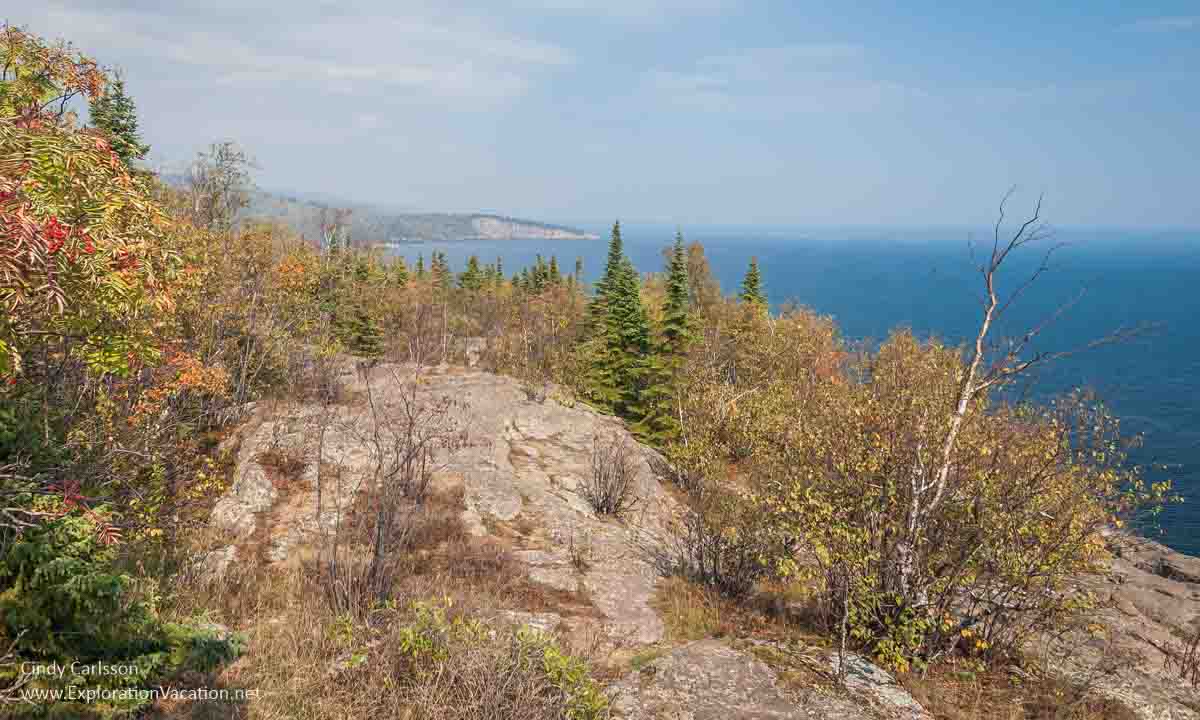
Palisade Head
Technically part of Tettegouche State Park, Palisade Head is a rocky outcrop high above Lake Superior. It has steep cliffs and rocky meadows – on windy days you can feel the spray from the waves crashing against the cliff more than 300 feet below. The first time I visited here we ran across the meadow singing songs from “The Sound of Music” – it’s that kind of place. On other visits, we’ve picked the sweetest (and tiniest) blueberries.
The view over the lake is spectacular here too, with beautiful views of nearby Shovel Point in Tettegouche State Park.
This was the view from our blueberry-picking spot! (That’s Shovel Point in the distance.)
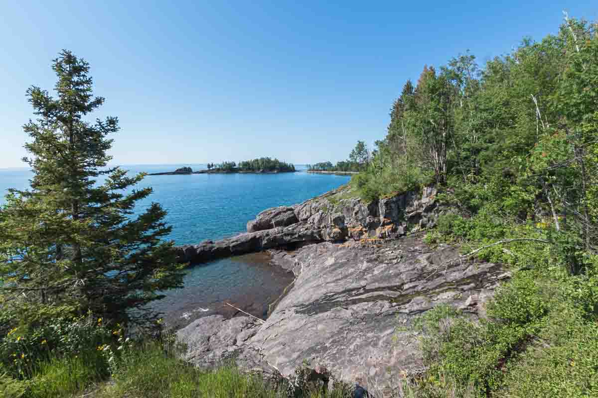
Tettegouche State Park
Tettegouche State Park offers a range of options for visitor – visitors can walk out to a point high above the lake at Shovel Point, hang out on a rocky beach along the lake, visit the high falls on the Baptism River (the highest waterfall completely within the state) or Illgen Falls or one of the other falls within the park, or hike the Sawtooth Mountains.

Shovel point from inside Tettegouche State Park.
There are also camp sites and good fishing lakes within the park. It’s a gorgeous area and is one of my favorite parks.
Minnesota Highway 1
If you’ve had enough of the shoreline and want to head inland, Minnesota Highway 1 will take you over the Sawtooth Mountains into the lakes and woodlands of northern Minnesota’s lake country. The drive to Ely (and on to Lake Vermilion) would be particularly lovely in fall. If you are looking for a serious road trip, you can continue all the way to North Dakota.
Highway 1 runs through part of Tettegouche, so this is the route to take to get to Illgen Falls.
Wolf Ridge Environmental Learning Center
The Wolf Ridge Environmental Learning Center has a full calendar of programs. Most are geared toward children, although there are adult events as well. This is one of the places up here that I haven’t gotten to.
Finland Minnesota Historical Society
The Finland Minnesota Historical Society is another spot I haven’t gotten to, but only because it’s never been open when I’ve been around. The site includes several historic and replica buildings that demonstrate the lives of early settlers in the area.
George H. Crosby Manitou State Park
Mostly a described as park for backpackers and serious hikers, George H. Crosby Manitou State Park looks lovely, with challenging trails that reward hikers with waterfalls and lake views. It also looks like a great place to kayak or canoe because most of the area I saw looks really wet! Lovely, but wet. (Bring good buy spray.)
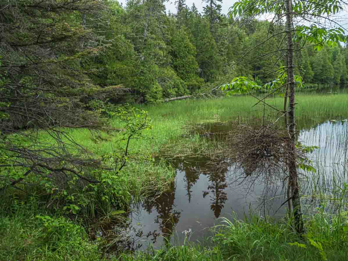
George Crosby Manitou State Park is really a wilderness experience, with few developed facilities.
Caribou Falls Wayside
A pull-off along the roads allows visitors to make a relatively easy hike (but with a lot of stairs) up to beautiful Caribou Falls.

Caribou Falls is a pretty, easy to reach waterfall that is seldom crowded.
Sugarloaf Cove
Friends introduced us to lovely little Sugarloaf Cove years ago. The beach here used to be amazing, changing from sand, to cobbles, to large boulders along a small cove. Now its much less varied, with few cobbles or medium-sized boulders. Makes me wonder whether the lake took them away or if visitors carted them all off as souvenirs! It’s still nice, but not what it was.
This is what I remember Sugarloaf’s beach looking like. Sadly, there weren’t as many lovely cobbles last time I was there.
There’s a really nice walk through the woods up to cliff with nice views too.
Rather than boulders, most of the shore at Sugarloaf is just giant slabs of rock.
And another path leads into the Sugarloaf Point SNA. (That’s on the point you can see in the distance.)
There is also a small visitor’s center here (open on a limited schedule) with a gift shop that carries great tee shirts (they used to have one with a photo of mine!).
Taconite Harbor
There’s a small harbor here. There’s also a few remains of an abandoned and removed town. But the most interesting views are of the old (non-functioning) power plant — if you are able to see through/over the fence.
This looks like a nice marina, but I was more interested in the other side, where you have sort of surreal views of the abandoned power plant!
This used to be a good place to see lakers unloading coal, but that ended when the power plant closed.
And, if you look carefully, you can spot a few signs of the old town of Taconite Harbor hidden in the trees.
Cross River Falls
The Cross River is another one with a dramatic waterfall visible right from the highway. A lovely new highway bridge somewhat obscures the view for photographers, but provides a much safer viewing area for pedestrians. (One used to have to dodge cars on the highway to observe the falls.)

The Cross River Falls is easy to enjoy from the Highway 61 bridge.
A rest area here makes the site even more accessible.
Cross River Heritage Center
Not sure why I haven’t gotten inside the modern Cross River Heritage Center, although last time I went through here before it was open for the day. It’s probably worth checking out. It also looks like a good spot to stop for reliable tourist information.
Father Baraga’s Cross Historical Marker
This is a great picnic area along the water with a few tables and porta-potties. The giant cross was placed here in as a reminder of the wooden cross Father Baraga placed here after a particularly harrowing trip across the lake in 1846.
Temperance River State Park
 Most visitors to the North Shore make at least a quick stop at Temperance River State Park, as the highway wayside is located right above a dramatic waterfall with fantastically eroded canyon walls. There’s almost no walking necessary to see the falls, and a state park permit isn’t required to stop here.
But the Temperance River is worth more time, as it the hiking is wonderful in either direction (toward the lake or toward the Sawtooth Mountains).
- Temperance River Walk (2012)
- A Scenic Drive (fall 2007)
Heartbreak Ridge
If you are looking for a gorgeous fall drive, it’s hard to beat Heartbreak Ridge. This section of road got its name in the days when loads of logs were hauled out of the forest with horses. Teams couldn’t always make it up this ridge, which caused the loggers a lot of heartbreak as the they either had to help the teams or go back down and try again. It runs along Forest Road 166 (the Six Hundred Road) between Forest Road 343 and County 2 (the Sawbill Trail). The whole route, including more of the Sawbill is just beautiful during leaf season.
Sawtooth Mountain peaks
North of the Temperance River, the Sawtooth Mountains offer fabulous hiking along the Superior Hiking Trail. Luckily for me, much of this area, including the hikes to Britton, Carlton, and Oberg peaks are accessible even to hiking lightweights like me. These are fantastic hikes at any time, but they are especially beautiful in the fall.
- Peak Experiences (2007)
The Sawtooth Mountains continue to follow the shore all the way up to Mount Josephine near the Canadian border. There are lots of trails through these “mountains,” but many are far beyond my hiking ability.
Carlton Peak
Located within Temperance River State Park, an easy climb leads to Carlton Peak and stunning views along the Sawtooth Mountains and over to Lake Superior.
Britton Peak

An even easier hike than Carlton Peak, the scenery from Britton Peak is almost as dramatic.
Oberg Mountain
The hike up Oberg Mountain is a little longer and more strenuous than the others, but the views from the top (1000 feet above Lake Superior) are worth the effort. (And the trail is lovely.) Once on top, the trail wanders around, providing dramatic views in most directions. There is sure to be an amazing view to photograph here at any time of day.

Lutsen Mountains
Lutsen Resort is noted for downhill skiing, but the trails through the area’s hills and ski lift rides are available all year. There’s also a state SNA here. It’s accessible from the resort, but I couldn’t find it.
North Shore Commercial Fishing Museum
Tofte is home to the North Shore Commercial Fishing Museum. Commercial fishing used to be a big deal and I know a few people who have Lake Superior fisherman in the family trees. Friends say this is a great little museum, but I keep missing it when I’m in the area.
Ray Berglund State Wayside
The Ray Berglund wayside rest area seems to be pretty new (at least, I don’t recall it being here very long). Steps take you to the ridgeline above the parking area where you have a somewhat obstructed view of the lake. A short, flat path along the ridge leads to the Onion River.

It takes you to an area where there is a water fall, but I don’t think you can get close to it . . . or at least not from this area.
Cascade River State Park
 Over the past year Cascade River State Park has gone from being a place I had always passed by to a favorite stop along the North Shore. This park has a bit of everything: rocky shoreline, forests, waterfalls, and wildflowers. The park’s namesake waterfall tumbles through a long canyon in a series of cascades and falls. It’s a beautiful place at any time of year.
- Cascades and more
- Cascade picnic area and beach
We also like the privately owned Cascade Lodge, which sits right at the edge of the park. It’s an old-fashioned place, with a traditional lodge (with updated motel rooms and a wonderful open living room on the main floor), simple cabins, and a good restaurant. It’s not at all fancy, but it is comfortable and affordable – even during the busy summer season.
Cut Face Creek Wayside
If you need a break along the way, the Cut Face Creek Wayside comes with toilets, great views, and access to a long beach with really cool stone. This is also a trailhead for a section of the Gitchi-Gami bike trail.
Show Less
Grand Marais
Grand Marais is the artsy heart of the North Shore. It is a town filled with shops, services, lodging, and restaurants. There are special events and activities here throughout the year, but especially during the summer. This is a vacation destination in and of itself.

There is also plenty of shopping available in Grand Marais. It’s a good place to stock up on groceries and other supplies if you are camping, but you can find all sorts of clothing, art, and gifts here as well. We are big fans of Sivertson Gallery, a beautiful space filled with art and fine craft by exceptional local and national artists. Visitors should also check out the Ben Franklin – it isn’t like any other Ben Franklin (remember those?) you’ve been in and it carries everything a Northwoods visitor might need.
Despite labor shortages and devastating fires, Grand Marais is still the best place for foodies on the North Shore.
Show more to explore in Grand Marais
Sightseeing in Grand Marais
Bally Blacksmith Shop
Established in 1911, the Bally Blacksmith Shop was a family business for 98 years. Today this historic site is owned by the Cook County Historical Society. It’s almost never open, so make plans to visit on those rare days when you can actually go inside because it’s pretty amazing.

Johnson Heritage Post Art Gallery
The Johnson Heritage Post Art Gallery is located in a replica of a historic trading post features revolving exhibits of work by local artists and permanent exhibit of work by Anna C. Johnson, an artists working in the early1900s. It’s operated by the Cook County Historical Society and always has something interesting on exhibit.
Artists Point
If there is one “must do” activity in Grand Marais, it is walking out to Artists Point. Every city has a promenade – that place where locals and visitors alike go to see and be seen. Main Street fills that function in many Minnesota small towns; in Grand Marais it is Artists Point, the breakwater that leads out to the light at the harbor entrance.

East Bay
You will discover East Bay if, instead of walking out to Artists Point, you turn the other direction. Once mostly hidden in plain sight, East Bay is beginning to fill with upscale hotels, condos, and lodges. However, even if it isn’t a secret anymore, it’s still the best place in the city to watch the sun rise.
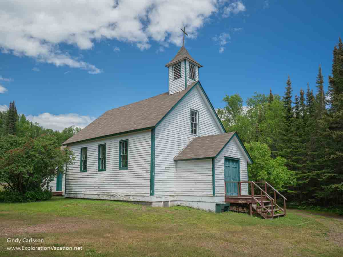
Chippewa City
Long a Anishinaabe village and now mostly private property held by whites, the the Saint Francis Xavier Church is the only remaining building from the village once known as Chippewa City. The church is now owned by the Cook County Historical Society, but Anishinaabe elders are often there when it’s open on summer weekends to tell stories about the church and the community that once lived here.
Learn a new skill in Grand Marais
Want to use your time here to expand your skills? Grand Marais is home to both North House Folk School and the Grand Marais Art Colony. Both offer a full schedule of classes throughout the year.
One of my favorite winter memories is of sitting by the wood stove in North House’s big classroom, drinking tea, and working on a beading project under the direction of Jo Wood. Huge snowflakes gently falling outside the window was a bonus – until I had to go out and shovel out my car! (Actually, everyone helped each other shovel out, making it an odd sort of party that continued on through dinner.) Classes range from plein air painting to building your own coffin, so there is sure to be something of interest.
There is also a summer arts festival if you just want to see art created by others!
Eating in Grand Marais
The food is always good in Grand Marais, with a range of really fine local restaurants. My favorite spots include the World’s Best Donuts (the name says it all, so be prepared for a line in any season), My Sister’s Place (the burgers are fabulous, particularly the bison), the Gun Flint Tavern (great north woods food and more), the Crooked Spoon Cafe (upscale modern cuisine at its finest, now served out of a food truck after losing their cafe in a fire), the Angry Trout Cafe (fine north woods dining with plenty of local fish), and The Fishermans’ Daughter at the Dockside Fish Market (the source of local fish, with a fish-focused deli and a side of gourmet cooking ingredients).
Show Less
Gunflint Trail
The Gunflint Trail (Highway 12) begins as you approach the north end of modern Grand Marias.
The Gunflint Trail begins in Grand Marais, running from the shore of Lake Superior to the edge of the Boundary Waters Canoe Wilderness Area. Along the way you will pass rocky outcrops, marshes where moose linger, lush forests and burned-over forests, wildflowers, the occasional bear, and lakes – lots and lots of lakes. The resorts along the trail are perfect places for exploring this watery mix of earth and water. The lovely little Chik-Wauk Museum and Nature Center sits at the very end of the trail and leaves visitors wishing it was their own home.
- The back route to the Gunflint Trail and At the end of the Gunflint Trail (2011)
- Blueberry Hill, Gunflint Lodge, Morning on Gunflint Lake, and Honeymoon Bluff (fall 2007)
Grand Marais to Grand Portage
Most visitors don’t go farther north than Grand Marais, but plenty of treats await those who continue on.
Show more to explore from Grand Marais to Grand Portage
Five Mile Rock
Ok, there isn’t really much to see here, but Five Mile Rock (designating the rock’s distance from the harbor in Grand Marais) is an area landmark. And there is a place to pull off the road here and take a break.
Kadunce River Wayside
On the lake side of the highway the Kadunce River empties into Lake Superior along a broad gravel beach.
Across the road, a trail leads through the woods and sort of along the river. It’s pretty, but not spectacular. However, various websites recommend hiking right in the river itself (when the water level is low) to explore the cascades and climb the waterfalls along the way. While lots of people do that, a friend who tried it fell on his way back down a waterfall and shattered his leg. So if you do try it, climb up the falls, but take the trail back down!
Judge C. R. Magney State Park
Originally named for the Brule River running through the park, Judge C. R. Magney State Park was renamed in 1963 to honor an environmental advocate who served as the mayor of Duluth and as a judge for many years. The park is only open for summer use, and its most notable feature is an unusual split waterfall on the Brule River. One half of this waterfall tumbles into a large pool; the other half – the Devil’s Kettle – vanishes into a pothole from which it never reappears. The trail to the falls wanders through the woods, but it is definitely worth taking for the scenery and the Kettle at the end.

- Along the Brule (2007)
Naniboujou Lodge
A historic landmark right along the shore, Naniboujou is a great lunch or breakfast stop. There is also lodging available here, so dinner followed by a night at the lodge is an option.
Once serving a private club for elite members (Babe Ruth was one) the over-the-top dining room has to be seen to be believed. It is said to be decorated with Cree motifs, but it looks more Aztec to me!

- Naniboujou (fall 2007)
Grand Portage
The farthest northeastern corner of the state is home to the Grand Portage Band of Lake Superior Chippewa. This is a beautiful part of the state and visitors are welcome, but it’s important to remember that visitors are guests of the tribe – be respectful and remain in areas open to the general public. Tourist amenities on the reservation include a casino and hotel complex, basic traveler services, a small art gallery, and a few other shopping options.
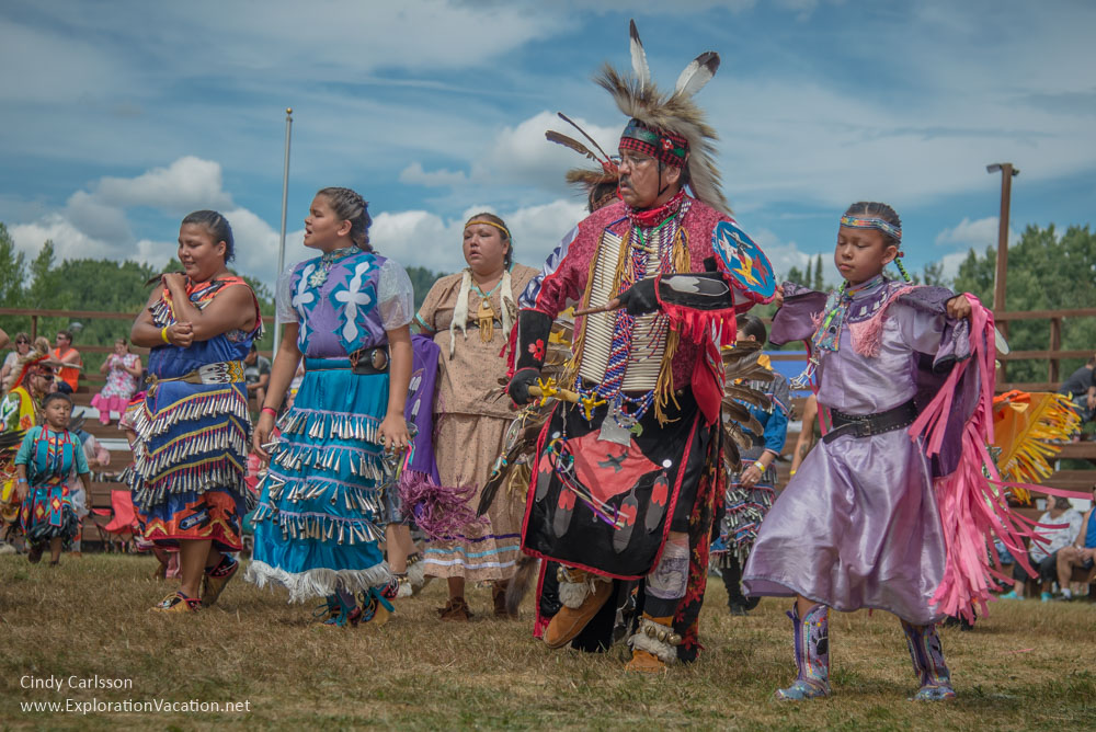
A traditional powwow is held each summer in conjunction with the summer Rendezvous at Grand Portage National Monument.
The ferry to Isle Royal also leaves from here.
There are a number of public campgrounds in the area, but only a very limited number of hotel rooms. During summer it is best to book well ahead.
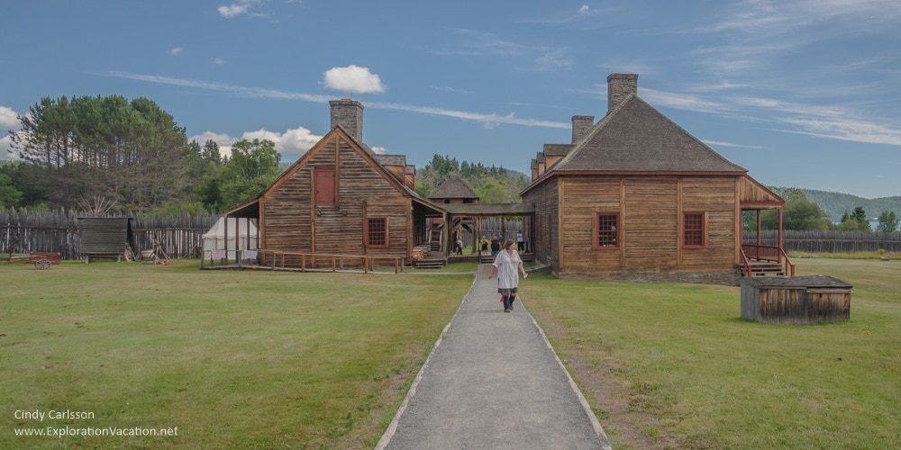
Grand Portage National Monument
Native communities were using the route known as the Grand Portage long before the fur seeking Voyageurs established a post here in the 1700s. The Grand Portage National Monument recreates a portion of the historic fur post that once stood here. In addition, the park’s Heritage Center presents cultural, archeological, and historic exhibits.
The annual Rendezvous recreates the summer gatherings of the fur post’s past.
The monument is on tribal land and is operated jointly with the tribe.
- Grand Portage National Monument (summer 2015)
- Grand Portage Rendezvous (summer 2015)
Grand Portage State Park
 Grand Portage State Park sits right along the Canadian border. Indeed, the park’s dramatic waterfalls can only be viewed from one side unless one leaves the park, goes out to the highway, drives up to the border, presents a passport, and crosses into Canada. Once in Canada, a nearby road leads to an overlook where the falls can be viewed from that side of the Pigeon River.
Grand Portage State Park itself is a joint effort between the tribe and the state of Minnesota, with the park located on land leased from the tribe and the joint visitor center managed by the tribe.
This is the last public wayside rest before reaching the Canadian border.
- Grand Portage State Park (fall 2010)
Show Less
Plan your trip to Lake Superior’s North Shore and the Gunflint Trail
This is road trip country – load up your car and head north! Part of the pleasure of a North Shore vacation is simply driving through this beautiful area, stopping to hike or just enjoy the view as you see fit.
You’ll also see plenty of motorcycles on the road for the same reason.
Getting to and around the North Shore
Most visitors from the greater MSP area head straight up Interstate 35 to Duluth. That trip takes about 2 ½ hours.
Driving the North Shore Scenic Byway
The North Shore Scenic Byway runs from Canal Park in Duluth, through a part of downtown, down London Road, and then along the North Shore Scenic Drive to the Canadian border. It stays along Lake Superior, so does not include the bypass. You can find a little more information on the Federal Highways American Byways website.
Map from the Federal Highway Administration
Show more North Shore trip planning

Biking the North Shore
https://www.dnr.state.mn.us/state_trails/gitchigami/index.html
https://northshorevisitor.com/wp-content/uploads/2021/06/gitchi_gami.pdf
https://www.ggta.org/
https://beyondyellowbrickblog.com/the-definitive-guide-to-the-gitchi-gami-state-trail/
Lodging and Camping
Camping
I haven’t camped along the North Shore for years, but I do know there are a lot of options, but probably not enough during peak summer and fall weekends
State Park campgrounds must be reserved on-line and fill quickly.
Seasonal events and activities along the North Shore and Gunflint Trail
You will have lots of company it you visit Minnesota’s North Shore or the Gunflint Trail during summer and fall. On weekends state parks and the cities of Duluth and Grand Marais are crowded with visitors. But even weekdays often see lodging, campgrounds, parking areas, and restaurants at or near capacity. So, while summer and fall are absolutely gorgeous times to visit (and the only time some historic sights are open regularly), it’s worth considering visiting at other times. Not that every season doesn’t bring a few challenges.
(For the best calendar of all scheduled events on the North Shore, check North Shore Nina’s North Shore Visitor events page.)
Here are a few reasons to visit throughout the year, along with some tips on the challenges each season brings.
Summer (June-August)
Fall (September-October)
My favorite season in northern Minnesota is fall. The weather is usually comfortable, often with lots of sunshine, bugs are mostly gone, and the fall colors can be spectacular. Of course, everyone else also loves the North Shore in fall, which means it can get crowded. Don’t expect to book camping or other lodging just before you visit — especially not over a weekend. Bookings for the last half of September through the first week of October should be made many months in advance if you want to stay on or near the shore.
Lake Superior moderates the weather along the North Shore, which means fall arrives a little later right along the shore than inland. (Color on the Gunflint Trail peaks before the North Shore, and is mostly yellows and golds.) By late-September, inland areas usually have good color. It may take another week for color to peak right along the lake. The last week of September through the first week of October usually offers the best mix of color both along the shore and inland a bit. But sometimes it’s earlier and sometimes later. And fall color depends on a lot of factors and some years just aren’t as glorious as others.
Use the Minnesota DNR fall color finder to predict when colors will peak and plan your travel accordingly. It uses data collected at state parks, most of which have more detailed information on the park website. It’s a great tool and you can sign up to get a weekly update.
Fall color routes
Get off Highway 61 and away from the lake for the best color.
The Sawtooth Mountains are laced with forest roads and hiking trails suitable for just about everyone, and this is where you’ll find the boldest colors along the North Shore. Forest road are unpaved and there are not many places to pull over, but they are usually pretty well maintained. The Superior National Forest has a map of fall driving routes through the forest (pdf) that includes many of my favorites. And Cook County has one with details for a loop that includes Heartbreak Hill (pdf).
Fall bird watching
Fall is also when birds begin migrating south for the winter.
While you can see many birds of all types everywhere at this time of year, the best place to see raptors (hawks and eagles) is at the Hawk Ridge Bird Observatory on the hill above Duluth. This is basically just a wide spot along the road with a couple of viewing platforms and (usually) a few volunteers. But in the middle of the day from September into November, this is a great spot to see migrating raptors.
Annual fall events
Winter (November-March)
November is when the most eagles and other large raptors migrate over Hawk Ridge.
Annual winter events
November 10: Edmund Fitzgerald memorial ceremony and beacon lighting at Split Rock Lighthouse.
Spring (April-May)
Resources
While I visit the North Shore regularly and make occasional trips up the Gunflint Trail, I’m not up there enough to always be on top of changes and current news and events. And I’m not a back-packer, camper, or serious hiker, so I can’t give you details on those activities.
Show Less

All Minnesota posts