
Last updated on June 12th, 2026
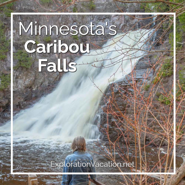
Looking for a pretty waterfall along Minnesota’s North Shore that’s easy to get to, but not crowded? The hiking trail at the Caribou Falls State Wayside offers just that – and it leads to a two-tier 35-foot waterfall that is sure to please!

Caribou Falls is pretty in any season, but it’s at its most dramatic in spring.
I drove past the Caribou Falls wayside a few dozen times over the years without realizing there was a really good reason to stop. Don’t repeat my mistake! Minnesota’s Caribou Falls is definitely worth a stop as you explore the North Shore.
This story may have affiliate links. I use links to provide additional information, but a few also pay me a small amount if you use them to make a reservation or purchase. You don’t pay extra, but it helps keep this website running without intrusive ads. To learn more, see my policies and disclosures.
Hiking the Caribou Falls Trail
The Caribou Falls hiking trail is just over a mile roundtrip, although it’s worth a little detour to spend more time hiking along the river’s edge. This trail is a spur off the Superior Hiking Trail.
Explore the Caribou River
It’s a short walk from the parking lot to the Caribou River. But the Caribou Falls Trail doesn’t follow the river to the falls. (It runs through the forest and then drops back down to the falls.) However, it’s worth spending time exploring along the river’s edge on your way to or back from the waterfall. (Or both.)

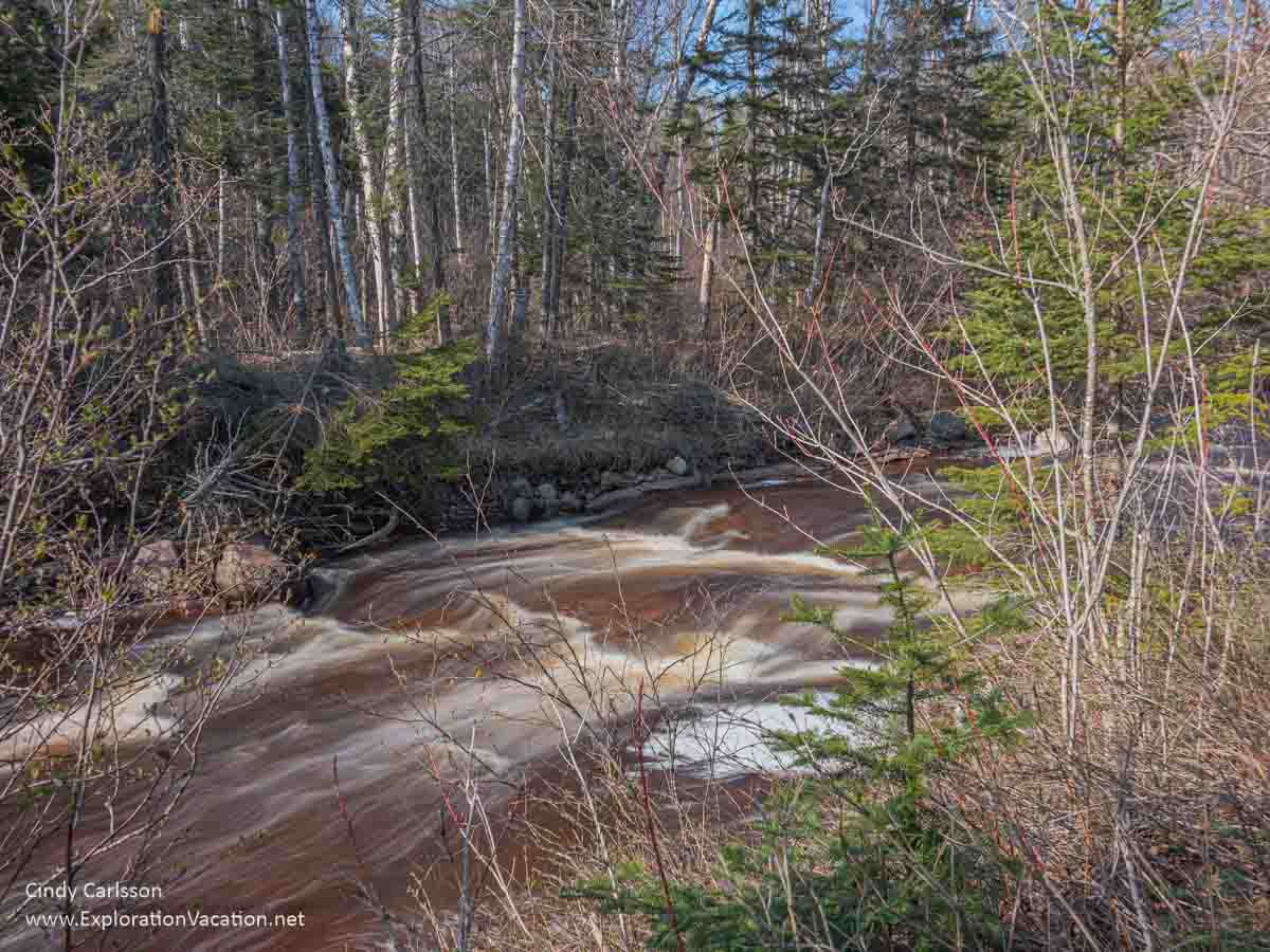
The Caribou River races by in spring. By summer it’s usually safe to step right into the river.
👉 Read more about the Caribou River
In summer and fall water levels are usually low enough that you can walk in the river. But the water can get pretty high in spring. Water levels had dropped from their spring peak when I visited in May, but the current was strong enough that it was best to explore without wading into the river itself.

The Caribou River has lots of rock ledges that let you explore the river without getting wet!.
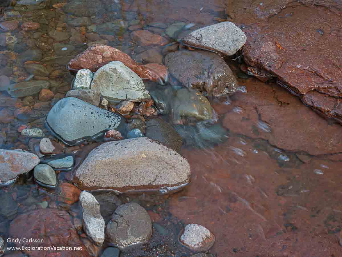
Of course, there are also lots of smaller loose rocks to check out.
Because the water was still pretty high and the river’s edge is mostly brushy, very few places allowed easy access to the river itself when I visited. The best spots were just off the main trail. The farther I walked along the river, the more difficult it was to get to (or even see) the river itself.
The farther you walk along the Caribou River’s edge, the harder it is to actually see the river!
As you explore, you may think the footpath along the river will eventually take you to the waterfall.
It won’t. At some point you’ll come to a cliff that blocks the path. If water levels are low and you are comfortable hiking in streams, you might be able to walk to the falls in the river itself. But for most of us, the only option to get to the Caribou waterfall from the riverbank is to turn around and head back to the main trail.
👉 Read less
Hiking to Caribou Falls
While the Caribou Falls Trail doesn’t follow the river to the waterfall, it does go through a pleasant woodland.
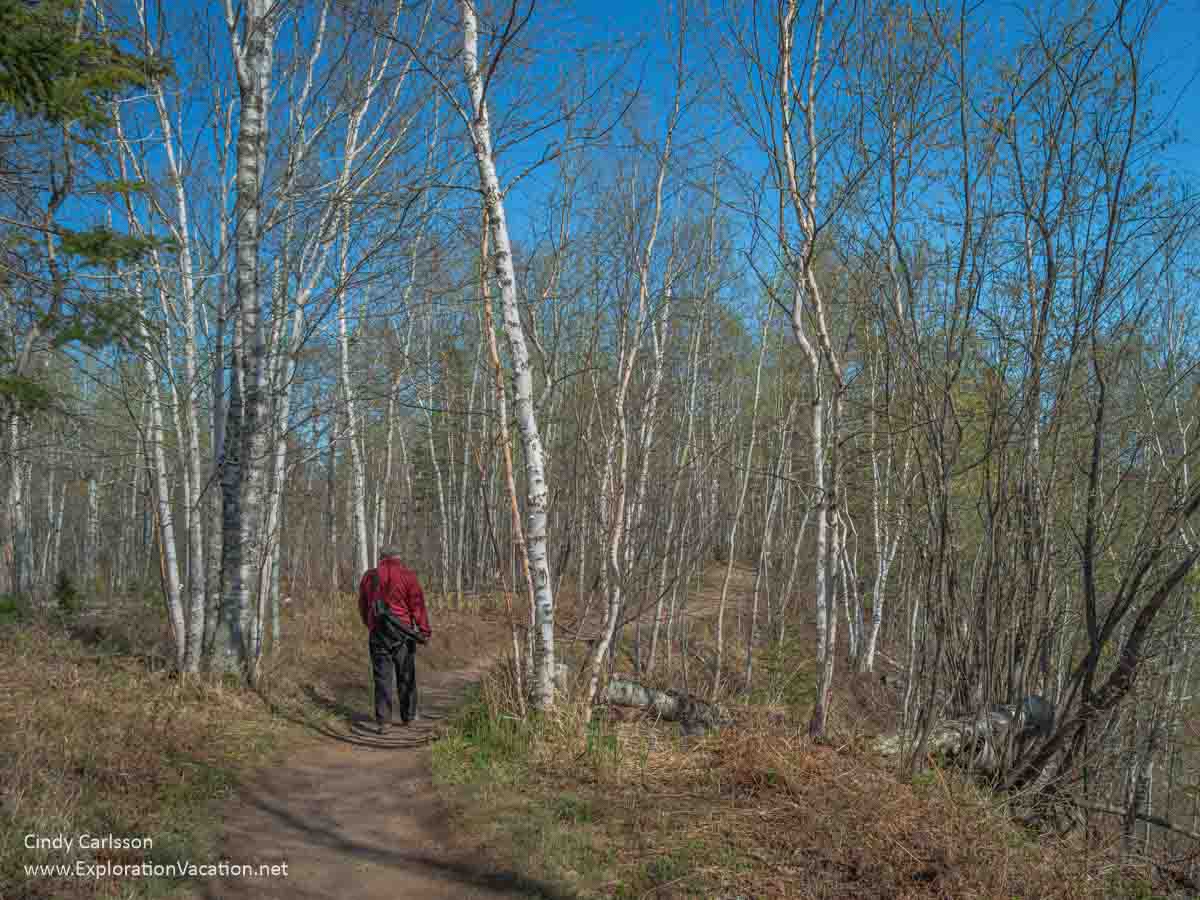
Hiking through the forest on the Caribou Falls Trail.
This area supports a mix of trees, with a few evergreens and a lot of poplar, birch, and maple. And the dappled light they create supports a lot of flowers, ferns, and other vegetation on the forest floor.
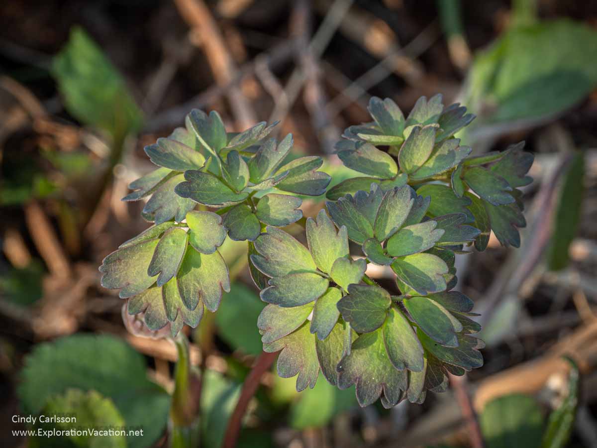
Mid-May was too early to see columbine in bloom along the Caribou Falls Trail.
Unfortunately, there weren’t many spring wildflowers in bloom when I visited. Even the leaves were just starting to appear on the trees along the trail. That made for a sunny hike.
By summer you’ll find more flowers and a lot more shade!
However, visiting before the trees fully leaf-out makes it a easier to enjoy views of the river below and Lake Superior in the distance.

You can get some good overviews of the Caribou River from the hiking trail.
Caribou Falls nestles in a bend in the river. That means you have to get almost to the waterfall before you can see it. But, when there’s a lot of water going over it, you can clearly hear it before you reach the first of the stairs.
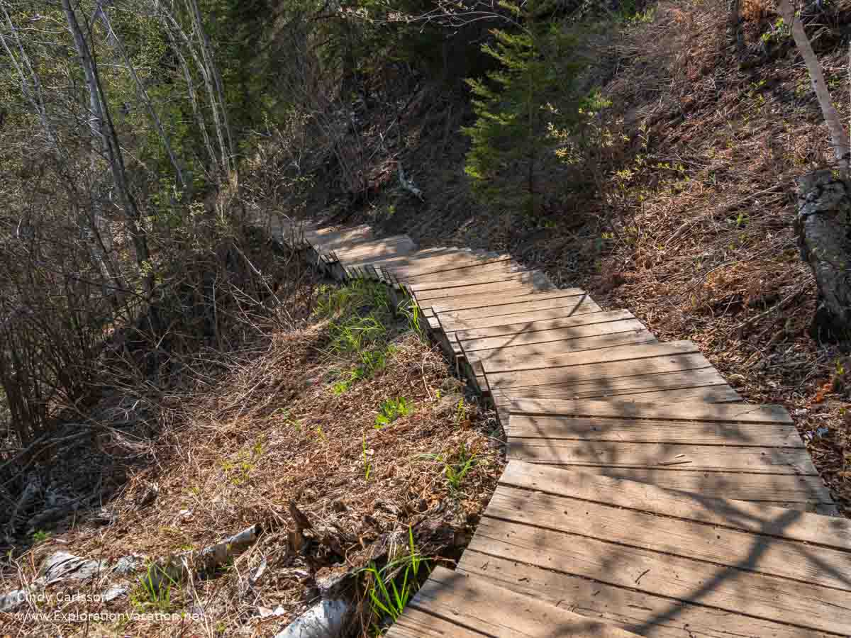
I could hear Caribou Falls before I reached the first set of steps down to it.
But even in spring, when there aren’t many leaves obscuring the view, you still need to be more than halfway down the stairs before you can actually see it.

Hey! There’s a waterfall down there!
And you don’t get a really good look until you are at the very end of the steps.

The final few steps are underwater, but you get a good view from the boardwalk.
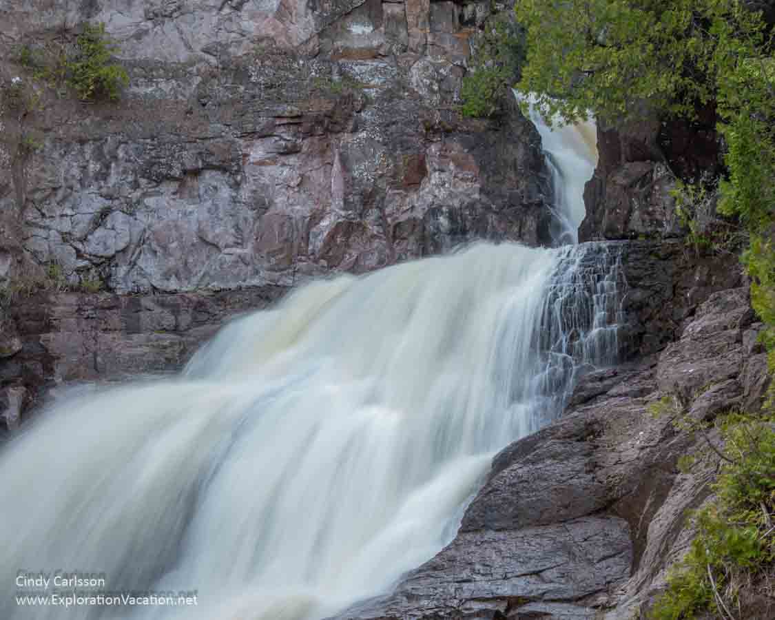
It’s a little hard to see the top of it from the boardwalk, but Caribou Falls is a beauty!
When I visited in May, it appeared there were a couple more steps below the water. There was no visible beach. Later in the season you should be able to get closer – like right up to the base of the waterfall. Of course, there won’t be as much water flowing over the falls, so it won’t be quite as dramatic. But the ability to explore from the beach seems like a good trade-off.
Caribou Falls used to be a separate state park
Caribou Falls offers enough great scenery to be a state park. Today it is part of Temperance River State Park. But once upon a time, it was a separate state park.
In 1947 the 92 acres that include Caribou Falls became a state park. As is true today, there wasn’t enough space to build a lot of park facilities. That limited Caribou Falls State Park to a hiking trail, a few picnic tables, a parking lot, and a trail to the river and falls.
Because of the park’s small size, Caribou Falls was reclassified as a state wayside in 1969. (A state wayside is an area that would be worthy of being a state park if it were bigger. It’s not intended to serve highway traffic like a rest area, just hikers and other day users.)
But that change also led to less investment in the site. By the mid-1970s signs directing visitors to the wayside were gone and the area seems to have been mostly abandoned as a park of any sort. Planning for the Gitchi-Gami Recreation Trail brought improvements to the Caribou Falls wayside by 2018. That included roadside signage, so travelers along the North Shore can easily find the wayside.
Where are the caribou?
Despite seeing caribou this and caribou that as you travel around Minnesota, you won’t see any caribou in Minnesota. Sorry. You need to go to a zoo or head up to Canada if you want to see caribou.

The only caribou in Minnesota are in zoos, like these at the Minnesota Zoo.
And, even in Canada, woodland caribou like those once found in Northern Minnesota are extremely rare around Lake Superior.
👉 Read more about caribou
It’s not that Minnesota never had caribou.
Minnesota’s caribou were once the dominate deer species in the northern forests. They thrived in a marshy, wooded habitat that also supported elk and moose. And there was once a lot of that habitat in North America, and these woodland caribou were plentiful throughout northern Minnesota and Michigan and all the north to Hudson’s Bay. Today caribou are only common in small portions of that area.
That caribou would be unable to survive manmade challenges is a bit of a surprise.
Caribou (called reindeer in Europe) are among the oldest of North America’s large mammals. Native to northern regions of North America, Scandinavia, and Russia, there are seven subspecies that inhabit barren ground, woodlands, and mountain areas. They survived more than 1.6 million years of climate change as ice sheets periodically formed, advanced, declined. They are survivors.
But woodland caribou need forests and wetlands and the ability to move around throughout the year. Loggers and settlers eliminated most of Minnesota’s forests. Settlers drained many of the wetlands. Railroads, roads, and cities blocked migration paths. And all of that made life challenging for the caribou. At the same time, it created ideal conditions for white tail deer. Deer not only thrive in this altered landscape, but they also carry a disease fatal to caribou. By 1940 Minnesota’s caribou were gone.
Today there are very few caribou left around Lake Superior. And, despite efforts to protect them, the few that remain have a bleak future.
👉 Read less
Plan your trip to Caribou Falls on Minnesota’s North Shore
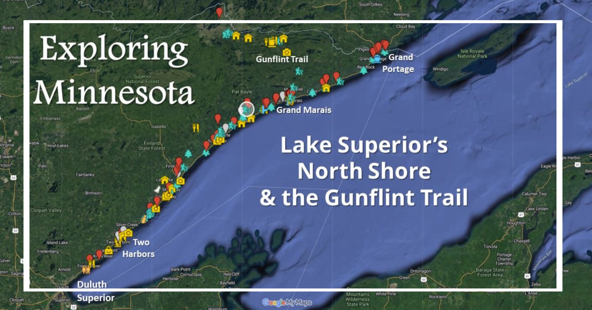
Located nearly halfway up Minnesota’s North Shore of Lake Superior in Temperance River State Park, the area around Caribou Falls State Wayside is the homeland of the Ojibwe (Anishanaabe or Chippewa) people and their ancestors. It’s among the most beautiful areas in Minnesota.
And Caribou Falls is an easy stop even if you don’t plan to travel the entire shore from Duluth to Canada.
Getting to the Caribou Falls Wayside
The Caribou Falls State Wayside is located just north of Little Marais on Highway 61. That’s about a 3½ hour drive from Minneapolis, but there are so many things to do along the way you should plan at least a full day just to get up there.
(While the wayside is within Temperance River State Park, you access each from different places.)
This isn’t a day trip from the Twin Cities, but it can be part of a weekend getaway. Of course, it’s better if you have at least three or four days to take advantage of the fabulous scenery you’ll find all along Lake Superior’s North Shore.
From Duluth it’s a 1½ hour drive, so very doable as a day trip. But again, this area is worth as much time as you can give it.
If you’re on the Superior Hiking Trail, Caribou Falls is on the Caribou Falls spur trail between Silver Bay and Lutsen. It’s NOT at the Caribou Trail trailhead by Caribou Lake.
Facilities
The Caribou Falls State Wayside is very basic. It’s largely designed to support day hikers.
- Parking is available for a dozen or more cars, but limited to 6 hours. Overnight parking is prohibited.
- There is one pit toilet.
- Basic signage makes the Caribou Falls trail easy to spot from the parking lot.
- There are no picnic tables.
- Plan to take trash with you when you leave.
Most of the Caribou Falls Trail is a simple dirt path through the woods. There’s little elevation change until you near the waterfall. But then, as you descend, you follow a series of wooden steps. The steepest section has steps linked by boardwalks and sturdy railings. There are even a couple of benches as you drop down to (and climb out of) the Caribou Falls viewpoint. The stairs and boardwalks were in excellent condition in May, but that can change quickly.
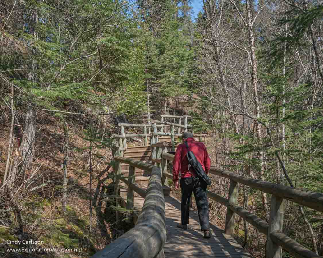
There’s a lot of new-looking infrastructure to ensure more people can get to the waterfall safely.
I didn’t count how many steps there are, but there are a lot of them.
When is the best time to visit Caribou Falls?
Caribou Falls flows throughout the year, but your experience will vary with the season. The amount of winter snow and summer rain will determine how much water is flowing through the Caribou River and over the falls at any given time. Water levels will greatly impact your experience, but can vary greatly from year to year.
👉 Read more about when to visit Caribou Falls
Spring
Spring is the time to visit if you want to see Caribou Falls at its fullest. However, following a wet winter, the beach beneath the falls can be completely flooded. And, early in the season, paths along the river’s edge may also be flooded. Fortunately, the inland trail that goes all the way to the waterfall should be open even when water levels are high. And you’ll find a mix of spring flowers all along the hiking trail.
The pictures you see here were taken in mid-May after a very snowy winter. At that point, there was still a lot of water in the falls, but I could also walk along the river and get to some of the exposed rock in the riverbed. However, the beach below the waterfall was completely flooded.
Spring also brings an ever-changing array of flowers, although I managed to visit at a point where there wasn’t a lot in bloom.
Summer
There’s less water flowing over Caribou Falls during the summer. But it’s still pretty. And you usually can get in to the beach below the falls and step into the river itself at various other spots. Summer also brings a colorful mix of wildflowers and shade along the path.
Fall
Unless it’s been very rainy in northern Minnesota before your visit, water levels in the falls and river below will be pretty low by fall. So, the waterfall may not look very dramatic. But the hiking trail should be glorious, with the best fall color in late September and early October. And, like summer, dry fall weather offers opportunities to explore below the falls and in the river itself.
Winter
The Caribou Falls Wayside is closed from the first major snowfall (usually late November) through late March.
Despite that closure, people do snowshoe into the area and down the river to the frozen waterfall. But don’t try that unless you really, really know what you are doing. The movement of the water under the ice creates thin spots and open water in even the coldest weather. And, by the time you reach the waterfall, help isn’t very close.
There are plenty of other waterfalls you can see in winter, so it’s best to skip Caribou Falls until the wayside opens again in spring.
👉 Read less
Tips for hiking the Caribou Falls Trail
This is generally an easy trail, but there are a LOT of steps to get down to the falls and back up again. They are solid, easy-to-use stairs, but there are a lot of them, and there isn’t a lot of space for people to pass.
Keep a close eye on children as you’ll find both rushing water and very steep drop-offs along the trail.
The Caribou River is a designated trout stream. You’ll find brook trout, rainbow trout and three kinds of salmon in the river, but fishing regulations in this area are a little complicated.
Bring water.
Some of this area is a little wet and marshy most of the year, so be prepared for mosquitos, ticks, and other biting insects. (Tick-borne Lyme disease is present in this part of Minnesota.)
Other places to visit near Caribou Falls
Caribou Falls State Wayside is in Temperance River State Park. That puts it in the middle of some of the North Shore’s favorite parks. There’s lots to see and do here!
The entrance to the main part of Temperance River State Park is just a few minutes north of the wayside north to visit Sugarloaf Cove, Cascade River State Park, and the funky little town of Grand Marais.
In under an hour’s drive south, you’ll find Tettegouche State Park, Palisade Head, Black Beach, Split Rock Lighthouse, Iona’s Beach, and Gooseberry Falls.
George Crosby Manitou State Park is just inland from Caribou Falls. It’s a winding ½ hour drive, that includes travel on a few unpaved roads.
Check my post on what to do along Minnesota’s North Shore for more information and ideas!
Lodging near Caribou Falls
A wide range of lodging is available along the stretch of Minnesota’s North Shore. However, this is a very popular tourist area both for travelers from Minnesota and those coming from other places. Thus, availability is very limited and prices are high from late spring through fall. Book ahead!
You can find a lot of the options (but by no means all) for lodging of all types and at all price points on Expedia. (Little Marais gets you close to the falls, but there are options farther out as well. If you want to rent a house, VRBO also has some options, including many suitable for families.
Camping
There are also a lot of camping options. These include campgrounds (and cabins) in state parks, state forests, federal forests, and private campgrounds. State parks and the best of the others fill during peak season, so you’re best off to book well ahead.
Follow these links for more information on camping in Minnesota state parks, state forests, and the Superior National Forest.
Looking for more information?
I discovered that the Caribou Falls State Wayside was once a state park. That and more can be found in Everyone’s Country Estate: A History of Minnesota’s State Parks (1991) by Roy Meyer. (It’s briefly discussed on page 166.) Meyer’s book is an opinionated, but well researched, history of the Minnesota State Park system through 1990. It was published by the Minnesota Historical Society. I bought my well-used copy through (affiliate link).
Want to learn more about Minnesota caribou? Niche has a great (but depressing) piece called Woodland Caribou and Borders that discusses the destruction of both the caribou and the Indigenous people who lived in harmony with them. Agate also has a good piece on the history and future of caribou in the Lake Superior basin.
See more pictures from the Caribou Falls Trail and Minnesota’s North Shore on Lake Superior at CindyCarlsson.com.