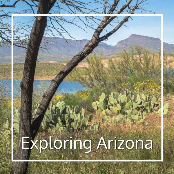
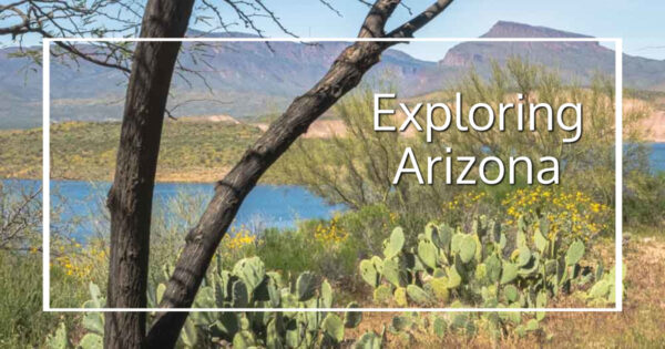
When I think of Arizona, I picture it as it might have looked in the 1950s with orange groves, turquoise and pastel houses in Phoenix, Native art and trading posts, saguaro cactus, and mule trips into the Grand Canyon.
I have absolutely no idea where this image comes from and it has only the most tangential relationship to the reality of Arizona either then or now, but it isn’t all fantasy. At some point on every trip here I come across something that is part of that picture. Indeed, on my very first trip I arrived late in the night and awoke in the morning to discover a scene outside my friend’s kitchen window that precisely fit my imaginary picture of Arizona. Her 1950s housing development was Phoenix exactly as I pictured it.
While I regularly visit the Phoenix area, there are still many areas I haven’t visited or have only passed through. Arizona is a big state with much more diversity than many people expect. There is something for everyone here.
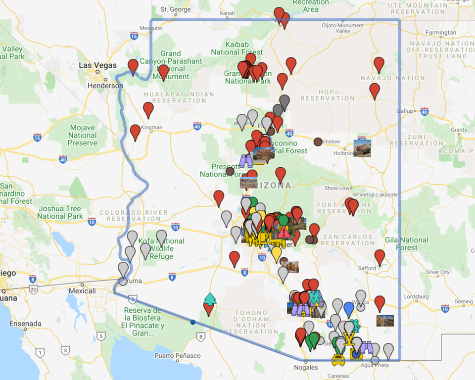
The map below is one of my planning tools. It identifies cities and sites I’ve explored or hope to explore someday. (Click to go to the interactive version.)
Spring is my favorite time to visit, when the sun is just starting to get hot and the flowers are in bloom. The vibrant colors of the desert in bloom is an amazing sight. Fall is also lovely here. Winters can be cool (or even very cold at higher elevations) and damp. Summer is blast furnace hot in much of the state, but comfortable (or at least bearable) at high elevations.
Note that traveling independently anywhere in Arizona without a car is almost impossible, even in Phoenix. On the other hand, the roads are generally good (if narrow) and the scenery is stunning, making it a perfect state for road trips.
I use links to improve your experience using this website. Some may be affiliate links that pay me a small commission if you use them to book a room, rent a car, or purchase goods or services. You don’t pay extra, but it helps keep this website running. To learn more, see my policies and disclosures.
Arizona is a big state. To make travel planning a little easier, I’m dividing it into 4 parts:
- Northern Arizona, including the Grand Canyon
- North Central Arizona, an area that wraps around Phoenix to the north and east that includes Prescott, Sedona, Payson and Globe
- Phoenix and the Valley of the Sun
- Southern Arizona, including Tucson
Exploring Northern Arizona
Northern Arizona is dominated by the Grand Canyon. But this part of the state also has forested mountains (complete with ski resorts), ancient cliff dwellings, a petrified forest, and a chance to step back in time along historic Route 66.
Grand Canyon
The Grand Canyon has National Park facilities for visitors along both the North and South Rim, with most visitors going to the easier to access South Rim.

In addition, the Hualapai Tribe has services and a canyon skywalk on the West Rim along the West Rim.
[showhide type=”post” more_text=”Show more…” less_text=”Show less…”]
I visited the North Rim years ago and fell in love. The surrounding area is densely forested, keeping it comfortably cool even in summer and providing a contrast to the red rock.
Morning at Bright Angel; Mule Trip; Along the Cape Royal Road; Sunrise at Point Imperial; Searching for Sunset
I finally made it to the South Rim in 2017! It was a lot busier, but equally amazing.

Here’s what to expect at every scenic overlook along the South Rim
I’d always heard the North Rim was better, but I have to disagree. The canyon looks even bigger and more expansive from the South Rim, with gorgeous colors in the rock. Sure, there are more people, but there is more than enough scenery for everyone.
Antelope Canyon
A number of years ago I saw a picture of Antelope Canyon at the Georgia O’Keeffe Museum in Santa Fe. I knew instantly I had to get there, but, in the end, it happened almost by chance.
Antelope Canyon (August 2006)
Antelope Canyon is part of the Lake Powell Navajo Tribal Park. There are upper and lower sections of the canyon, both of which can be visited as part of a guided tour. I visited the upper canyon, which is the easiest to access.
This is one of a number of otherworldly formations in the Colorado Plateau. This gorgeous expanse of twisted red rock extends into Utah. It can be a dangerous place to hike, but the scenery is incredible.
Glen Canyon, I mean, Lake Powell
I only know this area from two sources:
- The writings of the environmentalists who fought, and lost, the battle to preserve Glen Canyon. Their lyrical writing describes a place of majestic beauty. A place that I will never see as it was.
- Pictures of Lake Powell, dramatic red cliffs rising straight out of the water. It is a landscape that thrills me.
I’m not sure if I have avoided Glen Canyon/Lake Powell because I am afraid that all I will see is what was lost or because I am afraid I might love it anyway.
Taking a houseboat out on the lake is an iconic American experience, and an experience that may not be available for years to come as the water level in the canyon drops. In the end we may have destroyed one of the most visually stunning landscapes in America for no reason at all. I probably should go out on the lake while I can.
Monument Valley
Perhaps the most famous landscape of the American west, Monument Valley is located on tribal lands in the four corners area. While it takes very little time to do a drive through tour of the area, visitors with more time will find a wealth of hiking and off-road tour options.
Monument Valley (August 2006)
Walnut Canyon National Monument
Walnut Canyon National Monument may be among the more unexpected stops along historic Route 66.

A scenic canyon in and of itself, it also houses a large collection of cliff dwellings. Constructed by the Sinagua about 1100 to 1250 CE, visitors today have the opportunity to get a close look at about 25 structures.
Canyon de Chelly National Monument
Located on Navajo lands, Canyon de Chelly National Monument protects a canyon system that has been continuously inhabited longer than any almost any other place in North America.
Petrified Forest National Park
Located along historic Route 66, Petrified Forest National Park offers both giant chunks of petrified wood and surreal landscapes. The petrified wood for which the park is named is found in high concentrations throughout the southern section of the park. The rest of the park is made up of an odd assortment of eroded multicolored hills. It’s an oddly beautiful place.
Historic Route 66
Route 66 ran across northern Arizona on its way from Chicago to California. Winslow, Flagstaff, and Kingman are all located along the historic route, but sharp-eyed drivers can find historic signs and buildings all along the way.
[/showhide]
Exploring East Central Arizona
There’s so much to do in northern Arizona that I’ve grouped Sedona, the Verde Valley, and Tonto National Forest into a separate category. Everything in this area is an easy day-trip from Phoenix.
Sedona
 Sedona is red rock country, one of the most striking landscapes in central Arizona. Spiritual seekers flock here, but so do adventures of all types. It’s also a busy city with lots of specialty shops and dining options.
Evening reflections at Red Rock Crossing, Sedona, Arizona (2016)
Reading the V Bar V petroglyphs (2016)
Looking Back: A Quick Trip to Sedona (September 2009/January 2014)
Montezuma Castle (September 2009/January 2014)
Jerome, Clarkdale, and Cottonwood (Verde Valley and beyond)
 This trio of historic mining towns along Highway 89A offer visitors a peek into Arizona’s past.
We discover copper art in Clarkdale
Tonto National Forest
The Tonto National Forest extends from the edge of Scottsdale, south and east beyond Globe and north to Payson and beyond. It includes all of the Superstition Mountains, stretches of saguaro-studded Sonoran desert, pine-covered mountains, and the ancient cliff dwellings of Tonto National Monument.
Salt River horses (March 2016)
Visiting Butcher Jones (March 2009)
The Superstition Mountains
Easily accessible from Phoenix, the Superstition Mountains lie at the northeastern edge of the Valley of the Sun. If you don’t want to hike, the Apache Trail Historic highway makes for a challenging, but stunning drive. Mesa and Apache Junction on the west and Globe on the east are the main towns in this area.
Sunset at the edge of the Superstition Mountains (March 205)
Memorable Travel Moments: Dads and Daughters Day in the Desert (November 2012)
First Water (March 2009)
Recreating the Past at the Superstition Mountain Museum (February 2013)
The Apache Trail
Winding through spectacular scenery, a trip along the Apache Trail Scenic Byway is a great adventure at any time. But it’s even better in spring when the wildflowers bloom!)
Take a road trip on Arizona’s Apache Trail Historic Road
Lost Dutchman State Park
Located along the base of the Superstition Mountains, Lost Dutchman State Park provides an excellent base for exploring the mountains via a network of trails that lead into Tonto National Forest.
Usery Mountain Regional Park
Perfect for short or extended hikes, Usery Mountain Regional Park has both developed park areas and plenty of rugged areas.
Phoenix and the Valley of the Sun
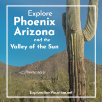 Most visitors to Arizona spend at least some time in Phoenix or the surrounding area, which is often refereed to as “the valley of the sun” for its abundant sunshine.
Once a collection of independent towns and villages, today it is almost impossible to distinguish where one sprawling community ends and the next begins. But Phoenix and Scottsdale have enticing, walkable downtowns with shopping, arts, and entertainment; there are art and cultural opportunities scattered throughout the area; and the valley’s location at the northernmost edge of the Sonoran Desert means that there is both plenty of options for hiking and botanically interesting landscapes to explore. And, of course, there are an overwhelming number of options for those just looking for a comfortable place to stay with a pool and warm sunshine.
- More information and travel journals for this part of the state can be found on the Phoenix and the Valley of the Sun page.
Southeastern Arizona
Boyce Thompson Arboretum
 Along the road to Globe, Boyce Thompson offers acres of native and exotic plants and beautiful hiking trails. Very little of it is a garden in the traditional sense, but it is a spectacular place — especially in spring.
Boyce Thompson Arboretum State Park (March 2015)
Cacti and More at Boyce Thompson arboretum (March 2009)
Historic Miami and Globe
Coming from the west, visitors to the old mining towns of Miami and Globe pass through a stunning canyon. Once in the towns, there is an intriguing mix of old and new.
Tucson
Historic Tucson
The Placita at Saint Augustine Cathedral
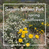
Saguaro National Park
Embracing the city of Tucson, Saguaro National Park preserves a classic cactus-filled Sonoran landscape.

Ajo and the border
Ajo is the gateway to Organ Pipe National Monument, a rugged area along the border with Mexico.
Discover street art in Ajo, Arizona
Arizona travel journals
Arizona and New Mexico (March 2015)
Central Arizona (February 2014)
Phoenix Area in Spring (March 2009)


Arizona is perhaps my favorite state after California. But for its extreme weather I’d probably move there. Because my sister lives there I had the opportunity to visit the state up and down for over 15 years, so I am acquainted with many of the sites you mention here. However, I still have some catching up to do which proves this state makes a great travel destination.
I didn’t know you had spent time here! You probably know things I have missed. I love AZ – there is so much to see. . . although you are right about extreme weather and I can’t say I have a lot of interest in being here in the summer. We’ll have to talk AZ sometime! Thanks for stopping by.