Last updated on June 12th, 2026
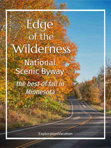
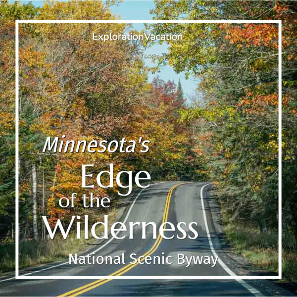
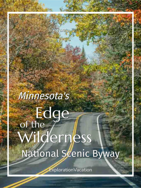
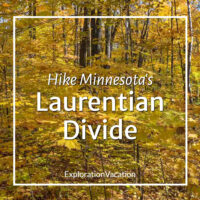
Minnesota has a lot of great fall drives, but the Edge of the Wilderness National Scenic Byway is among the best. And almost no one knows about it.
But now you do.
Keep reading for all the info you need to plan your own northern Minnesota road trip, including route details, favorite stops along the way, and places to eat and sleep.
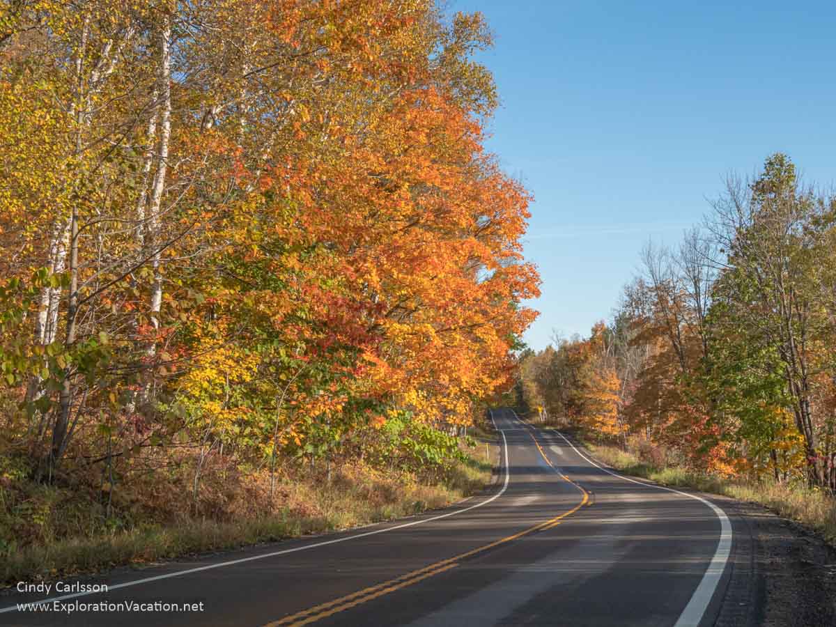
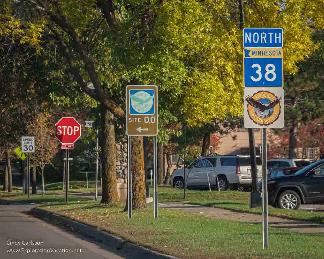
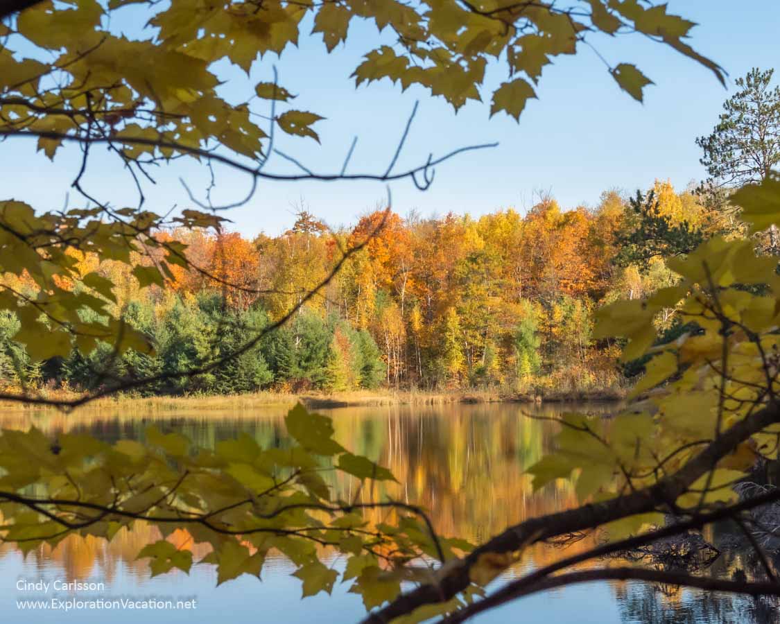
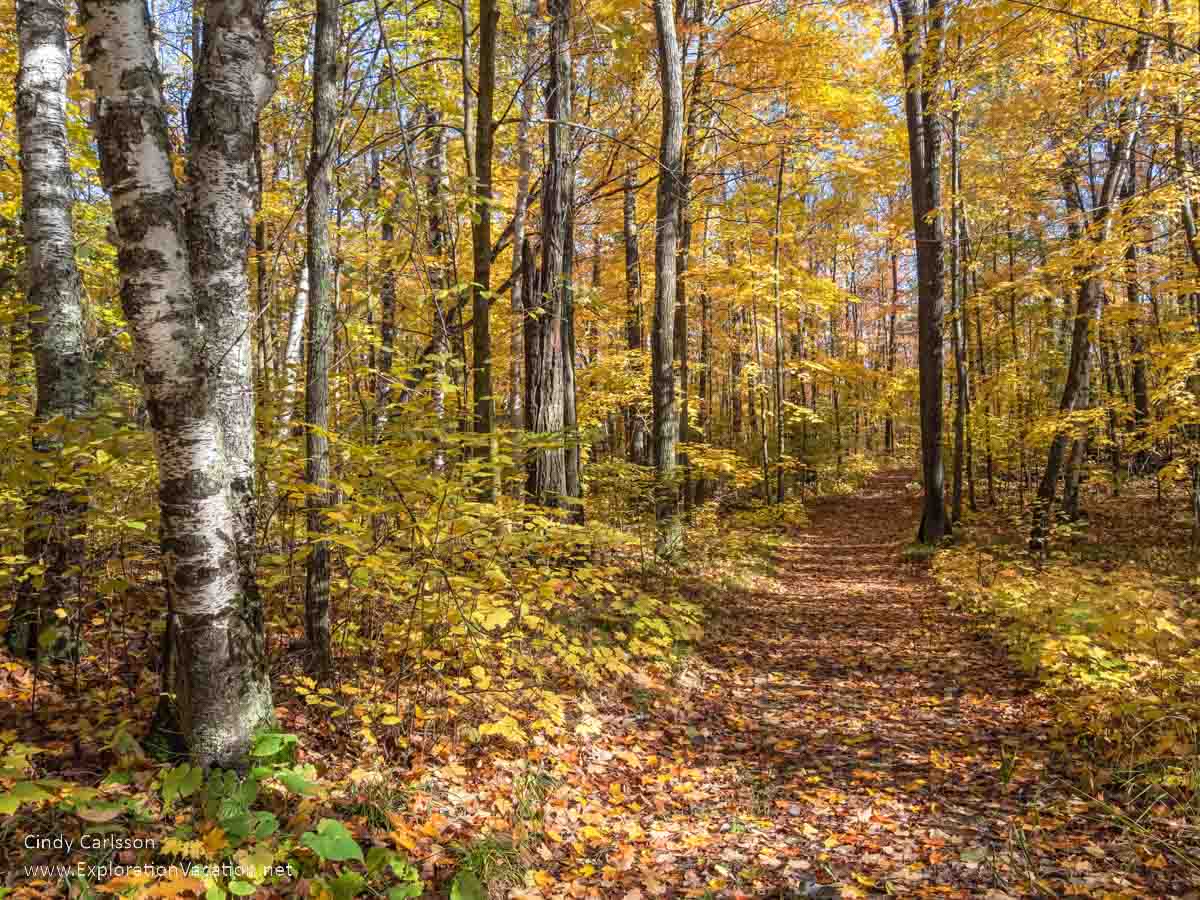
Fall color along Minnesota Highway 38, the Edge of the Wilderness National Scenic Byway.
Is this the best Minnesota fall color road trip?
Let me know once you check it out and decide for yourself.
A little background: I’ve driven (or been driven) along Minnesota highway 38 all my life, in all kinds of weather. Decades before the 47-mile stretch of highway between Grand Rapids and Effie became the Edge of the Wilderness National Scenic Byway, it was simply the road to my aunt and uncle’s house. A road we often followed far beyond their house looking for deer, enjoying the fall colors, and/ or enroute to one of the area’s many lakes and hiking trails. And we always ended up driving farther than planned because it was just too pretty to turn back!
It’s still beautiful. And I still have family there, so I still drive at least a portion of the scenic byway on Highway 38 at least once almost every year. Usually in fall, when the leaves burst into color.
(By the way, it’s gorgeous in the summer too. Fall’s just more colorful.)
I use links to improve your browsing experience, but a few also pay me a small commission if you use them to reserve a room, rent a car, or purchase goods or services. You don’t pay extra, but it helps keep this website running without intrusive advertisements. To learn more, review my policies and disclosures.
What you’ll see along the Edge of the Wilderness highway
Much of the Edge of the Wilderness Scenic Byway runs through undeveloped areas of the Chippewa National Forest. The route is noted for its lakes, forests, fall colors, and bald eagles.
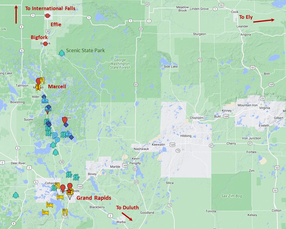
Click on the map or follow this link for an interactive map of things to see and do along the Edge of the Wilderness National Scenic Byway.
Before white loggers and settlers arrived, this was the home of the Anishinaabe (sometimes still referred to as the Ojibwe or Chippewa). The fish, game, wild rice, berries, medicines, and materials the land provided would have made a good life possible here long before white men arrived. And the landscape would have been dominated by vast forests. Forests that loggers almost completely cleared by the beginning of the 20th century.
Today the Anishinaabe have largely been pushed out of their ancestral lands. But the beauty of the land remains. There are still glistening blue lakes and second and third-growth forests have slowly replaced the towering pines that once blanked the landscape. It’s a different place, but still beautiful.
Know before you start
Don’t think I’ve led you astray when you start driving. I promise it will soon be gorgeous. After a few miles in either direction you’ll be very happy to be here – especially on a sunny fall day when the trees glow red, orange, yellow, and green! But, as you’ll see, neither end of the Edge of the Wilderness Scenic Byway is particularly scenic.
The following is a summary of what you can expect along the way. I’m also including a few highlights that are a bit off Highway 38, but worth the time and effort if you are in the area for a few days.
Starting in Grand Rapids (Mile 0)
The Edge of the Wilderness Scenic Byway on Minnesota Highway 38 starts at the edge of “downtown” Grand Rapids near the historic Central School and a block of historic buildings.
No, it isn’t wilderness, but I promise it gets better soon!
👉 Read more about Grand Rapids, Minnesota
(If you need a coffee or treat for the road, head down the street and around the corner to Brewed Awakenings. You’ll find an old building that’s been turned into a great coffee shop and café with a 50s vibe.)
Grand Rapids is better than it looks – and a great base for exploring the area
Downtown Grand Rapids is not a particularly auspicious place to begin a national scenic byway – even if this is one of the prettier spots downtown. But the Rapids has other things going for it.
With a population around 11,000, the Rapids is the largest city along Highway 38 and one of the larger ones in the region. But it doesn’t have much of its historic downtown left. That was consumed by the paper plant, two major state highways, a really ugly (and not terribly successful) shopping mall, and the usual site-by-site loss of historic buildings due to deterioration, fire, and the simple desire for something new. I thought the city was an urban planning disaster before I even knew what urban planning was.
However, my family has always thought Grand Rapids is the cat’s pajamas. And it IS a good place to live.
It’s even a good place to visit, with several lakes and the Mississippi River right in town, loads of parks and hiking trails, a few fun places to eat, the Judy Garland house and museum (she lived here for a few years as a child), the too-seldom-open Forest History Center, and an adorable historic depot where you can get visitor info center.
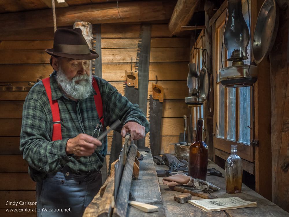
Learn what life was like in a logging camp at the Forest History Center circa 1900.
So, it’s worth spending at least a day or two in or near Grand Rapids – and stay longer if you want to hike, bike, fish, or just enjoy the scenery.
Lodging in Grand Rapids
Grand Rapids also has a fair amount of lodging in and around the city, but my all-time favorite bed and breakfast closed last year, so I’ll have to find a new place to feel at home in the city.
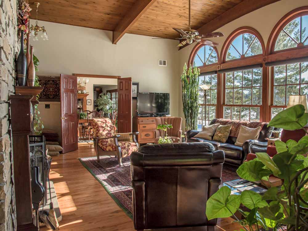
I need to find a replacement for my (now closed) home away from home in Grand Rapids.
For other lodging options in Grand Rapids, head over to Expedia or Booking.com, or check out VRBO to see if there are any lake homes available.
Or check the Visit Grand Rapids website. It has a list of lodgings, including places like Green Heron that have to be booked on their own sites. Unfortunately, there’s no map view, no way to sort by area, no reviews, and you need to follow at least two links to actually get to a site to get to the property’s website (if it has one) and/or a page where you can actually book. It’s probably easier to just do a Google search and use the map view to figure out what’s available. The exception: If you’re looking for a last-minute booking or a special. In that case, Visit Grand Rapids’ Last Minute Openings page might be useful. It looks pretty limited, but worth checking.
Eating in Grand Rapids
Grand Rapids has a ton of restaurants, including a lot of fast-food chains. A few personal recommendations:
- Timberlake Restaurant is the place to go for fine dining, although the pasta night is also a lot of fun. It was open on a limited schedule the last time we were in town.
- Forest Lake Restaurant is a northern Minnesota steakhouse in one area and more of a woodsy bar in the other. For years this was the go-to place for special occasions. It’s a little old-fashioned, but still has a nice atmosphere and really good meats. (I’m particularly fond of the ribs.)
- You can’t beat the view at Zorbaz located right on the Wendigo Arm of Pokegama. It’s fun and the pizza is good. You can even order ahead and cruise up in your boat to pick it up.
- I’m not a big pasties fan, but these vegetable and meat pies were a staple for generations of mine workers in the area. Pasties Plus makes the real thing and my cousin says they’re wonderful.
👉 Read less
Grand Rapids to Pug Hole Lake (Miles 0 – 13.4)
It takes a while to leave the woodsy exurban area that extends out along the highway from Grand Rapids. But once you do, you are in for a scenic treat. And if you visit during the fall leaf season, you can see really gorgeous fall colors all along the way – even before you get out of the Rapids!
Lind Greenway Mine marker and North Country/Mesabi Trail access
As you leave Grand Rapids you’ll pass through about 3.5 miles of rural residential areas until you get to Prairie Lake Road (County Road 61).
A short detour here takes you to a marker with information on the Lind Greenway Mine.
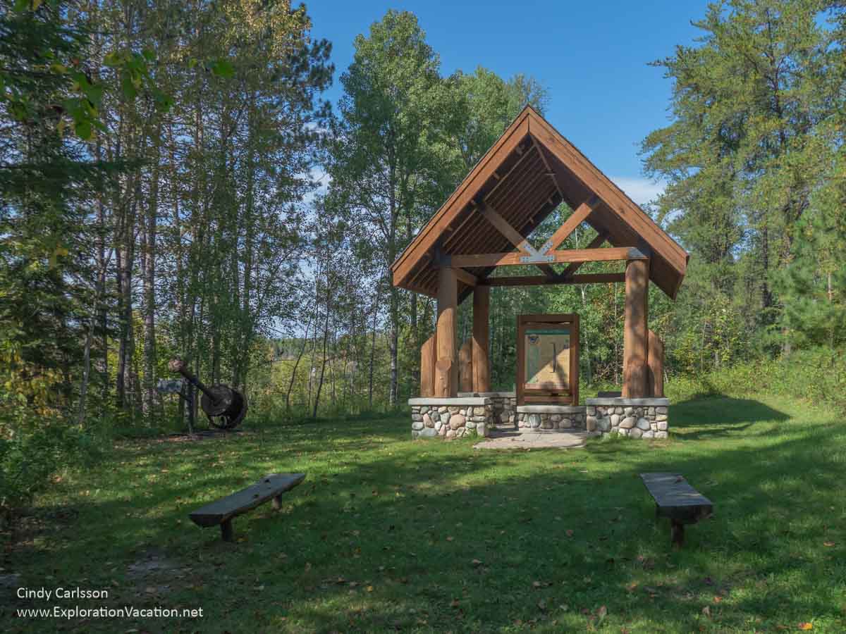
The Lind Greenway Mine kiosk and a piece of old mining equipment just off the Edge of the Wilderness Scenic Byway.
It also takes you back to pretty Lower Prairie Lake and a parking area for the North Country Trail and Mesabi Trail. (The trails should be conjoined here, with a 10-foot paved trail, but I haven’t been here since that happened.)
Black Spruce Tamarack Bog
Several maps of the Edge of the Wilderness Scenic Byway note a black spruce and tamarack (larch) bog around mile 8.5. There are lots of black spruce and tamarack bogs in this part of the state (although Minnesota is rapidly losing its tamaracks to larch beetles and climate change), but you can easily see this one from the road. However, there’s no place to pull over and you can’t get close to it.
Botany Bog SNA
The Botany Bog Scientific and Natural Area is located a few miles farther along and just off the scenic byway. It’s a short detour along Freestone Road (County 244), which is unpaved. Like all SNAs, Botany Bog does not have maintained trails or other facilities. But limited public access is allowed if you are up to a very wet hike through dense vegetation. Know the rules before you visit to protect this precious natural area!
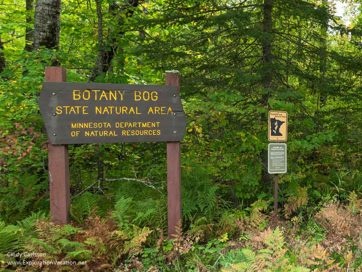
I found a couple signs for Botany Bog along the access roads, but nothing that resembled a trail. (This drops off into the bog just behind these signs.)
Trail to the Joyce Estate on Trout Lake
Visiting the Joyce Estate is a longer detour, as it’s a 3-mile hike into the site. But (what’s left of it) is pretty cool. This was the summer home of a wealthy Chicago lumber baron and his family. Begun in 1917 and pretty much completed in the 1920s, the property had a main lodge, family and guest cabins, greenhouse, par-three golf course, clay tennis courts, staff housing and work spaces, and storage areas for the family’s boat, seaplane, and automobile. The estate hosted many wealthy and influential guests and remained in use into the early 1970s.
Unfortunately, you won’t see much of that today.
When US Forest Service acquired the site, they decided it should become a natural area again. Thus, they left the property to rot until most of the buildings had collapsed or were about to collapse. By the time the site’s historic value (and value for various uses) was recognized, there wasn’t a lot left. Today only four of the original 40 buildings still stand. But it’s an interesting site and the hike to it is beautiful.
To get to the Joyce Estate from the scenic byway, take County Road 60 to County 335 to the Trout Lake Tract parking area. Then hike 3 miles along past Bluewater Lake and along Trout Lake into the site.
You also used to be able to get from the water, but you may not be able to come ashore there anymore. However, even if you can’t get on shore there, this whole area has gorgeous, mostly interconnected lakes that are fun to explore from the water.
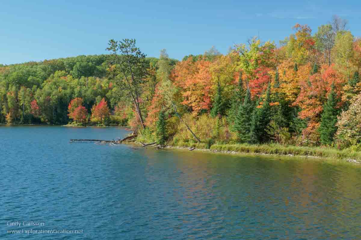
Pughole Lake
Pughole Lake at mile 13.4 is easy to access, with a boat landing, parking area, and small dock. (The entrance looks a little iffy from the highway, but you can get in with any sort of car.)
The lake is pretty, but the trees always have a great mix of color along the road, in the parking area, and along the lakeshore.
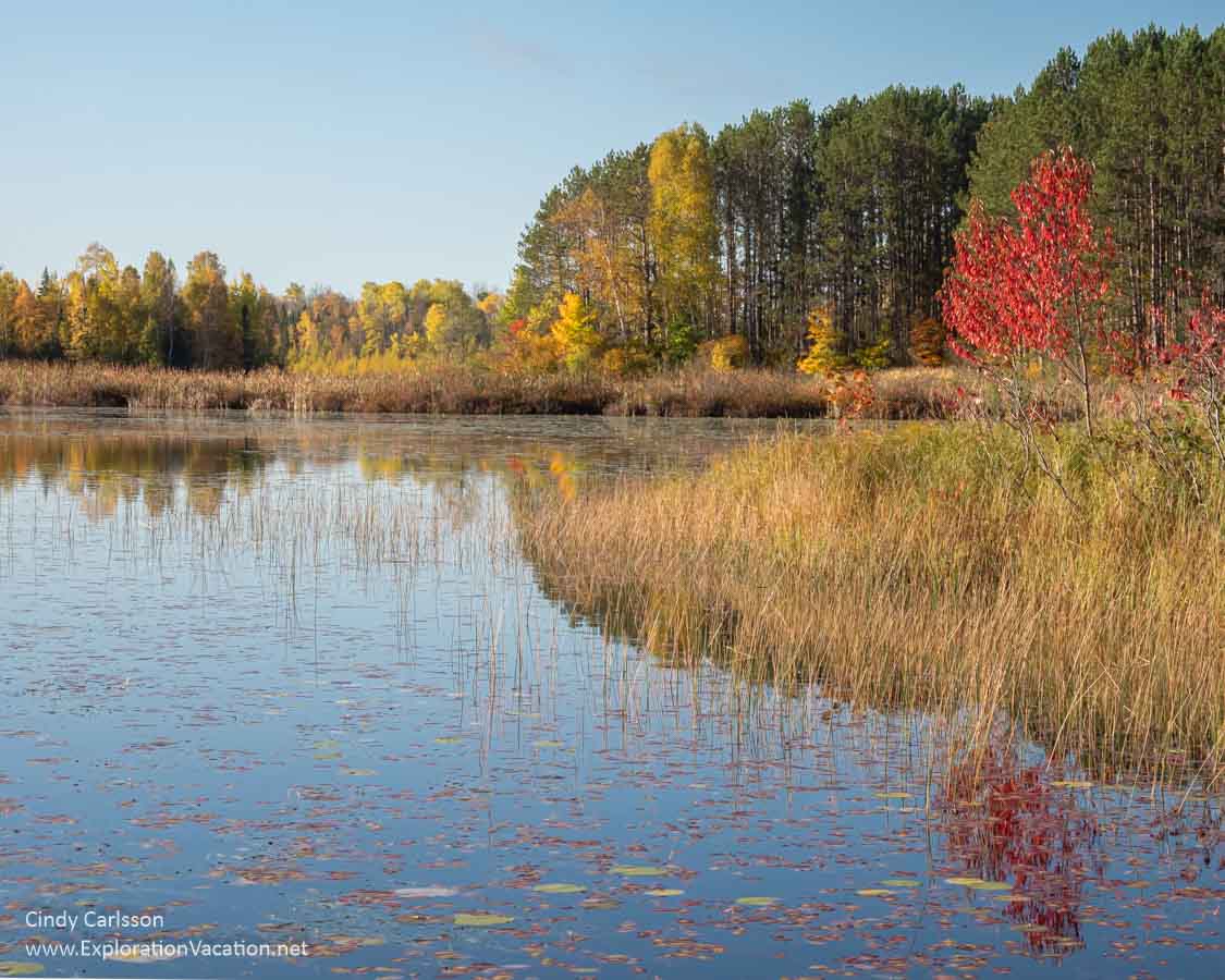
Fall colors along Pug Hole Lake.
Be careful coming out again, as people really fly through the curves on this section of the highway.
Pughole Lake to the Laurentian Divide (Miles 13.5 to 20)
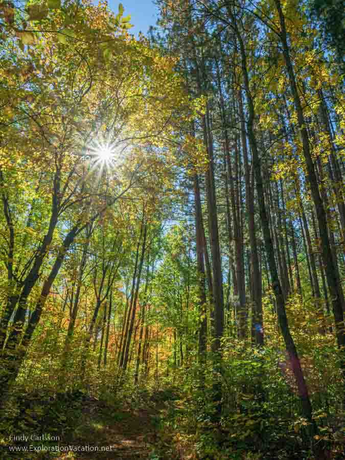
By now you should agree that this is a great fall drive. And the beauty is going to keep coming now for most of the rest of the route!
Suomi Hills and Day Lake CCC Camp
Suomi Hills is one of my favorite fall hikes. The forest here is gorgeous in fall and the rolling hills aren’t too hard to hike – or at least, the few miles I’ve done over the years have been pretty easy. And there are lots of lakes to fish in or just admire.
Fall hikes at Suomi Hills can be very colorful!
There are two access points to Suomi Hills: The southern entrance, about 1.5 miles north of Pug Hole Lake and the northern entrance just south of Day Lake at about mile 19.
This entire area is strictly non-motorized, so it’s great for bird and wildlife watching. Note, however, that the 19 miles of mowed trail seems to be shared by hikers and bikers, so you do need to be a bit cautious – not that this area ever seems very busy. (Perhaps that’s because this Chippewa Forest trail isn’t that well-known and the online maps aren’t very good.)
The remains of the Day Lake Civilian Conservation camp are at the north end of Suomi Hills. Built during the Great Depression, it was also used to house German prisoners of war during World War II. There’s not a lot left – mostly just a few foundations, chimneys, and bits of rusted metal.
Another unusual spot in Suomi Hills is the Miller Lake beaver dam washout. It’s near Amen Lake in the southern area. The original dam must have been enormous to create such a huge gully when it washed out. What remains is described as a “sunken” lake and the area was very wet and swampy when I visited not long after the second dam washed out in 1993. But if the mosquitos aren’t too fierce, it is pretty interesting to see how dramatically beavers can reshape a landscape.
Surprise Lake Roadside Park
Not exactly sure how this pull-off qualifies as a roadside park, but it is a good parking spot (along a road with almost no place to pull over) that lets you take a peek at two lovely lakes – Surprise Lake and Kremer Lake.
You can barely see the other shore of Surprise Lake through the trees.
You can get a better look if you climb down the bluff, but it’s muddy and slippery.
It’s easier to see Kremer Lake.
The leaves are just starting to turn along Kremer Lake.
While there’s no good access to the shore of Surprise Lake from the parking area, you could haul a canoe down to Kremer Lake.
It’s a little steep, but you’d have a good beach to put in a canoe at Kremer Lake.
Laurentian Divide to Marcell (Mile 21- 27)
You’re still in a gorgeous area for this segment of the Edge of the Wilderness byway, although you’ll start to see development again as you approach Marcell. But then, you’ll also have options if you want to stop and eat.
Laurentian Divide Wayside and Trails
The USA has five continental divides that mark the boundaries of major watersheds. One of those, the Laurentian or Northern Divide, runs through a big chunk of northern Minnesota. On one side of this line water flows north into Canada and the Arctic, on the other it mostly flows south to the Gulf of Mexico.
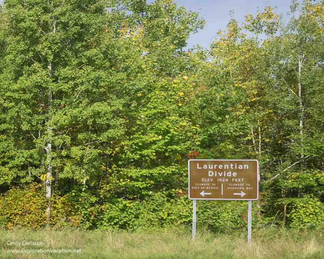
Marker on the Laurentian Divide along Minnesota Highway 38.
The Laurentian Divide Wayside (identified as the “Continental Divide Wayside” by Google) has a huge parking area, covered picnic tables, toilets, and a couple of very nice loop trails.
Most of the trails at the Laurentian Divide Wayside are heavily wooded and very colorful in fall.
If you brought a picnic or snacks, this is a good place to stop and eat.
Caribou Lake
Caribou is another pretty lake with access right on the road via a boat launch. This one also has a resort on the other side of the lake.
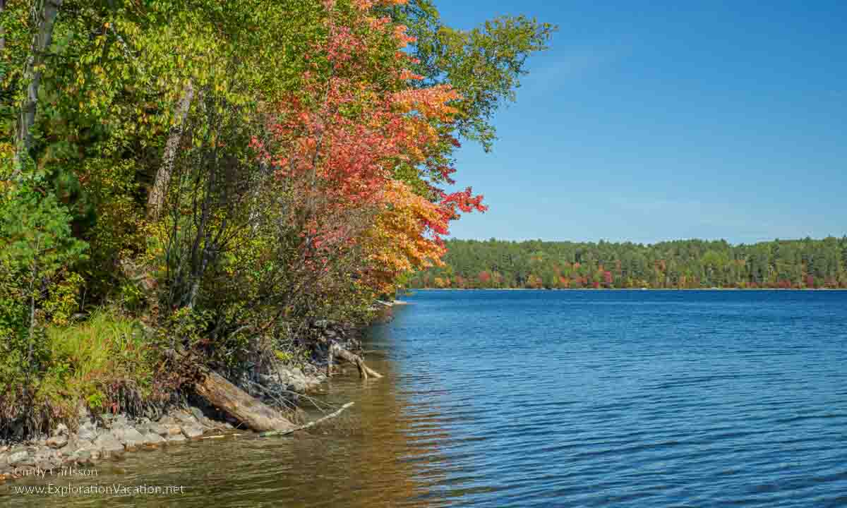
Fall color along Caribou Lake.
North Star Lake
North Star Lake first comes into view as you come up a slight rise and around a bend. And the view seems to capture “northern Minnesota” in an instant – especially if someone is out in a boat fishing!
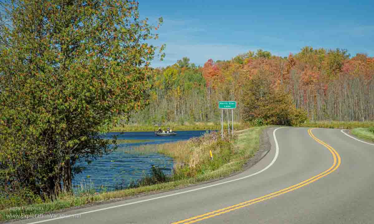
Doesn’t this just shout “Northern Minnesota?!”
Fortunately, there is actually some space to park here, both above the lake and at the boat ramp.
This looks like a really fun lake to canoe. And, with several resorts and a campground right on the lake, it would be an easy place to spend a few days or a week exploring.
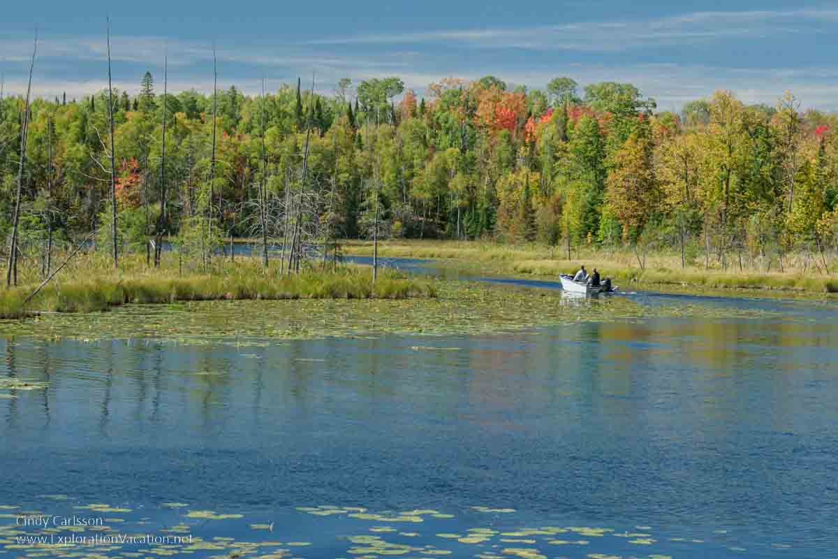
I’d like to take a canoe out on this part of North Star Lake.
Marcell (Mile 27.7)
Marcell looks like a small city, but technically it’s not a city at all. The “city” is the commercial hub of a rural township that covers 56 square miles, all or part of 48 lakes, and about 450 residents!
Edge of the Wilderness Discovery Center
If you started your road trip along Highway 38 in Grand Rapids, it may seem a little late in the journey for the Edge of the Wilderness Discovery Center. But it’s still worth a stop because you can get information on everything in the Chippewa National Forest, not just the sights along Highway 38. You can also get advice on other scenic routes, wildlife, and activities in the area. There’s also usually a good selection of maps and local information available.
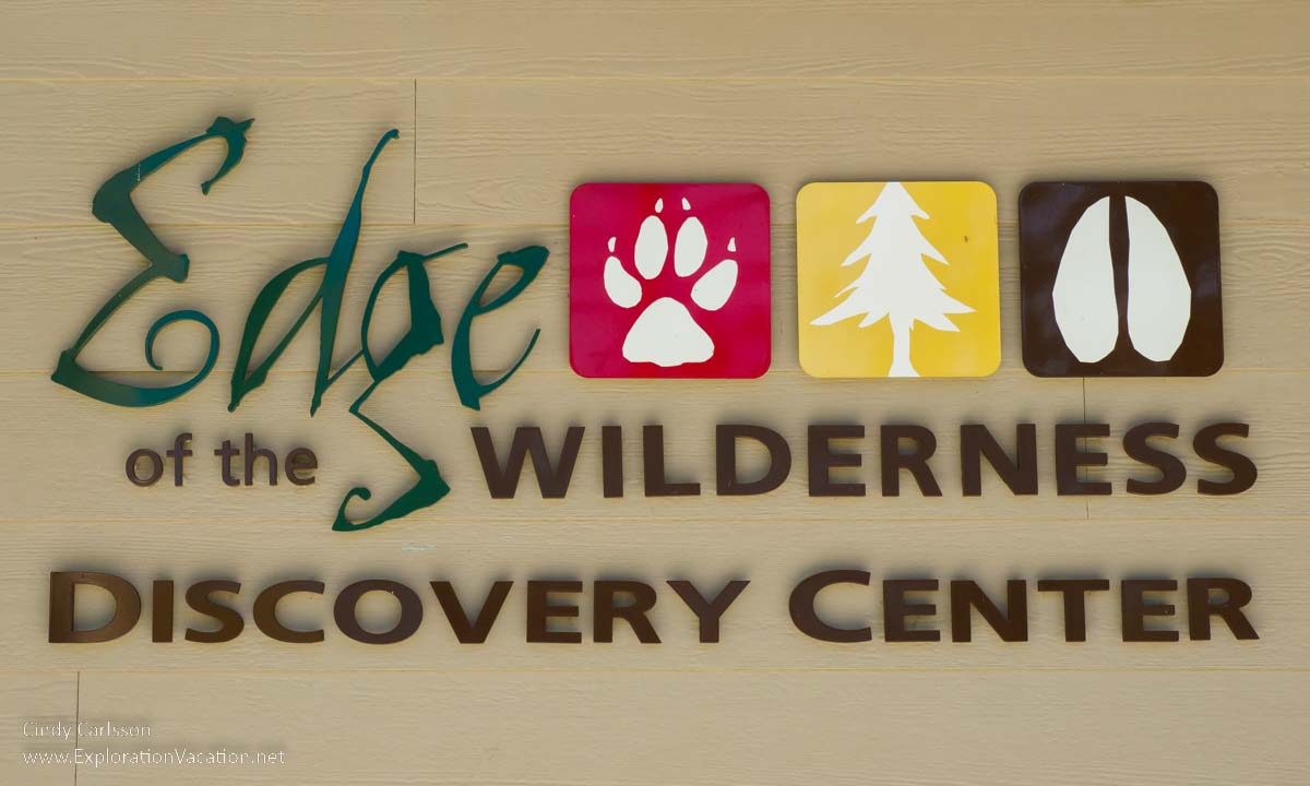
Stop in at the Edge of the Wilderness Discovery Center for information and a little shopping!
And the gift shop has some unique local items, sometimes even local hand-harvested wild rice.
Gut and Liver Rail Line
Several websites reference a stop for the Gut and Liver Line just off Jack the Horse Lake Road and very near Timberwolf Inn. The “Gut and Liver Line” was the short-lived early 20th century Minneapolis & Rainy River rail line. (The story behind the nickname is a bit unclear. It relates either to the too-frequent serving of liver sausage at the lumber camps along the rail line OR the amount of animal guts the train collected while hitting wildlife en-route. Yeah, I know. Ick.) You may find bits of metal or lumber from the long-gone track and rotted trestle here and there along the old rail line, but that’s about all that remains. There’s really not much to see.
I’m pretty sure there’s a marker here with info on the railroad, but I was too intent on getting my Bacon Blue Brussel Bowl at Timberwolf to pay much attention to it. I’ll take a closer look next time I’m up here.
Eating in Marcell
Marcell has one restaurant along Highway 38 in the “city” area. I haven’t eaten at the Pine Cone Soup and Sandwich Café, but it sounds good. Note that it’s a breakfast and lunch spot that closes after lunch.
My favorite spot is farther north, as you leave Marcell.
Timberwolf Inn is a northwoods lodge with a restaurant with food that draws visitors from Grand Rapids. Everything we’ve tried has been very good, but I love the Bacon Blue Brussel Bowl –fried brussels sprouts with bacon and blue cheese. (But they do have a new chef, so last time it took them two tries to get it right.)
Lodging in Marcell
There are no traditional hotels or motels in Marcell. However, there are a few lodges and VRBO rentals in the area. (Watch the map as you search.) Unfortunately, you can’t book most of the area’s resorts on third-party platforms.
Bigfork (Mile 40)
Despite a population about the same as Marcell, Bigfork is actually a city. And logging is still important here, as it has been since the first white man claimed a bit of the forest for logging and built a cabin here around 1887.
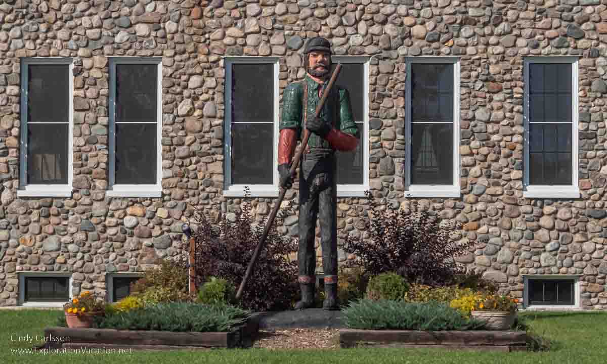
A carved wood statue outside the historic Bigfork City Hall commemorates early loggers.
Bigfork’s 1930 City Hall is on the National Register of Historic Places.
If you want to see another logging statue, there’s a logging scene at the north end of town.
Unfortunately, I’ve never spent as much time as I’d like exploring Bigfork. It looks like a nice little town. And, because it is near Scenic State Park, it has a variety of lodging and dining options. You can find a mix of hotels, motels, resorts, and private homes on both Expedia and Booking.com. VRBO also has options in the area. And there are additional lodges and resorts that aren’t on third party sites. Of course, camping is also an option in this area.
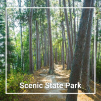
Scenic State Park
A short side trip out of Bigfork will take you to aptly named Scenic State Park.
Scenic is unusual in Minnesota because it was saved from logging by local residents who wanted to save the big pines along the shore. It’s been protected since 1921.
There are only two hiking trails here. Each is about 2 miles long and pretty easy. The Tell Lake Trail offers the best fall color. But take the Chase Point trail if you want to walk among the pines high above the water. (It’s pretty dramatic, even if they keep losing big trees to storms.)
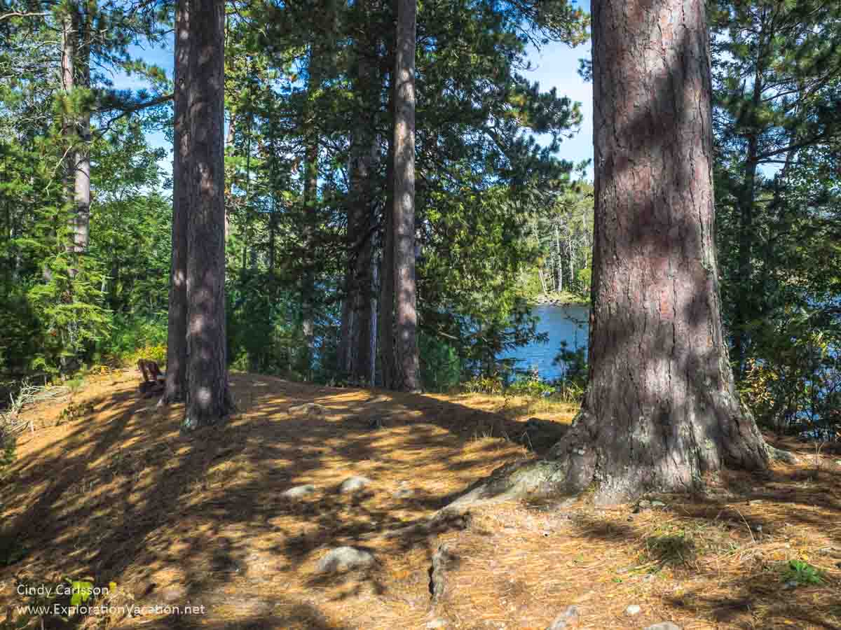
Pines high above the lake at Scenic State Park.
The park also has ten historic Civilian Conservation Core buildings – some constructed for the CCC camp located here and some built specifically for the park. These include a gorgeous lodge/interpretive center/picnic shelter with original handmade furniture.
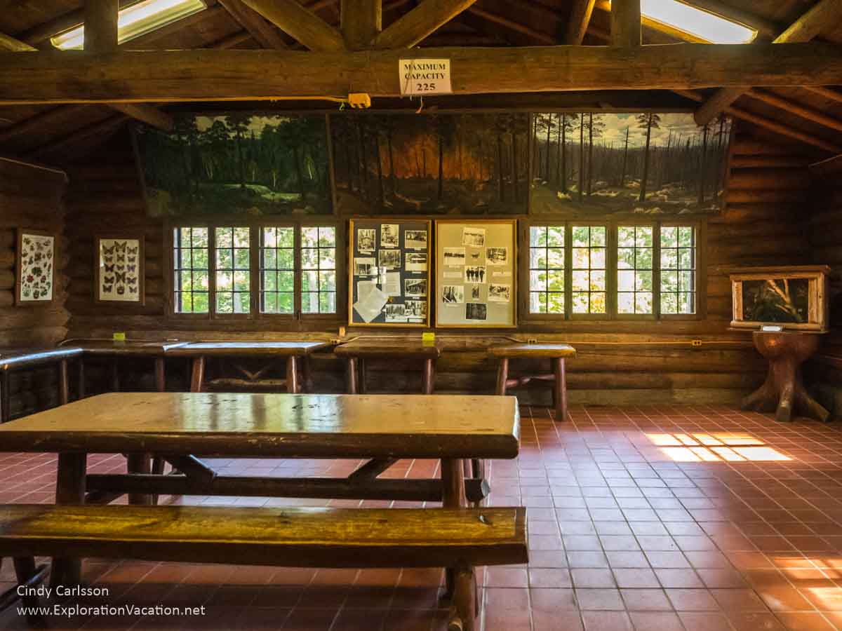
Interior of the lodge / interpretive center / picnic shelter at Scenic State Park.
Eating in Bigfork
The only places to eat in Bigfork seem to be the Pizza Palace and Park Recreation (mostly a burger and sandwich spot with ice cream). Both have good reviews, but I haven’t eaten at either one.
Effie (Mile 47)
A rural agriculture area more than a forest recreation area, Effie is a really small city. It’s noted for its summer rodeo, the Northstar Stampeed.
If you’re headed further into the wilderness, Effie is where you either head east to Lake Vermillion and/or the North Shore (via Ely) or head north to International Falls and Voyageurs National Park. Go either direction to find lots more great northern Minnesota scenery and activities.
Eating in Effie
You have better dining options in Marcell or Bigfork. However, if you are hungry when you get to Effie, you have a couple of choices right in town.
I’m pretty sure I ate at the Effie Café a couple of decades ago and it doesn’t sound like it’s changed much. It should be a decent spot for breakfast and lunch if you want something hearty and basic.
How do you get to the Edge of the Wilderness Scenic Byway?
The Edge of the Wilderness National Scenic Byway segment of Highway 38 runs between the north-central Minnesota towns of Grand Rapids and Effie. For most travelers, Grand Rapids (on the south end of the byway) is the easiest starting point
Wherever you start, you’ll want a motor vehicle. This is a road trip along a scenic byway that isn’t very safe for cycling (use the great bike trails through the area instead) and doesn’t have regular local bus service. So, you’ll need access to an auto or motorcycle to really explore the Edge of the Wilderness.
Most visitors drive their own vehicle. However, it’s possible to take a bus into Grand Rapids (Minnesota) or fly into Hibbing. From there you SHOULD be able to pick up a rental car.
👉 Read more about getting to the Edge of the Wilderness Byway
Driving to Grand Rapids
Traveling from the Twin Cities metro area.
Grand Rapids is about a 3-hour drive almost straight north of Minneapolis. While Highway 169 is usually the recommended route, it can be quicker (and more relaxing) to take Highway 65.
Highway 169 is mostly divided and runs through both lovely forest areas and heavily developed urban ones. If you are on the west side of the Twin Cities metro, this is the fastest, easiest route.
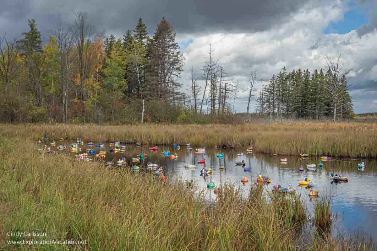
Highway 65 runs through urban development with lots of stoplights until you beyond the edge of the metro area. But after that it’s a scenic mix of farmland, wetlands, and forest with a few small towns along the way. It’s also where you’ll find Minnesota’s Ditch Ducks!
If you are coming from the east metro, take I-35 north to North Branch and then take 95 west to 65 at Cambridge. It’s a fast and pleasant route that avoids slow-downs in the metro area. It also gives you options for stops along the way, including Rice Lake National Wildlife Refuge and Savanna Portage State Park. Or you can keep going west out of Cambridge and pick up 169 in Princeton. That runs along Mille Lacs Lake and offers opportunities to see really big fiberglass fish statues and two state parks. (Mille Lacs Kathio and Father Hennepin, both of which are gorgeous in the fall.)

You can get a selfie with a giant fiberglass muskie in Isle along Mille Lacs Lake.
If you are coming from the Minneapolis airport, either 169 or 65 is the same distance and usually takes about the same amount of time. However, don’t take 65 through the city. Ignore Google and take I-494 to I-35E north to get out of the city. Then pick up 65 from North Branch and Cambridge.
Traveling from Duluth
Highway 2 takes you into Grand Rapids in about 1½ hours.
If you want more of a road trip, take Highway 53 up to Highway 1 at Cook. That will take you to the northern end of the Edge of the Wilderness Byway at Effie.
Traveling from International Falls
If you are coming from International Falls or Canada, you can get to Effie in about an hour. But leave time to take a break at the Big Falls in Big Falls.
Take the bus to Grand Rapids
Both Greyhound and Jefferson Lines offer regular service between several points in Minneapolis and Grand Rapids with a transfer in Brainerd. Assuming no delays, Greyhound’s transfers are well-timed to keep the total travel time under 4½ hours. Jefferson’s transfers are also well-timed, but the route is longer and makes several stops along the way, increasing the travel time to over 5 hours.
Both offer similar direct service to Grand Rapids from several points in Duluth. Most routes keep travel times under 3 hours.
Rental cars are available in Grand Rapids, but book well in advance if you are traveling during summer or fall.
Flying to lake country
There are no regularly scheduled commercial flights between MSP and Grand Rapids. However, Delta runs regular flights to Hibbing and Brainerd.
Hibbing is less than an hour’s drive from Grand Rapids. Brainerd is about 1½ hours.
Renting a car in Lake Country
Rental cars are available in both cities, but I couldn’t find any using third-party search sites. It looks appears some major rental agencies have offices in both cities, but they didn’t always come up in general searches. Duluth, Hibbing, and Grand Rapids both have ACar Auto Rental outlets that show (very expensive) cars available.
If you plan to take the bus or fly, do some research and reserve your car BEFORE you book your flight.
Bicycling
Much of the Edge of the Wilderness Scenic Byway looks like it would be fun to bike on a beautiful fall day — except that the most scenic sections are narrow and traffic moves fast.
Grand Rapids has a slew of designated bike and recreational trails. These are a much safer option
👉 Read less
When are the fall colors best along the Edge of the Wilderness Byway?
The area around Grand Rapids is one of the first places in the state to see fall color. Peak color is hard to predict, but you’ll usually see the best mix between the third week of September and the end of the first week of October.

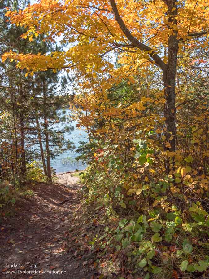
Fall color at the Pug Hole Lake parking area!
This area was heavily logged more than 100 years ago, so many of the original pines were replaced by aspen (poplar), birch, maple, and a sprinkling of oak. (Visit the Lost Forty if you want to see what much of the area originally looked like.)
But that second or third growth forest makes for a very colorful mix that reaches peak color relatively early. And boggy areas often have tamarack (larch), which turn a little later. So, if you miss the aspen and the first of the maples, you’ll still have later maples, birch, larch, and a few oaks to provide a bit of color. And there are always some deep green pines to contrast with all that bright color.
What’s the color like right now?
Use the Fall Color Finder to see what’s happening in the area as leaf season approaches. (It’s updated weekly.) Then look at what Savanna Portage, Scenic, and Schoolcraft state parks are reporting on their own websites. They’ll often provide more recent and more detailed information. That may include the color status along particular trails and for specific types of trees, as well as what to expect in the next few days or week. From that you can get an idea of when and where to find peak color.
When peak color occurs can shift year to year. In general, if the weather stays warm into September, the leaves usually change a little later. If there’s a nice cold snap with a frost in early September, you’ll see color a little earlier. (A good frost can really kick-start the color change.) Color may be better in a wet year than a dry one, but that isn’t always true unless it is really dry all summer. (If the trees are draught-stressed their leaves will start dry and drop during the summer, leaving fewer to turn color when fall comes around.) And, of course, a storm with wind and rain can strip most leaves from the trees in an afternoon.
Tips for exploring the Edge of the Wilderness Scenic Byway
The entire route is paved, although many side roads are not. And, while sections of the road are wide with wide mowed shoulders, many of the most scenic sections are a twisting two-lane road with no shoulders and lots of roadside trees. And, once you get beyond the Grand Rapids area, there really aren’t any roadside services and only a couple of spots with toilets along the highway until you get to Marcell.
👉 Read more tips for exploring the scenic byway
Biking along Highway 38 can be dangerous. Fortunately, a mix of paved and unpaved paths run through this area, offering a way to see similar scenery without biking right on the scenic byway.
Slow down, but only stop where it’s safe
While there usually isn’t a lot of traffic on the Edge of the Wilderness Byway, much of the traffic you will come across will be moving fast. Check carefully before pulling out of side roads and parking area and be cautious on curves.
White tail deer are found all along this route. Watch for them at any time of day, but be especially vigilant at dawn and dusk when deer are most active and hard to see. And keep in mind that they often move in small groups. When you see one, stop and look for more of them before continuing on.
The spots listed here are about the only places where you can pull-off and park along the road. In most areas, the lack of shoulders and limited visibility make it dangerous to stop even just to take a picture. (Forest roads are usually quiet enough you can do that, but not Highway 38.)
Make your trip shorter or longer
If you’re short on time and heading back to Grand Rapids on the same route, the Timberwolf Inn north of Marcell makes a good turn-around spot. The food is top-notch and you get to see the best of the scenic byway.
If you want to extend your time, the Edge of the Wilderness Scenic Byway provides access to a number of hiking and fishing options. The area around the byway also has a number of resorts, should you want to spend even more time exploring the Northwoods and its many lakes.
And, of course, the highway also connects to a number of other roads that offer great fall colors. Some of the best routes are on unpaved forest roads, so a little exploration can lead to some spectacular finds.
The Edge of the Wilderness Lodging Association has a website with information on the area with links to a bunch of maps. These include a map of Fall Color Routes (pdf) that give you some good options for fall loops if you don’t mind a few unpaved roads. The US Department of Transportation Edge of the Wilderness webpage also has a nice (little) map that shows the area around the scenic byway.
And don’t be fooled. While the Scenic Highway (County Road 7) has a few really beautiful sections (mostly within Scenic State Park), it’s mostly residential.
Prepare for the weather
Weather can be extremely variable here at this time of year. And it can change dramatically in a few hours. No matter what the forecast says, bring a jacket for fall leaf-peeping.
Also bring bug spray if there hasn’t been a good frost yet and you want to do some hiking.
Plan ahead
This area is relatively undiscovered, but it’s not a secret. And the fall leaf season coincides with some of the early hunting seasons that also draw folks to the area.
Although it’s easier to get a last-minute peak leaf season reservation in Grand Rapids than in Duluth or along the North Shore, Thursday-Sunday nights are often booked solid. And, while many resorts are still open, most will also still require at least a 3-night stay.
So, while it’s nice to wait and watch to see when the peak will be, you might not be able to find lodging unless you are camping.
(Rental cars and restaurant reservations can also be hard to come by from summer through leaf season.)
Seasonal events and activities include the annual Bargains are Great on 38 47-mile garage sale in September, as well as the beginning of the performing arts season in Grand Rapids.
👉 Read less
Tell Google it’s Grand Rapids MINNESOTA
Always add “MN” or “Minnesota” when searching online or you are very likely to get results for Grand Rapids Michigan!
For more information check the Edge of the Wilderness Lodging Association website and the (difficult to use, but very useful) Chippewa National Forest website. The US Department of Transportation Edge of the Wilderness webpage also has a nice (little) map that shows the area around the scenic byway.
See more photos of the Edge of the Wilderness Byway and northern Minnesota in general at CindyCarlsson.com.


Wow! Feel like I was there with you, and great pictures so I don’t feel that I have to actually go myself.
I hope that’s a good thing. . .