
Last updated on March 24th, 2026
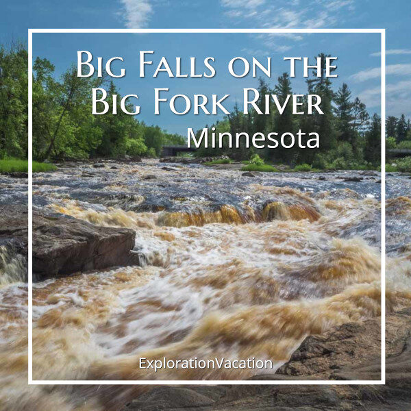
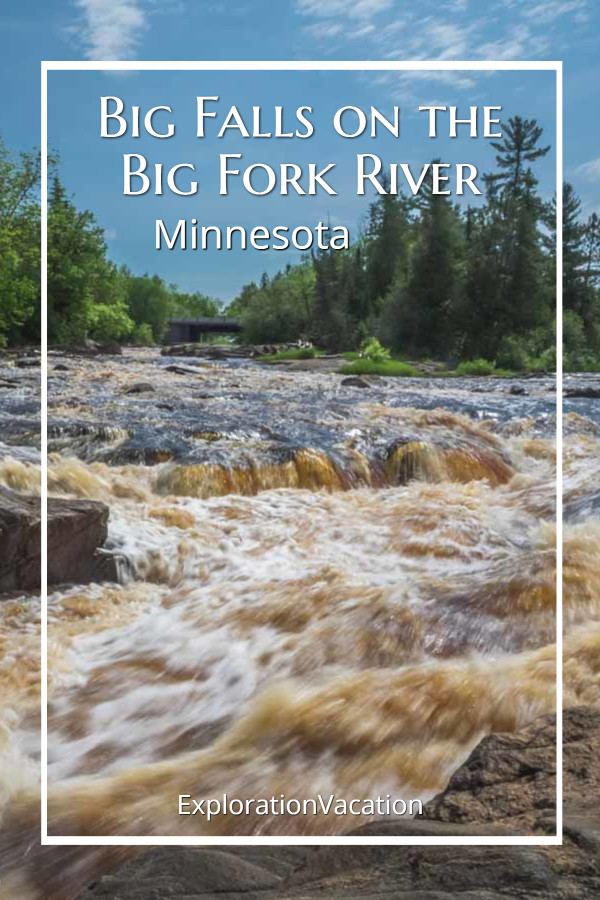
Although the Big Falls on the Big Fork River is more rapids than waterfall, it’s still a lovely spot.
The Big Fork River twists and turns through the heart of Lake Country in north central Minnesota. It runs north for 165 miles, winding through mostly isolated and undeveloped land from Dora Lake to the Rainy River along the Canadian border near International Falls.
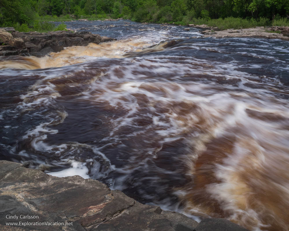
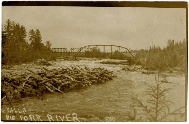
At the city of Big Falls, the Big Fork River drops 40 feet over a quarter of a mile in a series of four falls.

Once the scene of massive log jams as timber was floated along the river to lumber mills in International Falls, today the Big Falls on the Big Fork River is a scenic stop for visitors to Minnesota Lake Country.
I use links to improve your experience using this website. Some may be affiliate links that pay me a small commission if you use them to book a room, rent a car, or purchase goods or services. You don’t pay extra, but it helps keep this website running. To learn more, see my policies and disclosures.
Admiring the Big Falls
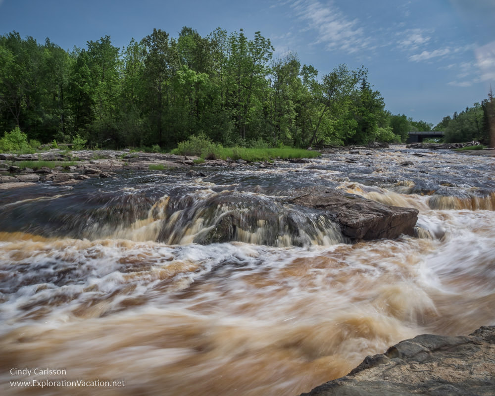
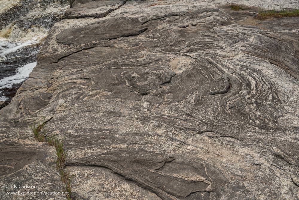
While none of the drops that make up the Big Falls on the Big Fork are particularly dramatic in and of themselves, the overall effect is impressive.
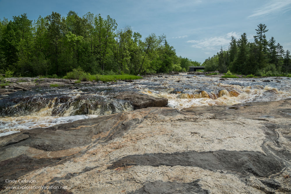
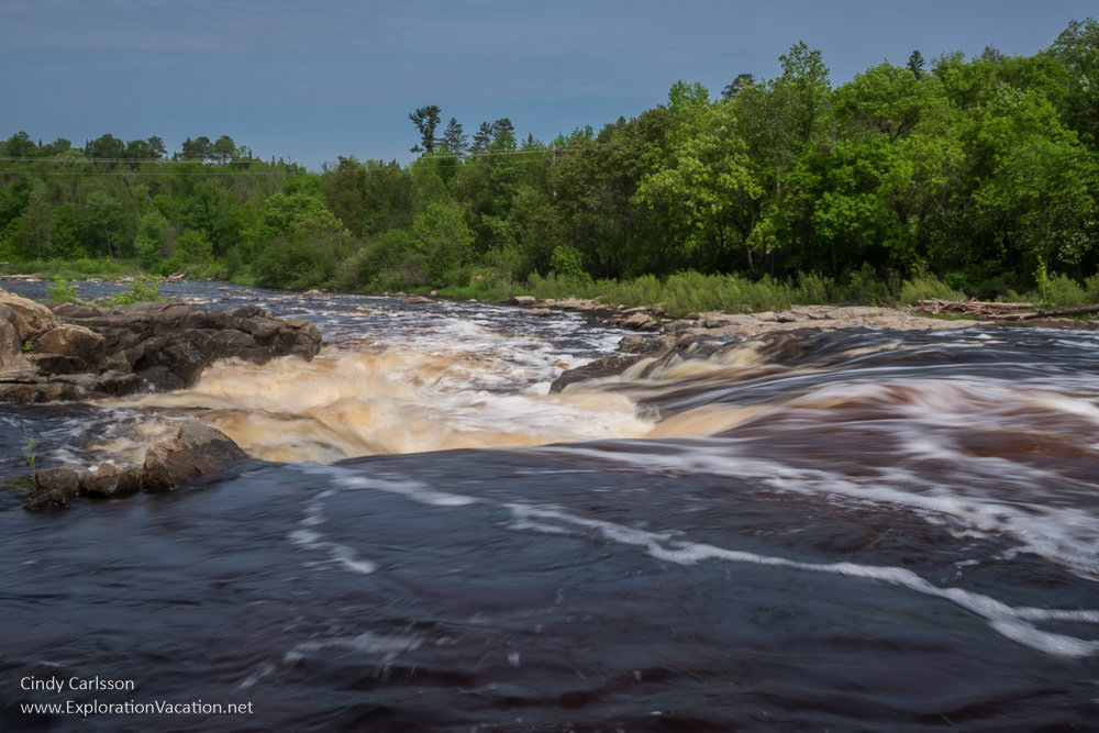
As waterfalls go, Big Falls is very user-friendly. The oddly striated rock that juts into the churning river provides stable viewing platforms that are all-but-in the falls itself.
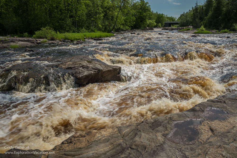
It’s pretty dramatic when you get close to the water.
Reflecting on the past
Of course, for decades the Big Falls on the Big Fork River was more of an industrial obstacle than a tourist attraction.
The Big Fork River was a busy logging route from the end of the 19th century into the early years of the 20th.
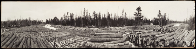
Logs in the Big Fork River, McNair Headquarters Camp, photographed by Olson, circa 1910. Photo from the Minnesota Historical Society collection, locator number HD5.41 r60.
Lumber would be cut upstream and hauled to the frozen riverbank during the winter. Come spring, those logs would be slid into the water to begin their journey to the mills in International Falls.
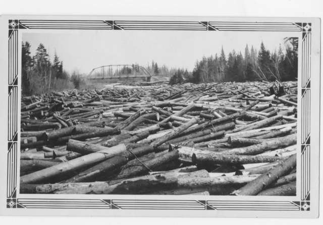
Log Jam on the Big Fork River, Koochiching County, circa 1910. Photo from the Minnesota Historical Society collection, locator number HD5.44 r23.
Thousands – maybe millions – of logs could flow smoothly along a fast moving river with no obstructions. However, the multiple drops and jagged boulders of the Big Falls on the Big Fork tended to toss logs into gigantic piles.
Logging on the Big Fork River (log jam?), 1925. Photo from the Minnesota Historical Society collection, locator number HD5.44 r31.
It might take days for the river rats responsible for keeping the logs moving to break up a big log jam.
And sometimes log jams seemed so intractable that explosives were brought in!
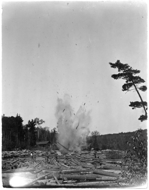
Breaking up a log jam with dynamite at Big Falls, circa 1890. Photo from the Minnesota Historical Society collection, locator number HD5.44 r9.
I’m guessing the Big Falls probably wasn’t a very relaxing spot for picnicking back then.
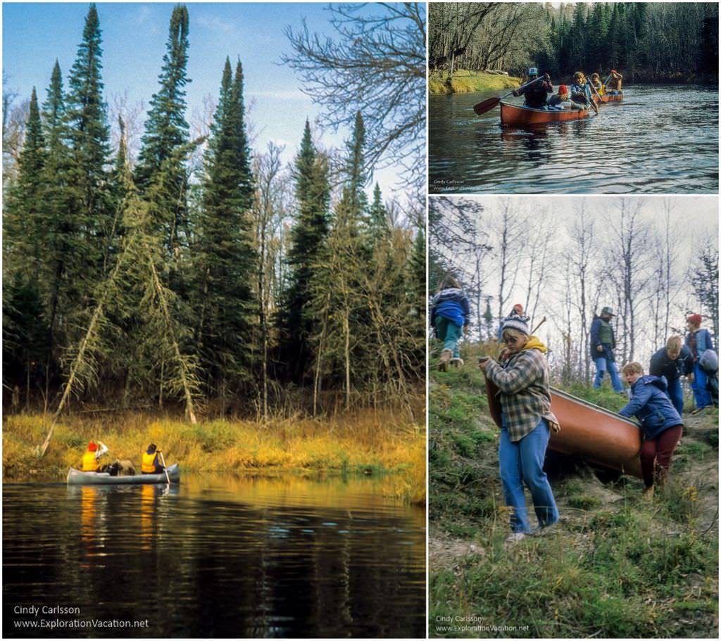
Paddling the Big Fork River
When I visited the Big Falls last year, I’d only been there once before: More than 30 years ago on a college canoe trip on the Big Fork River.
That long-ago trip started off on a perfect late fall day in October. The sun was hot and the wind was still, so we spent most of the day lazily floating downstream. Then the weather changed: The skies clouded over, the temperature plunged, and intermittent rain fell.
After a few days we came to the Big Falls.
The Big Falls requires a ½ mile portage. The day was windy and cold, with heavy skies threatening rain or maybe snow.
Some of us were ready for the trip to be over. The Big Falls was our escape route.
Instead of portaging our canoes over the road and downstream to continue on, a group of us pulled ours out of the water and tied them on the trailer. While the rest of the group continued on the river for another day, we watched the falls for a bit and then headed back to camp
That was my first and last canoe trip. It was a long time ago. So long ago that most of the details have gone soft and hazy like the shoreline on a damp, foggy morning.
I don’t remember where we put in, where we camped, what we ate, or even how many nights we were out (I think it was two, but it could have been three).
I do recall hauling canoes and gear up steep, slippery trails; setting up camp in wet grass; awaking to frost and ice; and feeling too exhausted to eat, but too cold to sleep.
But I also remember gliding through a beautiful wilderness, warm sunshine slipping through bare trees, and how fear turned into elation as we shot through small rapids.
And, all these years later, I am still friends with one of the women I got to know on that trip.
The Big Fork River bestows its gifts generously, but not easily.
Plan a visit to the Big Falls
Getting to the Big Falls on the Big Fork
The Big Falls on the Big Fork River is located right off of State Highway 71 at the northeast edge of the city of Big Falls
Big Falls is about a five-hour drive northwest from the MSP area. It’s less than an hour drive from International Falls and about 1½ hours from either Grand Rapids or Bemidji. It isn’t on a main highway, but most of the route to the Big Falls will be reasonably scenic. So relax and enjoy the trip.
ATVs, snowmobiles, mountain bikers, equestrians, and hikers can also reach Big Falls by following the Blue Ox–Voyageur Trail that connects International Falls and Bemidji along an abandoned railroad line.
At the waterfall
The State Highway 71 bridge crosses high above the uppermost section of the falls. However, the best viewing is below the bridge along the south side of the falls.
From the highway, follow a small road west along the falls to a parking area near the Big Falls campground. The city maintains this campground and a park area along the falls. There are parking spaces, picnic tables, and a restroom. From the parking area it is easy to walk on the rocks along the falls. There are also spots where it is possible to swim in the river.
Boat and canoe access are available just below the falls.
Extend your visit
The Big Falls Campground has 19 campsites available, most with electrical hook-ups.
On the east side of Highway 71, the Big Falls Horse Camp has six sites with tether lines, picnic tables, fire pits, and electric and water hook-ups. The Horse Camp is also run by the city of Big Falls and guests can use the campground shower house.
Paddling trips on the Big Fork
The Big Fork River is a designated state water trail along its entire length from Lake Dora to the Rainy River. Much of the route is undeveloped and isolated, although there are campsites located along the way. Those interested in paddling the river should be competent river paddlers who are comfortable with wilderness camping – or traveling with others who are.
Technically, Big Falls is a class IV-VI rapids. While it may be possible for a highly skilled paddler to run it during some times of year, paddlers should expect to portage around it.
The Minnesota Department of Natural Resources has a downloadable map (PDF) available on its website.
Canoes and kayaks can be rented from outfitters near the river in Big Falls, Big Fork, and Grand Rapids.

Why are the falls water color orange?
Kerry – The water is that color mostly because of the amount of tannins in it from tree roots, bark, decaying leaves, and such. Sort of like a fine red wine where the tannin from the grape skins add color as well as flavor! In some parts of the state iron leaching from rocks might add color as well, but this is a part of the state with a lot of both forests and peat bogs, so I think it’s from the plants. Lot of rivers in northern Minnesota have water that’s this color.
I haven’t stopped at Big Falls for many years. I grew up just 20 miles from there, and we used to go there often for Sunday afternoon picnics..
What a fun spot to explore as a child! I’ve always been there when the weather’s been cold, but I bet it would be a wonderful spot for a family picnic!