
Last updated on June 12th, 2026
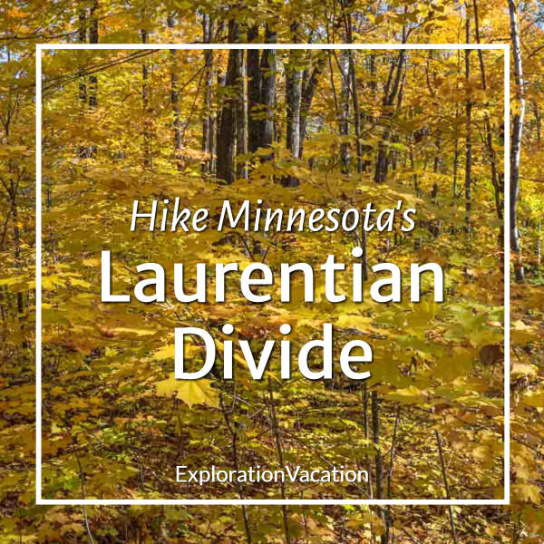
A hike along the Laurentian Divide in northern Minnesota offers beautiful forest scenery and uncrowded trails. It’s lovely in any season, but it’s best when fall brings a burst of brilliant color before winter arrives.
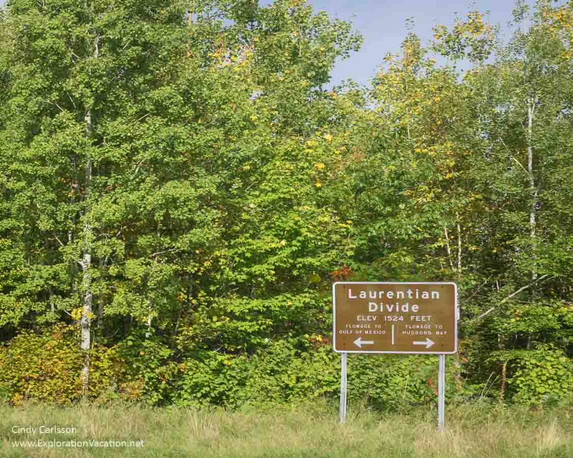
A golden autumn day on the Laurentian Divide.
It’s a perfect hike for almost anyone.
I use links to improve your experience, but some may also pay me a small commission if you use it to reserve a room, rent a car, or purchase goods or services. You don’t pay anything extra, but it helps keep this website running without intrusive advertisements. To learn more, review my policies and disclosures.
What is the Laurentian Divide?
Over the decades, a lot of family photos and selfies have been taken high in the Rockies along the Continental Divide, the ridge line where rain falling on one side flows east and on the other flows west. It’s what everyone thinks of when they hear “Continental Divide.”
But that’s only one of five continental divides that mark the boundaries of major watersheds in the USA.
Where three watersheds meet
Two of those other continental divides run through northern Minnesota.
The longest of those in Minnesota is the Laurentian Divide.
Along the Continental Divide on Highway 36.
While not nearly as dramatic as the continental divide that runs along the Rocky Mountains, the ridge that winds through Minnesota directs where the state’s waters flow. Also called the Northern Divide, this subcontinental divide runs from a peak in Glacier National Park all the way to the Labrador Sea in Northern Canada.
On one side of the divide, waters flow north into Canada and the Arctic. On the other side, they mostly flow south to the Gulf of Mexico.
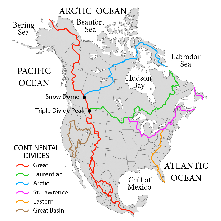
Map of continental divides in North America by Pfly – Own work, CC BY-SA 3.0
I say “mostly” because the Saint Lawrence Divide intersects the Laurentian on the Mesabi Iron Range in northern Minnesota.
Known by the Ojibwe as the “Hill of Three Waters,” the upraised volcanic hill where these continental divides meet splits the state’s waters three ways:
- North to Hudson Bay and on to the Arctic Ocean
- East into Lake Superior and on to the Atlantic Ocean
- South to the Mississippi River and Gulf of Mexico
The Ojibwe recognized the significance of this site. Because of its importance, the hill was a gathering point for the Ojibwe and generations before them. Today it is a small bit of green in the midst of a vast open-pit mine.
An old border
The Northern Divide is also significant as the original northern boundary between the USA and Great Britain’s Canadian territory after the Louisiana Purchase in 1803.
Later, an 1818 treaty moved the boundary to the 49° latitude from Lake of the Woods west. This added formerly British territory in what is now northwestern Minnesota and northeastern North Dakota to the rapidly expanding United States.
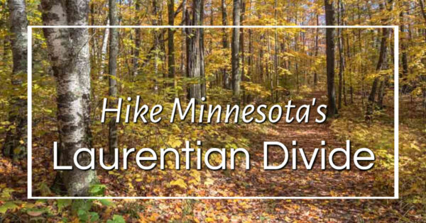
Fall hiking along the Laurentian Divide
Both the Laurentian and Saint Lawrence Divides offer great hiking amid picture-perfect northern Minnesota scenery. And, while this is a great place to hike (or ski) almost any time of year, it’s particularly lovely in fall.
A number of trails wind along and across the Laurentian Divide as it twists and turns across Minnesota. However, I’m a big fan of the Continental Divide Wayside, a small rest area on Minnesota Highway 38 between Grand Rapids and Marcell.
The highway here is part of the Edge of the Wilderness National Scenic Byway. Despite that designation, it never seems very busy. Maybe that’s because this area isn’t as well known as the North Shore or some of Minnesota’s other lake areas. Or perhaps it’s because there’s a lot of undeveloped space to get lost in up here. In any case, it’s nice that there never seem to be many other people around – even at the peak of fall leaf season!
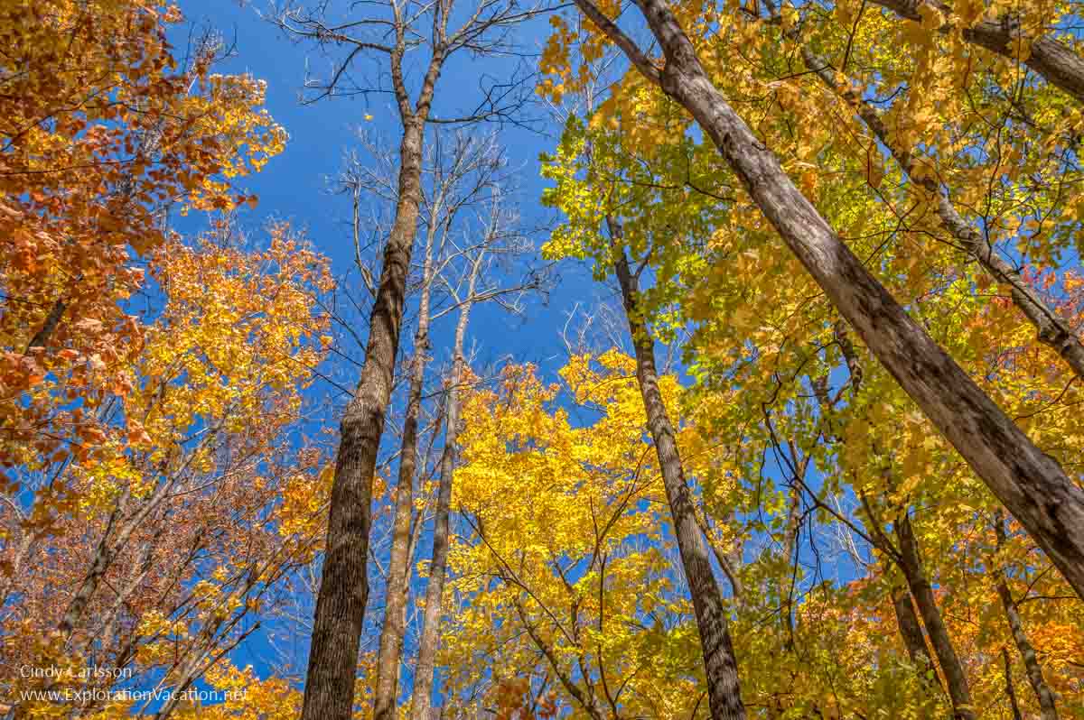
And fall is my favorite time to hike here, as the mix of trees varies enough to offer an ever-changing blend of red, orange, yellow, and green.
There’s no better place to be on a perfect fall day!
It’s also an easy place to hike, with a basic loop trail and a couple of overlooks.
The trail starts right at the parking lot. Aside from deciding whether to go left or right (it doesn’t really matter), the only other decision you need to make is whether to hike up to the Ice Road Overlook.
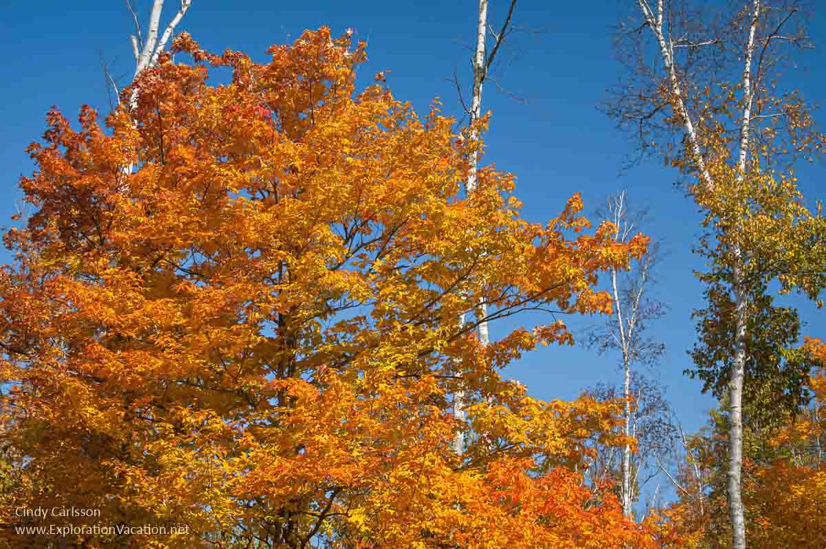
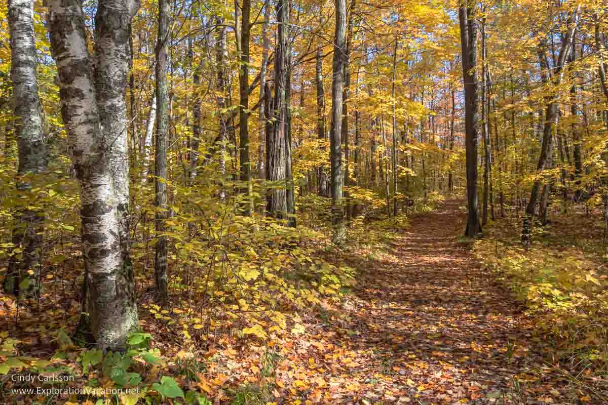
Maples don’t hold their leaves very long, but they are stunning while they last.
Most of the trail runs through a mixed deciduous forest with a smattering of pine and a few maple groves. The amount of color that mix of trees creates makes this a great walk during the fall.
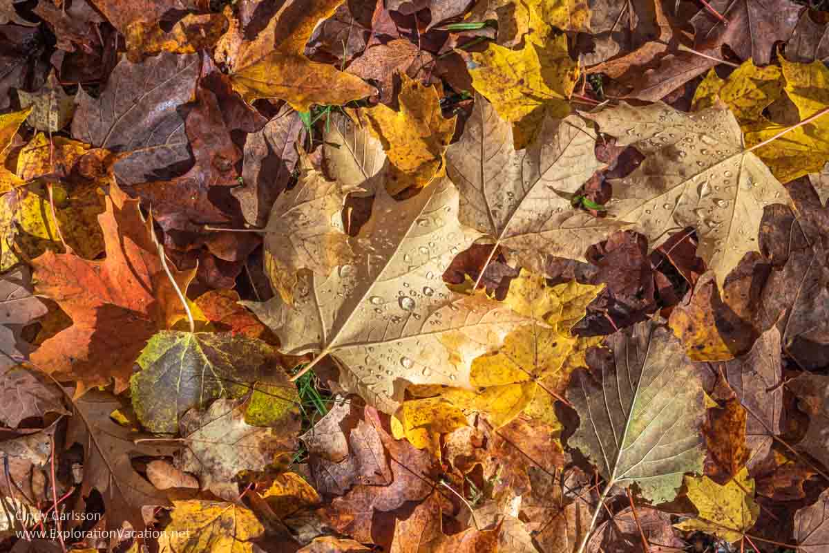
There’s even a lot of color underfoot.
Of course, there are also plenty of small details to watch for, including a wide variety of mushrooms, lichen, and moss.
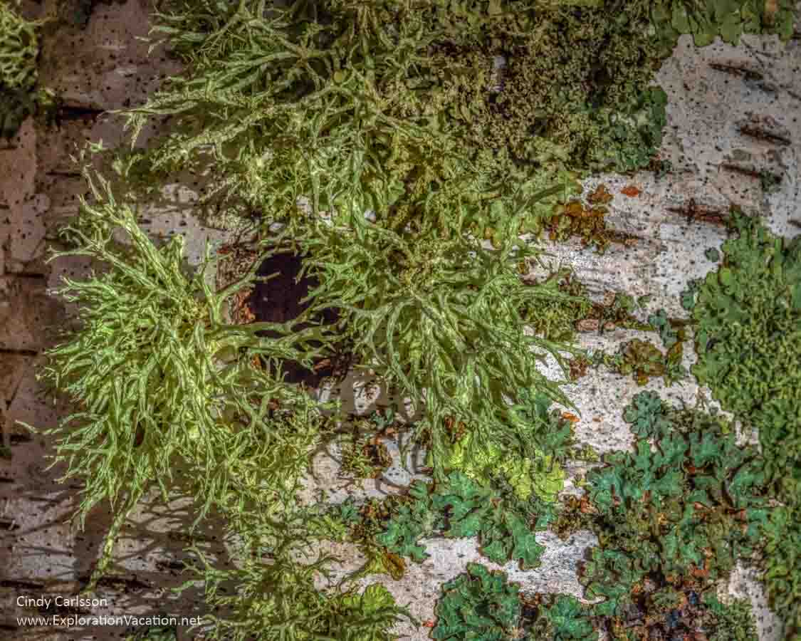
You’ll see lichens and moss throughout the year.
And, if you are quiet and come early in the morning, you’ll also likely meet a few deer along the trail.
(If you aren’t up early, you still might see a deer on the trail. They’re pretty common here.)
While there are a couple of scenic overlooks, hiking here is about enjoying the forest’s beauty and solitude.

I like just being surrounded by all the leaves.
Plan your visit to the Laurentian Divide
Although some sources now refer to it as the Northern Divide, in Minnesota it will almost always be called the Laurentian Divide. It’s also occasionally described only as the “continental divide,” which is confusing since the Saint Lawrence Divide is so near.
While the Laurentian Divide twists very unevenly across the state, the most scenic portions are located to the east of Bemidji, running to and through the Mesabi Iron Range and then north and east before disappearing into Canada near Lake Superior. This post only covers the portion in and around the Mesabi Iron Range in Koochiching, Itasca, and Saint Louis counties.
While this is great hiking country at any time of year, fall usually brings spectacular color. This area was once part of Minnesota’s vast pine forest. When loggers harvested virtually all of them, the forest returned as a mixed woodland of pine and various deciduous trees that combine to form a brilliant tapestry of color each fall.
The Continental Divide Wayside
I’ve featured the Continental Divide Wayside because it is a favorite of mine and a bit of a hidden gem. The trail system here is not extensive, making it a nice stop for a short hike during a day of exploring various sights in the area.
There’s basically no information on the site online (no wonder we usually have it to ourselves!), even though it seems to be jointly managed by the Minnesota departments of Natural Resources and Transportation and the US Forest Service.
There is no fee to use this site.
Camping is not allowed.
Where is the Continental Divide Wayside
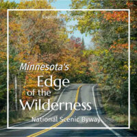
It’s located along the Edge of the Wilderness National Scenic Byway, which runs for 47 miles between Grand Rapids and Effie. Grand Rapids is located a little over three hours north of Minneapolis via US Highway 169 or 1 ½ hours northwest of Duluth via US Highway 2.
👉 Read more about the Continental Divide Wayside
Edge of the Wilderness Byway is Minnesota Highway 38. You’ll find it right in downtown Grand Rapids, running north from Highway 2.
Don’t worry if you aren’t impressed with the scenery as you leave Grand Rapids. I promise it becomes wonderful just a bit farther along.
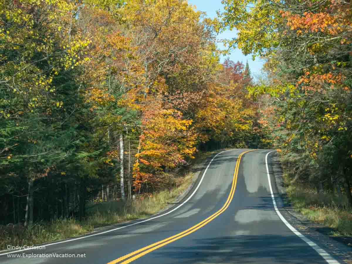
Highway 38 winds through the northern forest.
Located about 20 miles along the route, the well-marked wayside rest stop offers hiking trails, picnic tables, and toilets.

This is where the best trails are!
(Yes, the sign identifies this as the Laurentian Divide Wayside. However, Google Maps calls it the Continental Divide Wayside. If you google “Laurentian Divide Wayside,” you’ll likely end up farther east at the rest area near Virginia, Minnesota.)
Wayside amenities
This isn’t a fancy rest area, but there are a reasonable number of parking spaces, including spots suitable for RVs or a vehicle with a trailer.
The pit toilets here are generally maintained well enough that fishermen and locals working in the area regularly use them.
There’s also a small sheltered picnic area with a couple of grills.

Hiking trails
There’s basically one loop trail through the site. I have no idea how long it is, but I’m a slow, wimpy hiker, and I don’t find it particularly long or challenging.

This is an unpaved trail that wanders up and down the hillsides, so it’s not handicapped accessible. However, the trail isn’t particularly steep and has been in good condition whenever we’ve been on it, so it’s pretty easygoing once you get down to it. If it’s been wet, the lowest section can be muddy.
The only trail map is on a sign by the parking lot, so if you want a map while you are hiking, take a picture of the sign. But you don’t really need one, as it is a loop and the turn for the Ice Road Overlook is marked.
There’s what looks like an old road that crosses the trail. Apparently, this is the snowmobile trail. You could walk along this as well (it’s wide and flat), but it isn’t as scenic as the hiking trail.
Food and dining
Your best bet is to bring a picnic lunch. You can stock up in Grand Rapids or find snacks and such at the C-store in Marcell.
If you are looking for a meal, you can try the Timberwolf Inn or the Pine Cone Café just up the road in Marcell.
Otherwise you can head down to either Cohasset (where I recommend Lmno P-Za) or Grand Rapids (where you have a wide variety of options).
Lodging
If you want to spend a few nights in this area, you need to plan ahead. It’s not unusual for pretty much all lodging to be fully booked for most of the season between the fishing opener in May and the end of leaf season in October.
Lodging can be found at any number of campgrounds or resorts in the area and includes everything from primitive campsites to luxurious lake homes. However, while there are plenty of lodges, resorts, lake homes, and cabins around Marcell, many will not take bookings for just a night or two. That’s especially true during the summer and peak fall leaf seasons.
For stays of any length, check VRBO. There are usually a good variety of options between Grand Rapids and Marcell.
Of course, a full range of accommodations is available in Grand Rapids, although these too tend to be fully booked during the peak summer and fall seasons.
Most lodging will be around Grand Rapids.
Nearby: Great hiking at Suomi Hills
Of course, there are many other hiking trails that offer spectacular fall color along this scenic drive. Among the best are found at nearby Suomi Hills. Trails here wind between lakes and up and over hills along the continental divide.
👉 Read less
Other hikes along the Laurentian Divide
Since the Laurentian Divide takes a convoluted path through western and northern Minnesota, there are many places where hikers can access it. In the lakes area near the Mesabi Range, trail systems along and over the divide include:
- Laurentian Divide Recreation Area, accessed through the Laurentian Divide Rest Stop on US Highway 53 near Virginia
- The Continental Divide Trail at Savanna Portage State Park
- Cut Foot Sioux Trail near Deer River
- Giant’s Ridge near Biwabik
Laurentian Divide Recreation Area
The Laurentian Divide Recreation Area’s Lookout Mountain is one of the easiest and most developed spots to access the Northern Divide. Just pull into the Laurentian Divide Rest Stop on US 53 near Virginia to access 15 miles of hiking, biking, and ski trails; scenic overlooks; picnic areas; restrooms; and interpretive signage. It offers plenty of options to get out and start exploring.
As will be obvious as you approach the rest area, this is the heart of the Mesabi Iron Range and very near an enormous active mine. I have not hiked the trails here myself, but suspect the mine is visible from many viewpoints.
Because the site is located along the region’s main north-south highway, it’s also likely to be busier than other trail systems that require a little more effort to reach.
Continental Divide Trail at Savanna Portage State Park
Located in one of north-central Minnesota’s gorgeous, but relatively unknown state parks, the Continental Divide Trail at Savanna Portage State Park takes hikers over the Laurentian Divide.
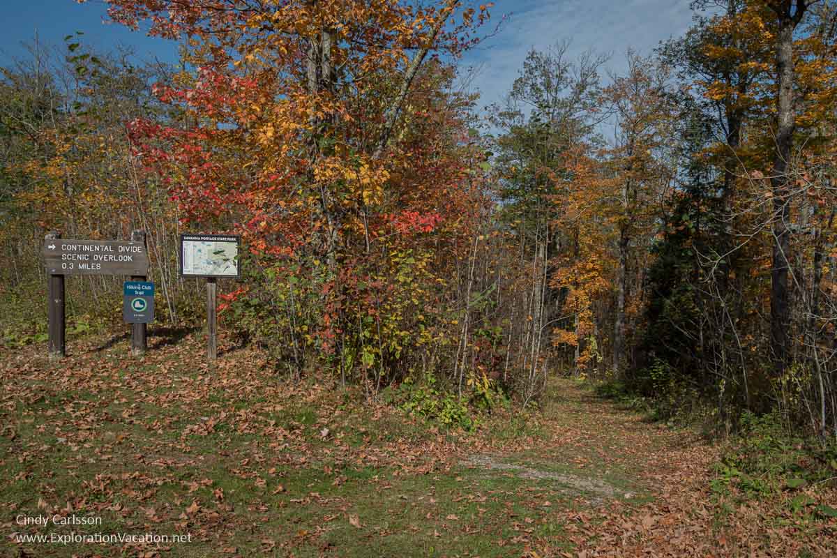
One end of a park trail along and overlooking the Laurentian Divide.
(It’s a pleasant trail, but I’m not sure where the overlook is. Maybe it’s hidden by trees?)
Cut Foot Sioux Trail
Mostly a horse trail, the Cut Foot Sioux Trail follows old forest roads and includes paths that run along the Laurentian Divide. The trail begins near Deer River and is open for hiking, biking, and riding.
Giant’s Ridge
Not surprisingly, the Giant’s Ridge ski and golf resort appears to straddle the Laurentian Divide. Several trails wind through the property and seem likely to provide good fall hiking. And, because it’s a ski resort, some trails can be accessed from the hilltop via the chairlift!
The Mesabi Trail runs through the property, so public access is available via that trail. Other trails through the property may have restrictions or be closed to the public.
Hull Rust Mahoning Mine View
The Hill of Three Waters is located in Hibbing, at the heart of Minnesota’s Iron Range. The site sits, literally, within an active iron mine. To be more specific, it sits inside the Hull Rust Mahoning Pit, the world’s largest open pit iron mine. The hill is just a tiny part of a vast, ruined red landscape formed by dozens of mine pits expanding into each other over the past century.
Mine owners preserve the hill’s unique geology, biology, and history as part of an understanding with the local Ojibwe people. Oddly, there is no iron in this particular spot. That’s probably fortunate, as it means there’s no reason for the mine to destroy it except as a matter of convenience.
However, the fact that the Hill of Three Waters still exists does NOT mean you can go out and explore it.
The closest you can get is the Hull Rust Mine View overlook.
This is a new overlook. It replaces a previous one that provided a view of the pit and the Hill of Three Waters. I assume the new location also provides a view of the hill, but I’m not sure where it is located in relation to the old overlook and have yet to visit the new one myself.
If you’d like to know what it’s like to actually visit the site where the three watersheds meet, check Aaron Brown’s story on his visit to the Hill of Three Waters back in 2012. (And then go and see what else Brown is writing about, as he has a deep understanding of northern Minnesota and the Iron Range past, present, and future.)
Walk or bike the Mesabi Trail
The Mesabi Trail also runs through this area. When finished, it will offer about 155 miles of paved trail between Grand Rapids and Ely.
While not quite complete, over 130 miles of paved trail are available along the route. The longest complete section runs out of Grand Rapids. However, other paved sections are found in various spots along the trail’s entire length.
A permit is required to use a bike, inline skates, or a skateboard on the trail. Both 3-day and annual wheel passes are available from a number of local merchants and bike shops or online. The 3-day passes are also available at self-pay kiosks in communities along the trail.
Pedestrians can use the trail for free.
Fiction set along the Laurentian Divide
Sometimes the best way to get a feel for life in a particular place is through fiction.

For a fictional view of life in northeastern Minnesota, take a look at novels by Minnesota author Sarah Stonich.
Both Vacationland and Laurentian Divide are set in a fictional town not too far from the east of the sites mentioned above. I started with Laurentian Divide, but Vacationland is actually the first book in the series – set in the same place with the same characters, but at a different time.
Look for all of Stonich’s novels on AbeBooks.


Bob Dillon is from Hibbing, MN. Did he ever write a song about the Hill of Three Waters?
I don’t know the answer to that, but I might know who to ask. It would be a great song title!