Last updated on June 12th, 2026
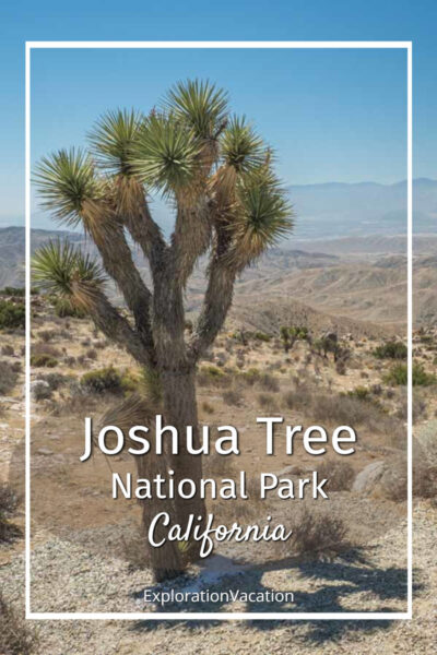
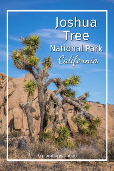
The USA’s desert southwest has a lot of strange landscapes, but Joshua Tree National Park in southern California stands out as one of the most alien-looking. That makes it a fascinating place to explore. Along with the park’s signature Joshua trees, visitors will discover mountains, huge boulder piles, cacti, and even a few palm oases.

Keep reading for everything you need to know to get the most from a short trip to Joshua Tree National Park.
I use links to improve your browsing experience, but a few also pay me a small commission if you use them to purchase goods or services. You don’t pay extra, but it helps keep this website running without intrusive ads. To learn more, review my policies and disclosures.
Get to know Joshua Tree National Park
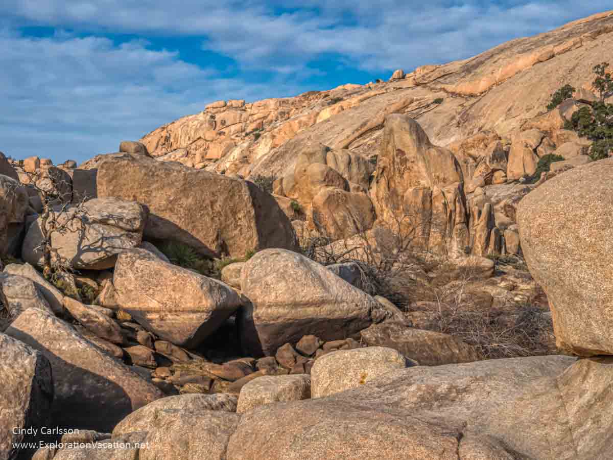
Located where the Mojave and Colorado deserts meet the Little San Bernardino Mountains in southeastern California, Joshua Tree National Park protects more than 1,200 square miles of wilderness. With three ecosystems, visitors can explore some very different places without leaving the park. That means visitors can see the park’s iconic boulders and Joshua trees as well as large stands of ocotillo and cholla cacti, palm trees, and mountains with juniper and pinyon pine.
The park is home to over 800 plant species, 57 kinds of mammals, 46 kinds of reptiles, and more than 250 different bird species. It also protects more than 700 archeological sites and historic structures.
Almost 200 miles of road and as many trails provide access to a wide variety of the park’s riches. However, wander very far beyond the park’s roads and you’ve entered a wilderness area where permanent development – even campsites and trails – are largely prohibited.
Joshua Tree National Monument was established in 1936, largely due to the work of Minerva Hoyt to keep the area’s desert plants from ending up in the gardens of Los Angeles. It became a national park in 1994.
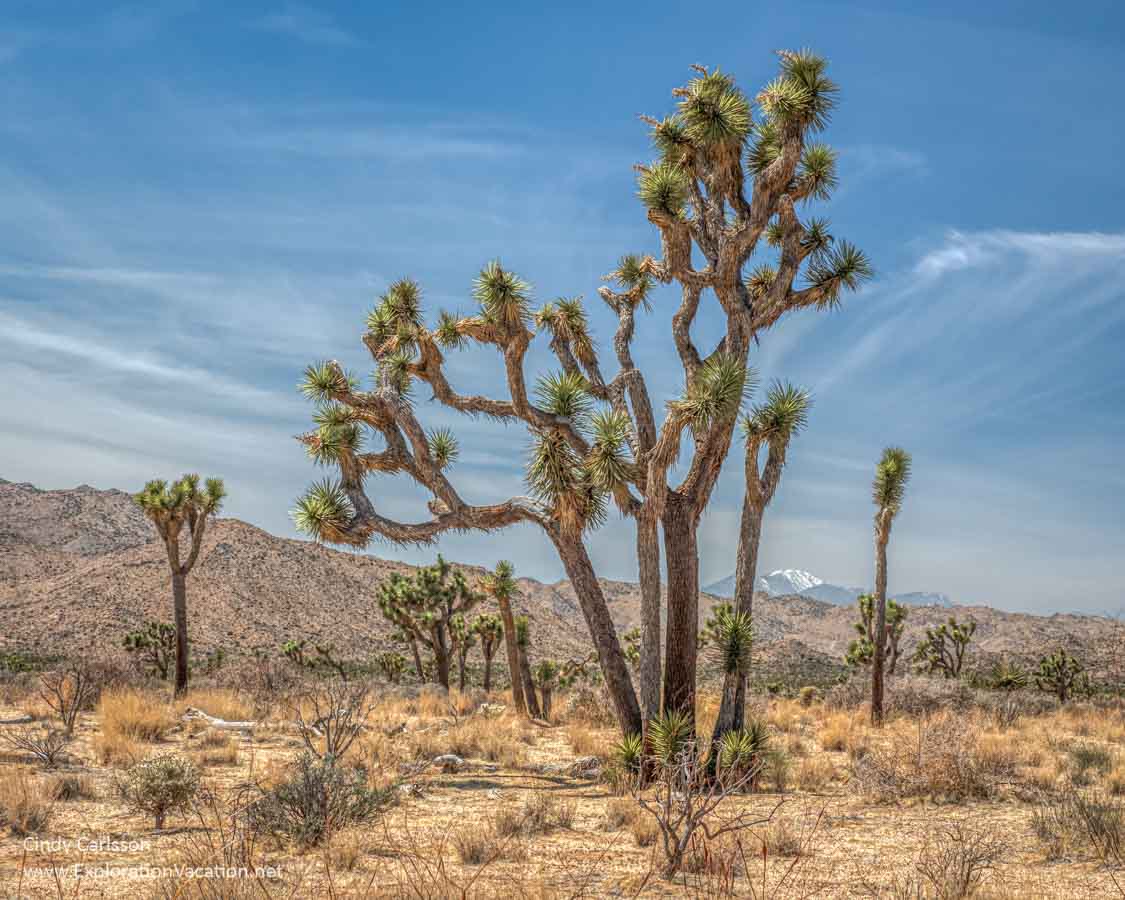
What is a Joshua Tree?
With their spikey “branches,” Joshua trees look like something created to illustrate a novel about life on another planet or a children’s cartoon.
But they are real. They just aren’t trees.
Yucca brevifolia is a type of agave. It’s closely related to Mojave yucca, which also grows everywhere in Joshua Tree National Park.
A Joshua trees starts as a single stalk. Once it blooms, branches form. These branches may create a tree that is round and busy or one that is tall and rangy. They can reach 40 feet in height with a root system of similar size. However, because Joshua trees plants lack the rings found in true trees, it’s hard to know how old each is. The best guesses are that they have an average lifespan around 150 years, but can live much, much longer.
👉 Read more about Joshua trees
Mormon pioneers are said to have called these odd plants Joshua trees because they reminded them of the Biblical figure of Joshua with his arms upraised toward God. (Perhaps pleading for help surviving in this harsh landscape!)
But these “trees” were also useful to early settlers. While Joshua trees can’t replace lumber for construction, they were used for fencing. And the miners who followed burned them as fuel.
Of course, the area’s native Cahuilla people were familiar with these strange yuccas long before the Mormons arrived. Calling them either hunuvat chiy’a or humwichawa, they wove the leaves into a variety of items and ate the flower buds and seeds.
Joshua tree flowers
When a Joshua tree blooms, bunches of creamy white or pale green flowers form on branch tips.

In order to produce seeds (and more Joshua trees), these flowers are pollinated by a very specialized moth. The Joshua tree yucca moth (Tegeticula synthetica) is the only creature that can pollinate Joshua tree flowers. And that moth can only reproduce by laying eggs inside a Joshua tree blossom. Neither can exist without the other.
Joshua trees generally bloom between February and April. But not every tree blooms every year. You’ll see the most Joshua tree flowers after a wet winter. And climate change is also impacting these rare plants. Drought makes it more difficult for plants to survive while warmer temperatures can cause them to bloom too early in winter for the moths to pollinate them.
Where do Joshua trees grow?
Joshua trees grow in California’s southern deserts, northwestern Arizona, southern Nevada, and a tiny bit of Utah. And, while they look pretty much the same to you and me, that range actually includes two separate varieties:
- Western Joshua trees grow in California, in an area that includes Joshua Tree National Park and Death Valley, as well as a small area of southern Nevada.
- Eastern Joshua trees grow in Arizona, Utah, California’s Mojave National Preserve, and a few areas near Las Vegas.
Although Joshua tree plants are found in many areas of Joshua Tree park, the largest concentration is Queen Valley and Lost Horse Valley, neither of which are along the main paved road.
👉 Read less
The best easy things to do in Joshua Tree National Park
A visit to Joshua Tree is all about seeing the park’s namesake Joshua tree plants and experiencing the odd landscape where they grow. A visit can take many forms and can range from a day trip from Palm Springs to an extended camping trip.
There are multiple ways to explore the park as well. There are hiking trails suitable for everyone, ranging from short strolls that barely take you out of sight of the parking lot to challenging multi-day backpacking treks. Rock climbing and bouldering are very popular activities here. Horseback riding is also an option.
But the main park roads offer a good introduction to some of the best places to visit in Joshua Tree. And many of these can be enjoyed even if you aren’t very fit or your time in the park is limited!

The following lists some of the best fast and easy things to do in Joshua Tree. Most of these can be relatively quick stops that require little or no hiking. (Although many also access longer trails too.) All of them offer a chance to see and explore this unusual landscape.

(I’ve added a few labels to identify sites not included on the official Joshua Tree National Park map)
I’ve generally listed the stops below as if you were driving through the park from the northwest. If you only have one day in Joshua Tree, pick a few that look the most interesting and work your way through the park.
(See the Joshua Tree hiking page for more information on hiking in the park and a list that includes more challenging trails.)
Quail Springs Picnic Area
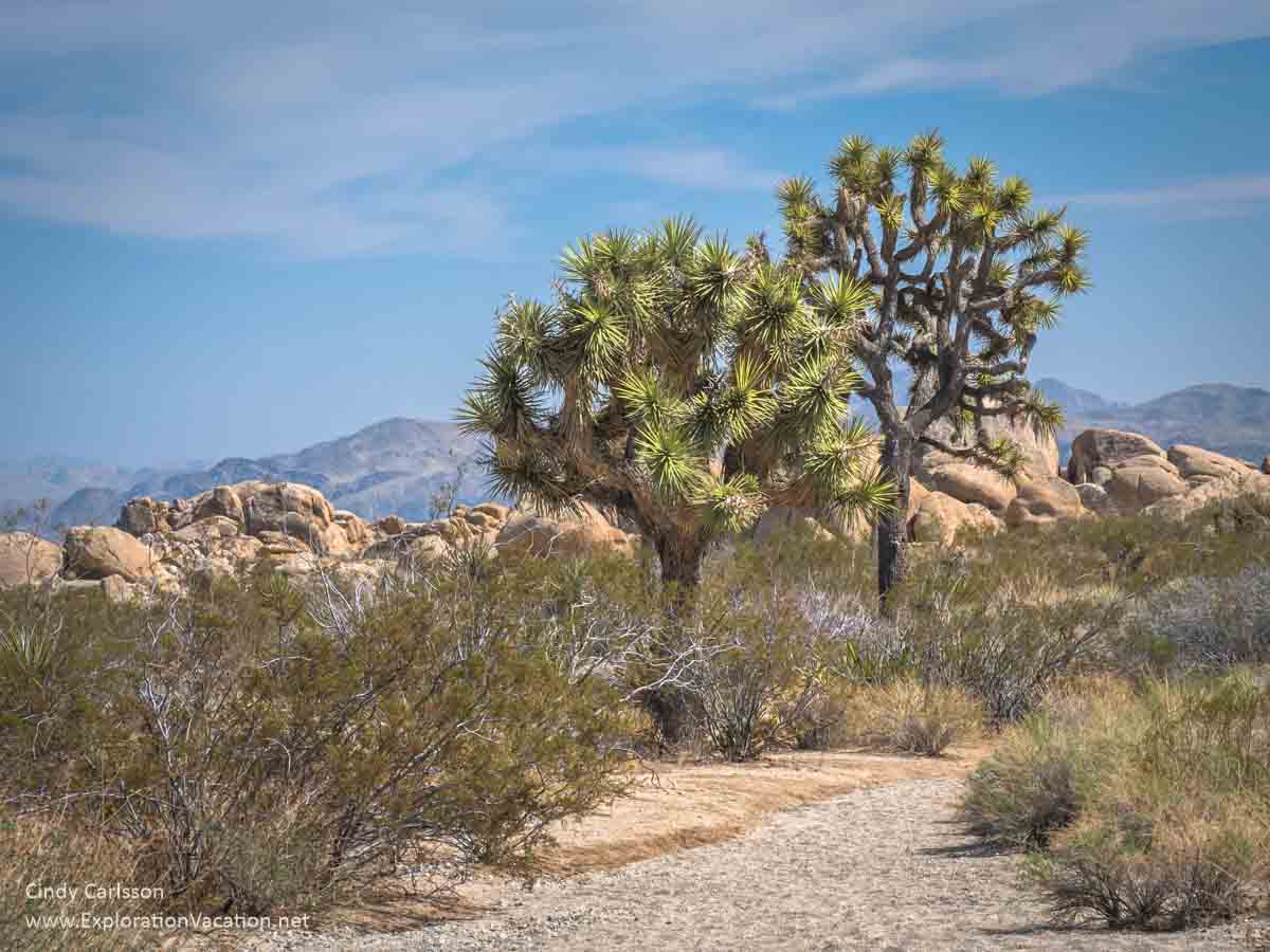
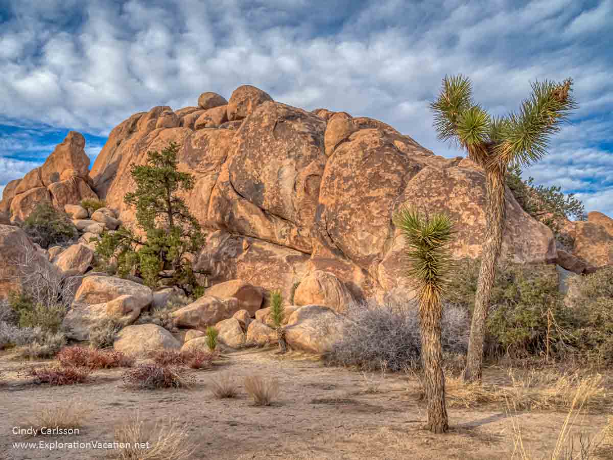
You’ll start to see more and more Joshua Trees and weird piles of huge rounded boulders as you drive into the park from the West Entrance (from the town of Joshua Tree). I guarantee you will want to stop and start taking pictures, but there aren’t a lot of places to pull off the road until you reach the Quail Springs Picnic Area.

Fortunately, this is a good place to stop. There are Joshua trees, huge boulders, and a large parking area. (There are two sections to the parking area. If the first if full, keep going.) Picnic tables are nicely spaced along the boulders and there is plenty to see right there.
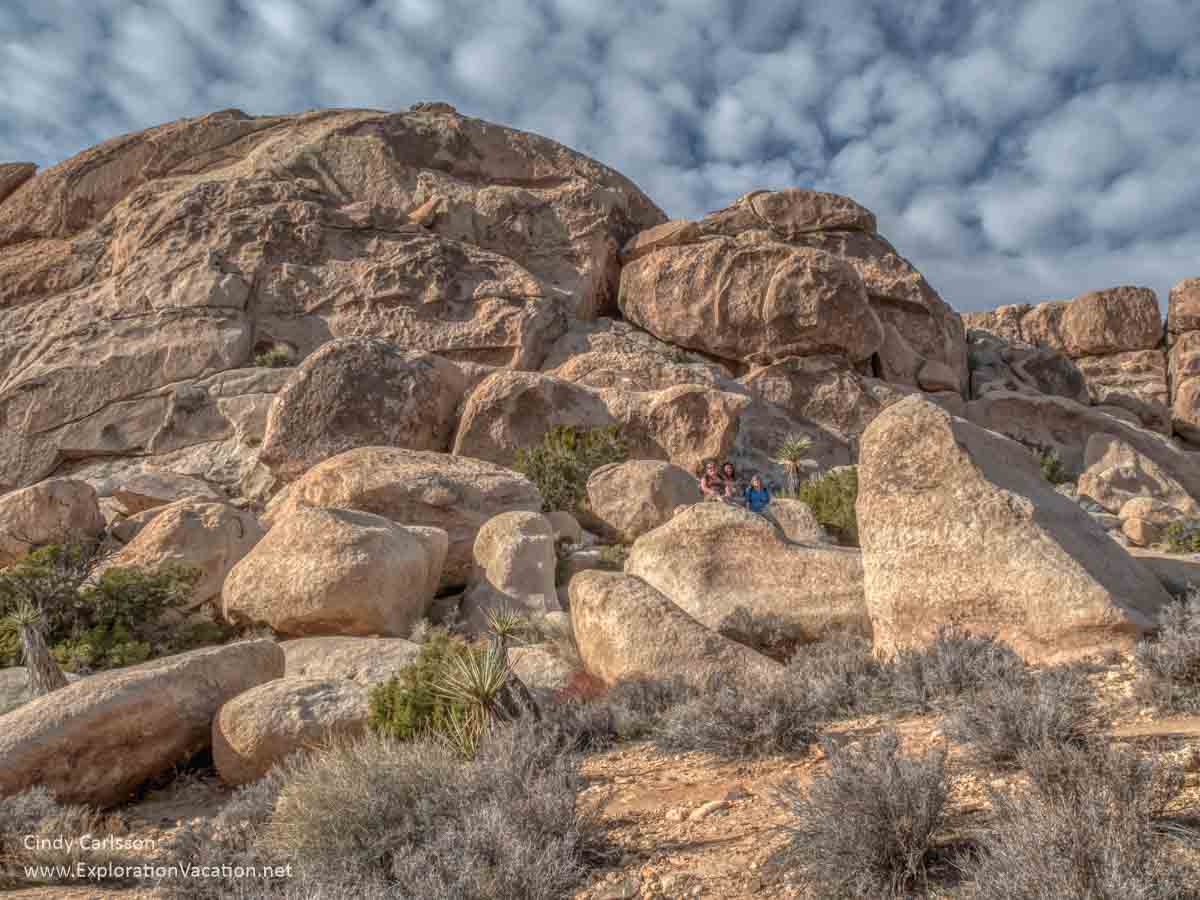
Hidden Valley
One of Joshua Tree’s most popular and best short hiking trail, the Hidden Valley trail is an easy 1-mile loop around a scenic little valley encircled by rock. It’s a beautiful area with an intriguing history that includes cattle rustlers and dynamite-wielding ranchers!

Read about my visit to Hidden Valley
Besides the hiking trail, Hidden Valley has picnic tables and a large parking area.
The Hidden Valley Campground is on the other side of the road, along a smaller road to Keys Ranch and Barker Dam.
Keys Ranch
While Joshua Tree National Park is generally thought of as a wilderness park, it also protects a large number of cultural resources. One of these is Keys Ranch. This former ranch is now a historic site listed on the National Register of Historic places.
I have not taken the Desert Queen Ranch tour, but it looks fascinating. And Bill Keys was quite a character, so there should be lots of stories to go with the odd collection of buildings, vehicles, equipment, and general detritus on the ranch site.
Keys Ranch can only be visited as part of a guided tour. Tours are limited to a very small number of visitors and are not offered during the summer. Tickets can be booked 60 days in advance and almost always need to be reserved well before your visit.
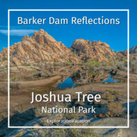
Barker Dam
Once called the Big Horn Dam, Joshua Tree’s Barker Dam was built by cattlemen in 1900. It was raised to its current height by Bill Keys (of Keys Ranch) in 1949. Because this area has more water than most of the park, this is a good spot to look for wildlife. It’s also absolutely gorgeous when water pools behind the dam. However, decreasing rainfall and falling water tables greatly reduce the likelihood of seeing that most years.
When there is a pool of water here, Barker Dam is among the most beautiful spots in the entire park.

But it’s well worth a visit even if there’s no standing water.
Beyond the dam, the trail loops back to the parking area via a small valley with lots of boulders.
Although a few spots require walking over and squeezing between boulders, the Barker Dam trail is an easy 1½ mile loop. Early morning visitors may spot wildlife in the area and there are always birds around.
See Barker Dam when there’s water in it
Cap Rock nature trail
Park Boulevard turns to the south between Hidden Valley and Barker Dam. Keep heading south at the intersection with Keys View Road. Cap Rock is located right at the intersection.
The nature trail here is only a ½ mile long. However, it winds past some great rock, lots of Joshua trees, and a juniper woodland. Lots of other plants grow here too, and in spring this is a great place to look for wildflowers. Informational signage makes this an easy place to learn about Joshua Tree’s ecology and geologic past.

This area isn’t named on the Joshua Tree park map, but there is a hiker icon.
Keys View overlook
I’d recommend continuing south a side trip to Keys View. This little detour will take about an hour, but it’s well worth it. It’s a scenic drive past a lot of Joshua trees that ends at a truly spectacular overlook about a mile above the Coachella Valley.

From here you have a fine view of the San Andreas Fault and Palm Springs. The Salton Sea is also visible from here and, on a really clear day, you can see Signal Mountain in Mexico.
There’s a short, paved trail along the rim with a few benches. There’s also lots of parking. However, this area is insanely popular at sunset when the mountain ridges glow in the fading light. (Watching sunset here is often cited as one of the best things to do in Joshua Tree.) But you can visit almost any other time of day for a great view without a crowd.
If you want to be here for sunset, plan to arrive at least an hour or more before the sun will set to get a place to park. Better yet, show up a few hours in advance and enjoy a picnic while you wait for sunset.
Hall of Horrors
Back up on Park Boulevard, you’ll soon come to an area called the Hall of Horrors. This is a popular spot for rock climbing. But it’s also a great spot for an easy hike that includes a good view of a large Joshua Tree forest and plenty of boulders non-climbers can explore. And a wet spring will bring lots of wildflowers.

There’s a short loop trail around the main rock formation.
(I have no idea why this area is called the Hall of Horrors, although some of the rock formations do create halls of a sort. Maybe it’s horrible for climbing, but it’s a fun place to scramble around.)
This area isn’t identified on the Joshua Tree park map. It’s easy to spot though, since there is a very large parking area right off the road.
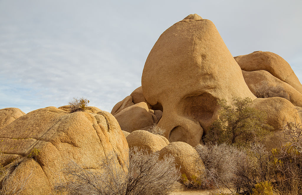
Skull Rock
Skull Rock is on this list because everyone, including park rangers, identify it as a must-stop location. It’s not. Yes, there is a large rock along the road here that looks sort of like a huge human skull. But it will be teeming with people no matter when you stop. The same is true of the otherwise great trails that run through the jumble of rocks behind and spread out from Skull Rock.
Apparently, it’s possible to see Skull Rock without masses of people if you visit in December. Photo by Tony Webster from Portland, Oregon, United States, CC BY 2.0 via Wikimedia Commons.
Unless you really need a picture of yourself (or a stranger) standing it what sort of resembles the eye socket of a humongous skull, spend your time exploring a less-crowded pile of rocks elsewhere in the park. (After all, you have a lot of these to choose from.)
Parking at this spot is very limited, but it’s an easy walk from Jumbo Rocks. Expect both parking areas to be full most of the day.
Split Rock
At first glance, Split Rock looks a lot like any other boulder in Joshua Tree. But take a closer look as you walk around it to find the 2½ mile trail – you’ll see how it got its name. You’ll also get a good view over the surrounding landscape.

We hiked a bit around and below Split Rock, but the trail was hard to follow so we crossed the parking area and hiked the other direction for a while instead.

If you don’t want to wander too far, there is plenty to see right around the parking area.
Live Oak
Like the Quail Springs picnic area, the Live Oak picnic area is a pleasant spot to stop with enough plants and boulders to make it worth exploring for a bit. It’s also way less crowded than nearby Jumbo Rocks or Skull Rock.

Picnic tables and parking are spread out along a boulder outcrop with a variety of informal trails through and around the site. Despite being right off the main road, this layout makes the area pretty private. Just be sure to check it out even if the “parking full” signs are out – once they go up, they seem to stay up even after everyone leaves.
This is the last picnic and hiking area in this part of the park. Continuing on Park Boulevard will take you out of the park and up to the Oasis of Mara Visitor Center. To continue exploring the park, head south on what becomes Pinto Basin Road.
Oasis of Mara
The Oasis of Mara is located behind the old national park visitor center up in Twentynine Palms. It’s actually outside the park in the town itself.
While the oasis itself isn’t the most scenic spot in the park (apparently, I’ve walked through it twice without taking any pictures), it’s a good orientation stop. The visitor center located here is good and the ½ mile paved trail through the oasis begin right outside the back door. Plaques along the trail identify various plants and explain the history of the oasis and the people who once lived here.
The oasis as it came to exist was as much a work of humans as of nature. Surface water from a spring attracted the Serrano people. They tell of planting the first palm trees (one for each son born, with 29 planted in their first year here) and who sustained their community by managing the area and its abundant water to provide what they needed.
There’s no longer a functioning spring here, but the park service ensures enough water flows into it to keep the remaining California fan palms and other vegetation alive. Sadly, its reduced and rather bedraggled state make it hard to imagine what this place was like when it was the living heart of a thriving native community.
Now we’ll go back and re-enter the park at the North Entrance, following Park Boulevard down to the Pinto Basin Road.
Arch Rock
The White Tank campground provides access to the Arch Rock trail. This 1 ½ mile loop leads to a small arch. It’s poplar with hikers even though it isn’t named on the park map.
Around White Tank you move from the Mojave Desert to the Colorado Desert. As that happens, the Joshua trees disappear. They are replaced by cholla and ocotillo. And, when conditions are right, loads of wildflowers appear.
Cholla Cactus Garden
While there are cholla scattered all over this part of Joshua Tree, the biggest concentration of them is called the Cholla Cactus Garden. It’s an easy walk on a ½ mile loop trail.
Don’t be fooled by these fuzzy-looking cacti: They immediately hook into anything that gets too close. (Most people call them “jumping cholla” for a reason!) But you don’t have to worry too much here, as paths and fences keep all but the most determined visitors a safe distance from the cacti.

The best time to visit here is either very early in the morning or late in the day when the cacti seem to glow.
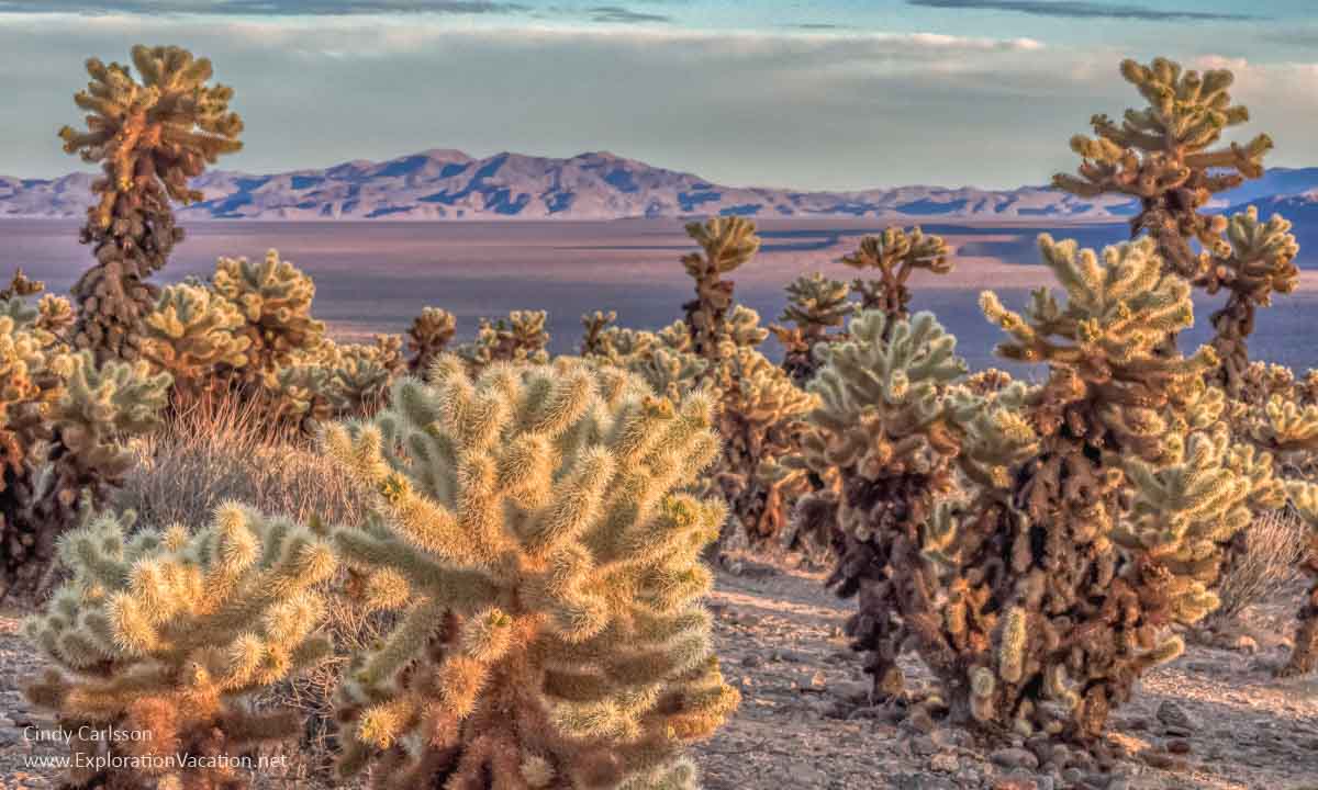
This stop would be amazing if the cholla were in full bloom. They usually bloom in late spring, but it’s been so dry I didn’t see any flowers or buds this year.
Other plants live here too. The park has a botanical trail guide for the Cholla Garden on its website.
Cottonwood Spring Oasis
Cottonwood Spring Oasis is located just past the Cottonwood visitor center at the far southern end of the park. The 1-mile trail passes through a small oasis with cottonwood trees and California fan palms. It’s an easy walk with interesting vegetation and lots of birds.

The spring was used by the native Cahuilla people for centuries and some signs of their lives remain.
Miners also used this area. Remains of their activity can be seen if you continue past the oasis on the 3-mile Mastodon Peak loop trail.
Explore Joshua Tree’s unpaved roads
All the sites listed above are located right along the park’s main paved roads. But there are also a few unpaved roads in Joshua Tree. These include short routes suitable for vehicles of all types as well as longer routes that require 4-wheel drive. Mountain bikers are also welcome on these roads.
Brief descriptions and links to maps are available on the park website.
Unpaved roads suitable for all vehicles
Short, unpaved roads suitable for all vehicles:
- Queen Valley, Bighorn Pass, and Desert Queen Mine Roads
- Stirrup Tank Road
- Odell Road
- First part of the Geology Tour Road
Although they are a little rough and dusty, the roads into Queen Valley are suitable for regular passenger vehicles.

(Keep in mind that Queen Valley Road is one-way coming into the Barker Dam area.)
Relatively few people seem to drive through here. We didn’t see another car while we were out here.
Bike racks near Hidden Valley and Bighorn Pass (near Barker Dam) allow bikers to combine a hike with their bike ride.
4-wheel drive roads
Joshua tree has many more miles of often challenging roads suitable only for use by 4-wheel drive vehicles:
- Covington-area roads
- Pinkham Canyon
- Old Dale
- Black Eagle Mine
- Berdoo Canyon
- Geology Tour beyond mile 5.4
These are open to mountain bikes as well.
Both bikes and motorized vehicles must stay on the road at all times. Off-road travel is absolutely prohibited.
Wildflowers in the park
I was on a wildflower viewing trip when I visited in 2011. It wasn’t a fabulous year for wildflowers, but there were some areas with nice color. By 2021, the park was suffering from several years of drought (and lots and lots of tourist tramping all over off the established trails), so there were almost no flowers in early April. The only exceptions were a few Joshua trees and ocotillo.
But when the park gets enough rain, you can get a good wildflower show here – especially in areas with fewer visitors where the soil hasn’t been disturbed.

Although spring flowers may start blooming as early as February and continue through June, you’ll see the most flowers in bloom during March and April after a wet fall and winter. (Joshua trees generally bloom sometime between February and late April.)
Follow my 2011 search for wildflowers in Joshua Tree
Plan your trip to Joshua Tree
Joshua Tree National Park used to be a pretty quiet place. Not anymore. That means a little advance planning is required for the best experience. The following tips will help you avoid unwanted surprises and make the most of your time in the park.
Where is Joshua Tree National Park?
Joshua Tree National Park is located near Palm Springs in southern California. On the north side of the park, entrances are located in the towns of Joshua Tree and Twentynine Palms.
The park is only a few hours from all of the region’s major cities:
- Palm Springs to Joshua Tree is about an hour drive
- San Diego to Joshua Tree is a 160-mile drive that usually takes less than 3½ hours
- Los Angeles (LA) to Joshua Tree is a 130-mile drive that that takes at least 3 hours, although heavy traffic can make it take a lot longer
- Las Vegas to Joshua Tree is a 200-mile drive that usually takes less than 3½ hours.
If you are visiting a number of southwestern national parks and want to add Joshua Tree, it’s about a 4-hour drive from Death Valley. It’s almost 6 hours from Zion or the south rim of Grand Canyon National Park.
What is the best time of year to visit Joshua Tree?
The best time to visit Joshua Tree is spring and fall, when temperatures are the most pleasant. (I love spring when at least a few flowers should be blooming.) Of course, these are also the busiest times to visit. Expect full campgrounds and parking lots, especially during holiday weekends and spring break.
Winter can be a good time to visit. Relatively few people visit Joshua Tree in winter and the weather can be spectacular. (It was 75 and sunny when I visited in January 2020.) But the weather can also turn very nasty quickly, with cold temps, wind, rain, and even snow. Be sure to check the Joshua Tree weather forecast before visiting the park in winter.
Summer in Joshua Tree is hot, hot, hot, with temperatures regularly rising well over 100 degrees. And there isn’t a lot of shade around. Of course, there aren’t as many people around either. If you do visit in summer, make sure you are well prepared for desert heat with sun protection, lots of water, and salty snacks. Only hike early or late in the day and take it really easy. Summer is when most of the park’s fatalities happen.
Seasonal information on weather in Joshua Tree is available at WeatherSpark. (Lots of good information, but also lots of ads.)
Basics before you head to the park
While the entrance to Joshua Tree park is all but located in the towns of Joshua Tree and Twentynine Palms, once you are in the park, basic services are a long way away.
Be ready to travel without your phone
Expect that you will NOT have cell service in Joshua Tree. That means no ability to pull up a map or other information or contact others on your phone while you are in the park.
Be sure to check the Joshua Tree National Park website well before your trip. Not only will it provide the most up-to-date information on the park, it will have information on temporary closures, COVID restrictions, and other issues.
Print or download a copy of the park map to your phone BEFORE you get there. On our recent (2021) visit, the basic Joshua Tree map was the only printed information available. Besides, you may want to enter the park before the gates are staffed.
If you are staying outside the park, put your route in Google maps or another app and download it to your phone before heading into the park for the day.
Prepare for a day in the desert
There are very few places to get water in Joshua Tree park. This is the desert, so bring more water than you think you will need for the day. Pack a few salty snacks too. If you plan to spend a full day in the park, bring lunch with you. There is no place to purchase food once you enter the park.
Bring sun protection. There is very little shade anywhere in the park and the reflected light can be really strong – you can overheat or burn here faster than you expect.
Sturdy, closed-toe shoes or hiking boots are a good idea even on paved trails. There are lots of rocks and sharp cacti and other spiny things around.
Prepare your vehicle
Fill your vehicle’s gas tank too. There are no gas stations or other services in the park, so have enough fuel for the day before you head into the park.
Entering and getting around Joshua Tree
There are two entrances on the north side of the park – the West Entrance outside the towns of Joshua Tree and the North Entrance in Twentynine Palms. The West Entrance is the busiest of the two. Consider using the one in 29 Palms on weekends and other busy periods.
The main part of the park is also accessible from the south through the Cottonwood entrance.
Both the Black Rock area and Indian Cove have separate entrances on the north side of the park. You cannot drive to the rest of the park from either of these entrances.
Joshua Tree hours and entrance fees
Joshua Tree National Park is open 24-hours a day, even if you aren’t camping in the park. However, some developed areas, including many picnic areas, are only open during the day.
👉 Read more about Joshua Tree fees and getting around the park
Park entrances and visitor centers are only staffed during the work day. Park maps and other information are only available when entrances and visitor centers are open.
Visitors must show or buy an entry pass both when entering and exiting the park.
- $30 7-day vehicle permit for one vehicle and all passengers
- $55 Joshua Tree National Park Annual Pass for pass holder and passengers in one vehicle
- $25 7-day motorcycle permit
- $15 7-day permit for one person entering on foot or bike
- There is no charge for America the Beautiful pass holders and their passengers
Keys Ranch tours are $10 and must be reserved in advance.
Getting around Joshua Tree
Joshua Tree has 93 miles of paved roads and 106 miles of unpaved roads. These provide access to many of the park’s popular sites, but not all. Some areas can only be reached by long and/or arduous hikes or on horseback.
There are no trams or shuttles in the park.
Basic maps of Joshua Tree National Park are available at park entrances. These show all park roads and some trails. They also identify the location of campgrounds, picnic areas, and a few trailheads. The reverse side had information on park history, geology, and such.
Usually a park “newspaper” is also available. (There weren’t any available on my last visit, but I think they were just out of them at that point in time.) This also has a park map. It’s slightly different from the nicer multi-color one and I think it is more useful. The newspaper also has information on hiking trails, park rules, advice, etc.
The National Park Service also has an app that includes interactive maps, virtual tours, and a whole range of information on all of the national parks. I just found this, so haven’t used it yet. If you want to try it out, the NPS App is available for both iOS and Android devices.
👉 Read less
Park facilities
Visitor and nature centers
The park has four visitor centers. All have park information, a bookstore, exhibits, and flush toilets. Staff is available to answer questions and help you plan your time in the park, although lines can be long. All but the Joshua Tree Visitor Center (in the town of Joshua Tree) also have picnic tables and water.
Joshua Tree Visitor Centers
Located in the town of Joshua Tree, the one Joshua Tree Visitor Center is right along the way to the park’s busy West Entrance. This visitor center also has a café.
A new Visitor Center is located in downtown Twentiynine Palms. This replaces the gorgeous Oasis Visitor Center that used to be located at the Oasis of Mara.
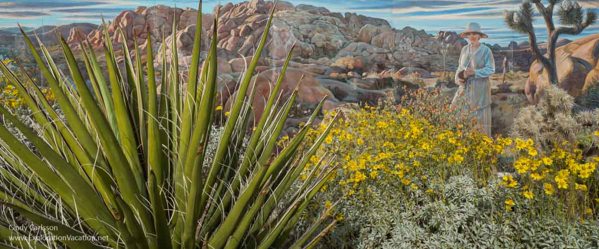
The wonderful Oasis Visitor Center is no longer open, but hopefully they’ve preserved the beautiful gardens and mural by Corey Ench that depicts Minerva Hoyt in the park that she helped create.
The new visitor center isn’t nearly as close to the North Entrance as the old one, but it’s still the fastest way into the park when it’s busy. That’s because this entrance it isn’t as busy as the West Entrance. However, the drive into the park from this side isn’t as scenic and doesn’t have any Joshua trees until you’ve traveled quite a ways.
Cottonwood Visitor Center
Visitors entering Joshua Tree from the south can stop at the Cottonwood Visitor Center to get park information.
Black Rock Nature Center
This visitor center is located in the Black Rock campground just off Highway 62 at the far northwestern end of the park.
Restrooms
Flush toilets are available at the four visitor centers and the Black Rock and Cottonwood campgrounds.
Pit toilets are available at all other campgrounds, as well as at picnic areas, and trail heads. While these are well-distributed throughout the park, most have only one or two stalls.
Avoiding crowds
Since spring and fall are the most pleasant seasons, that’s also when you’ll see the biggest crowds. But beyond that, Joshua Tree isn’t very far from Palm Springs, Los Angeles, San Diego, or Las Vegas. That means weekends, holidays, school breaks, and even the first nice day after a span of cold grey weather all draw carloads of people to the park. So don’t expect to have the park to yourself during those times.
Midweek will be less crowded than weekends.
The earlier you start your day, the fewer people you’ll be sharing the park with.
Popular sites like Skull Rock, Hidden Valley, and Barker Dam get increasingly busy throughout the day. If you’re visiting in the afternoon, stop at a less well-known area and hike a bit. There are odd boulders and Joshua Trees everywhere, so you don’t have to go to one of the most popular spots to see them.
Sunset from Keys View is pretty great, but it’s packed with people every evening. Don’t head down there 20 minutes before sunset and expect to find a place to park.
But a better option might be to just stop and enjoy the sunset wherever you are. If there are any clouds, all you need is a spot where you can see the sky.

If you are comfortable driving on dirt roads, Joshua Tree has a number of short unpaved roads suitable for vehicles of all types. Very few people seem to use these, so you are generally more likely to meet a biker or hiker than another vehicle.
Get out of your car
While it’s easy to tour Joshua Tree from your car, everyone should get out and explore at least a little. Just be realistic about your own ability to handle both the trail or route you are considering and desert conditions.
Hiking
With 191 miles of hiking trails that can be accessed at 32 trailheads, there are a lot of contenders for the title of best Joshua Tree hike!
I only mentioned a few of the park’s many trails in the sections above. The Joshua Tree website has a good page on hiking in Joshua Tree. It provides general hiking information and includes a list of some of the most popular hiking trails in the park to help you choose the best one for you. These range from very short, paved nature trails to longer and/or more challenging trails that should not be attempted during hot weather. There’s also a link to information on backpacking in the park.
While it may look like nothing but dust, desert soils are actually very fragile. They also hold the seeds and roots of seasonal plants. For spring flowers to appear, park visitors really need to stay on established trails.
And pets are NOT allowed on any trail except the paved trail at the Oasis of Mara.
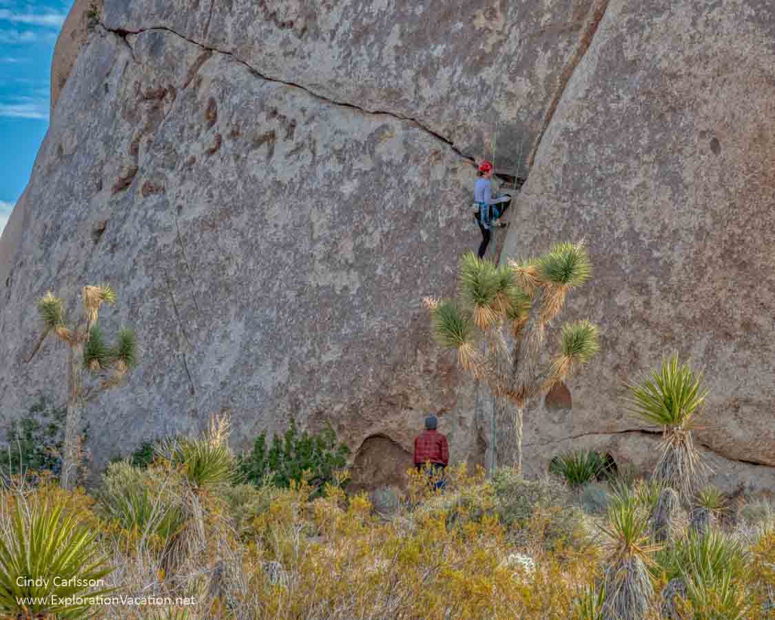
Rock climbing and bouldering
With more than 8,000 climbing routes, Joshua Tree National Park is popular with rock climbers of all abilities. Check the park’s webpages for information on climbing, bouldering, highlining, and slacklining in the park.
Horseback riding
I have never seen riders in the park, but with more than 250 miles of trail, I know they are out there enjoying the park away from the crowds. However, riders need to be comfortable in desert conditions and well-prepared. There are two campgrounds with areas for horses. There are also a few ranches that offer trail rides in the park. Information on riding at Joshua Tree can be found on the park website.
Eating and drinking
There is no place to buy food or beverages once you enter Joshua Tree National Park. Even if you don’t plan to hike, always have water and at least a few snacks with you when you enter the park.
Dining options
There are a few dozen places to eat and drink in the towns of Joshua Tree and Twentynine Palms. Bars and restaurants come and go and change all the time – for the most up-to-date information check TripAdvisor or your favorite review site.
On my most recent trip, we had a great take-out pizza from Rocky’s New York Style Pizza and amazing pastries from Campbell Hill Bakery.
Grocery stores
There are convenince stores and other small markets in both Joshua Tree and Twentynine Palms. Stater Brothers groceries are located in Yucca Valley (before you reach the park) and Twentynine Palms.
There are liquor stores in all of the communities along the park’s northern boundary.
Lodging
Many people visit Joshua Tree as a day trip from Palm Springs. While I’ve done that, it makes for a long day if you want to see a lot of the park and do a few short hikes. It also makes it harder to visit early in the morning or evening, when the light in the park is beautiful, the weather is cooler, and the crowds a little thinner. Spending a night or two in the park or near one of the entrances makes for a more relaxing visit and lets you see and do a lot more.
There is a wide variety of lodging available around the park.
I’ve always rented a house or cabin when visiting Joshua Tree so I can be out in the desert even if I’m not camping. My favorite is Spin and Margie’s Desert Hideaway, where I stayed years ago. (You can see what it looked like then, and it seems to be just as wonderful now.)
There are lots of options from basic motel rooms to luxury auto camps and houses at all price ranges around Joshua Tree and Twentynine Palms. Expedia seems to have the widest mix of options, including rental homes through VRBO. Both towns are artsy and would be fun places to stay, but there are plenty of options out in the desert as well.
TripAdvisor is a great place to see what’s available in the area and check reviews and prices. You can book right there or head over to or Expedia and VRBO to book. (Unless you want to stay at Spin and Margie’s. Then you have to book directly.)
- Check what’s available in Twentynine Palms on Booking.com, Expedia, or Vrbo.
- Check what’s available in Joshua Tree on Booking.com, Expedia, or Vrbo.
Camping at Joshua Tree
I’m not much for camping, but I’ve long wanted to camp at Joshua Tree because most of the campgrounds look pretty fabulous. But we don’t have the gear or organizational skills required for desert camping far from home ☹ Still, every time I go to Joshua Tree I look longingly at those campsites!

Joshua National Park has nine campgrounds with more than 500 individual campsites, although not all are open in the summer.
Two campgrounds, Black Rock and Indian Cove, are not connected to the park road system. They are on the north side of the park and have separate entrances.
The process for getting a campsite varies with the campground:
- The Black Rock, Cottonwood, Indian Cove, Jumbo Rocks, and Ryan campgrounds all require a reservation through the national park reservation site. Reservations can be made six months in advance.
- Sites at the Hidden Valley, White Tank, and Belle campgrounds are available on a first-come, first-served basis. Payment must be made by cash or check on arrival.
Equestrian sites are available at the Black Rock and Ryan campgrounds.
Information on each of the campgrounds is available on the Joshua Tree website.
Despite the number of campsites available within the park itself, Joshua Tree has far too many visitors to accommodate within its boundaries. So, if you want to camp in the park, make your reservation as early as possible.
Learn more about Joshua Tree National Park
If you wonder how all those boulders ended up piled on top of each other, the park website has a nice video that explains the park’s odd geology in a simple, straightforward way.
Other places to see Joshua Trees
Travelers can find Joshua trees growing in parts of western Arizona, a tiny bit of southwestern Utah, southern Nevada, and northwestern Mexico, as well as southern California. Most often they grow in open, sandy expanses. However, sometimes, you might find them mingling with giant saguaros (at the edge of the Sonoran Desert) or pinyon pines (in the San Bernardino Mountains)!
In California
Death Valley National Park has a large Joshua Tree forest at Lee Flat in the Panamint Springs area.
Until 2020, the world’s largest Joshua tree forest was on Cima Dome in the Mojave National Preserve. About 25% of that forest, an estimated 1.3 million Joshua trees, were killed in a devastating wildfire fed by invasive non-native grasses. I didn’t spend time here when we drove through in 2011, but those who knew the area describe it as magical and gone forever.
In Arizona
Apparently, two significant populations of Joshua trees can be found near each other in Arizona. One is located northeast of Kingman. The other is along seven miles of Highway 93 between Wikieup and Wickenburg. (I’ve not visited either of these areas, as our route through Wickenburg took us northeast toward Prescott instead of northwest to Wikieup and Kingman.)
In Nevada
Joshua trees grow throughout southern Nevada, but two of the best places to see them are the Wee Thump Joshua Tree Wilderness and Red Rock Canyon National Conservation Area. Both are near Las Vegas.
See more photos of Joshua Tree National Park