Last updated on March 20th, 2026
Fall in Minnesota brings spectacular color. That means, once autumn rolls around, it’s time to enjoy a few scenic fall drives.
With so many great options, it can be hard to choose just one. But Heartbreak Hill on Minnesota’s North Shore is a great choice if you’re looking for a short loop that delivers a brilliant burst of fall color.
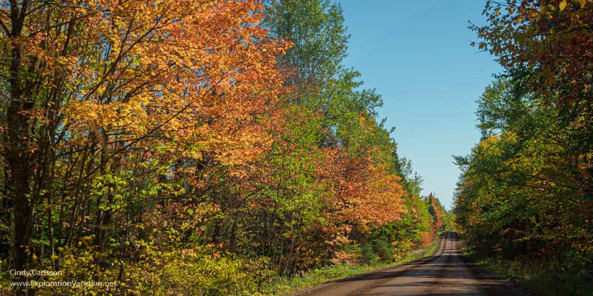
Heartbreak Hill explodes with color during peak leaf season.
Heartbreak Hill isn’t the most scenic drive in Minnesota because you won’t have any dramatic vistas during leaf season. But if you want to truly immerse yourself in the season, this route always seems to deliver some of the North Shore’s best fall color!
I use links to improve your experience using this website. Some may be affiliate links that pay me a small commission if you use them to book a room, rent a car, or purchase goods or services. You don’t pay extra, but it helps keep this website running. To learn more, see my policies and disclosures.
A fall color drive on Heartbreak Hill
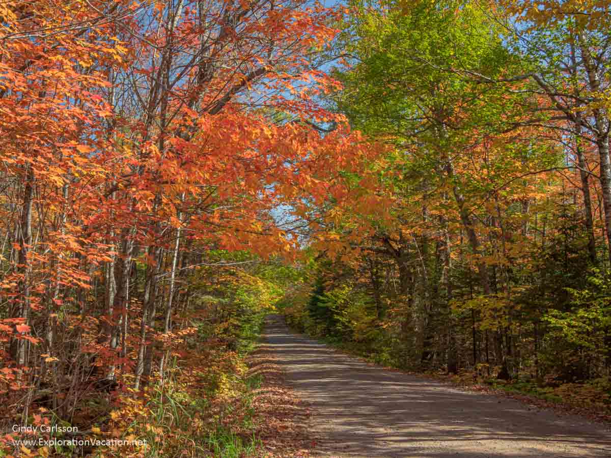
The drive along Heartbreak Ridge (Forest Road 166) isn’t very long, but it delivers a load of peak season fall color!
Last time I drove to Heartbreak Hill, we started at the Sawbill Trail on the north end of Forest Road 166. Starting there, you immediately get a fall scenery hit as you cross the Temperance River.
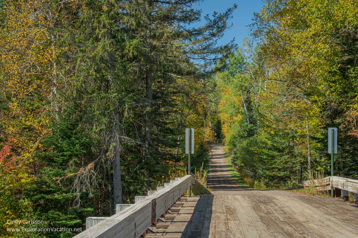
Crossing the bridge over the Temperance River as we begin our drive to Heartbreak Hill.
There’s actually a spot to pull off just before you cross the bridge. I think this is generally used by folks coming here to fish, but it’s also a great spot to stop and walk onto the bridge to take a picture.
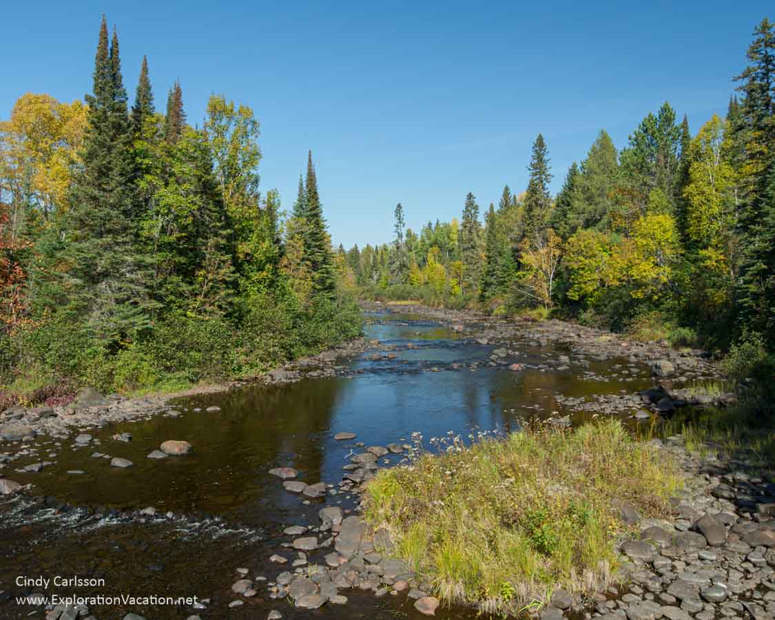
The Temperance River is still calm here.
Forest Road 166 isn’t paved, but it’s been in pretty good shape every time I’ve been on it. And it’s not like you are going to be leaf peeping at high speed!
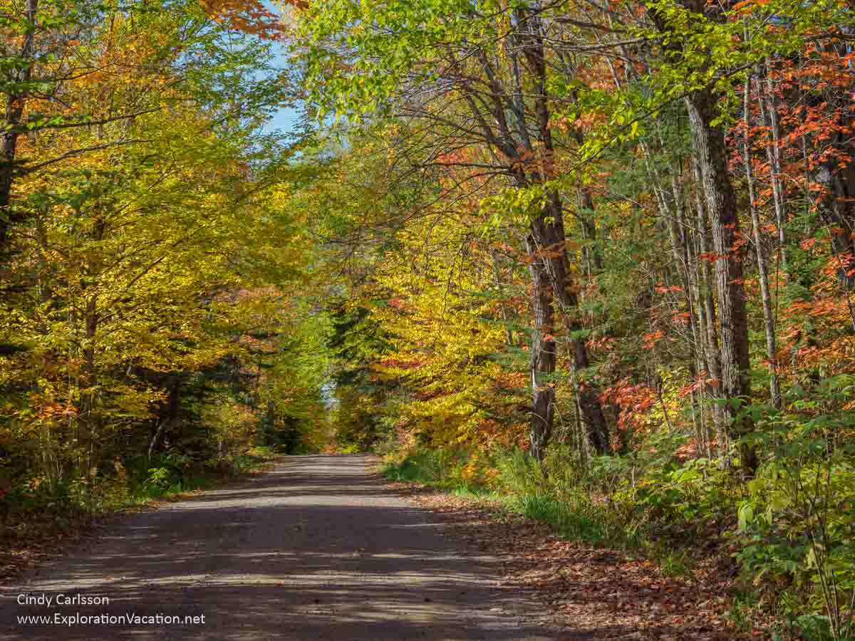
Surrounded by color on Forest Road 166 on Heartbreak Ridge.
The Forest Service has a sign that sort of explains why this area is called Heartbreak Hill. There’s a rare place to pull over by the sign. That makes it easy to stop here, read the sign, and take a few pictures.
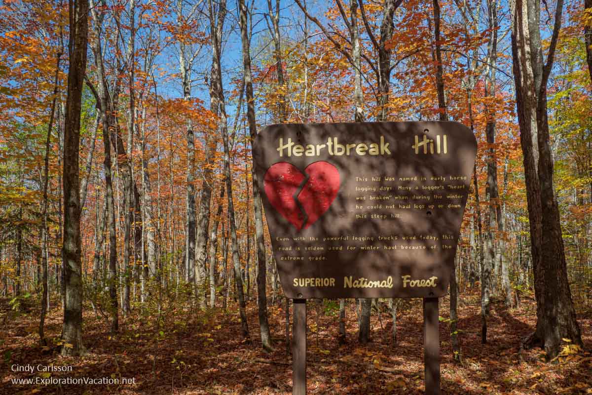
The Forest Service gives leaf peepers a mini history lesson about Heartbreak Hill.
While the cute sign does (more-or-less explain) that once upon a time logs were hauled out of the forest here – in winter, using horses – it’s a little light on the details.
Loggers weren’t just “Oh, my sweetheart broke up with me” sad when he horses couldn’t get up the hill. It was far more serious crisis.
That’s because loggers weren’t paid until their logs were out of the forest. They got food and lodging (such as it was) as part of the job. But actual cash payments were based on the number and quality of logs that came out of the forest and arrived at their intended destination. If logs weren’t out of of the forest before spring thaw, everyone on the logging team saw a serious cut in their paycheck.
So, getting the winter’s logs up Heartbreak Hill was a really big deal.
If horses couldn’t pull the loaded logging sledges up the hill, loggers had a limited number of options. They could remove logs from the load and make more – maybe many more – trips up the hill. Or they could take a long detour around the ridge. That option likely also required building a new ice road at least part of the way. Both required physically demanding labor and a lot more time. And more hard work for less money was not what a logger was looking for!
There really aren’t many other places where you can pull off the road to take pictures. However, there’s usually so little traffic we just pull over as far as we can (when we can’t see anyone else in either direction) and I take a few quick pictures.
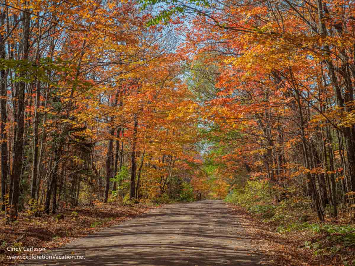
You really don’t have to leave the road to find great fall colors on the North Shore.
(But it’s too bad there isn’t a small parking area and short trail up here.)
We usually take the Temperance River Road (Forest Road 343) down into Temperance River State Park.
The Temperance River Road wouldn’t be very interesting if it weren’t for colorful leaves in fall and enticing glimpses of Lake Superior. (I know you can’t see the lake here. You have to trust me on that one.)
You can extend your leaf tour by following Forest Road166 to Forest Road 342 (the Two Island River Road). This route can by pretty scenic, with a mix of colorful woodlands and wetlands. But you don’t have the same sort of in-your-face color all around you that you get on the shorter loop.
But I like waterfalls, and the falls on the Temperance River seem to change all the time, so I tend to go that way.
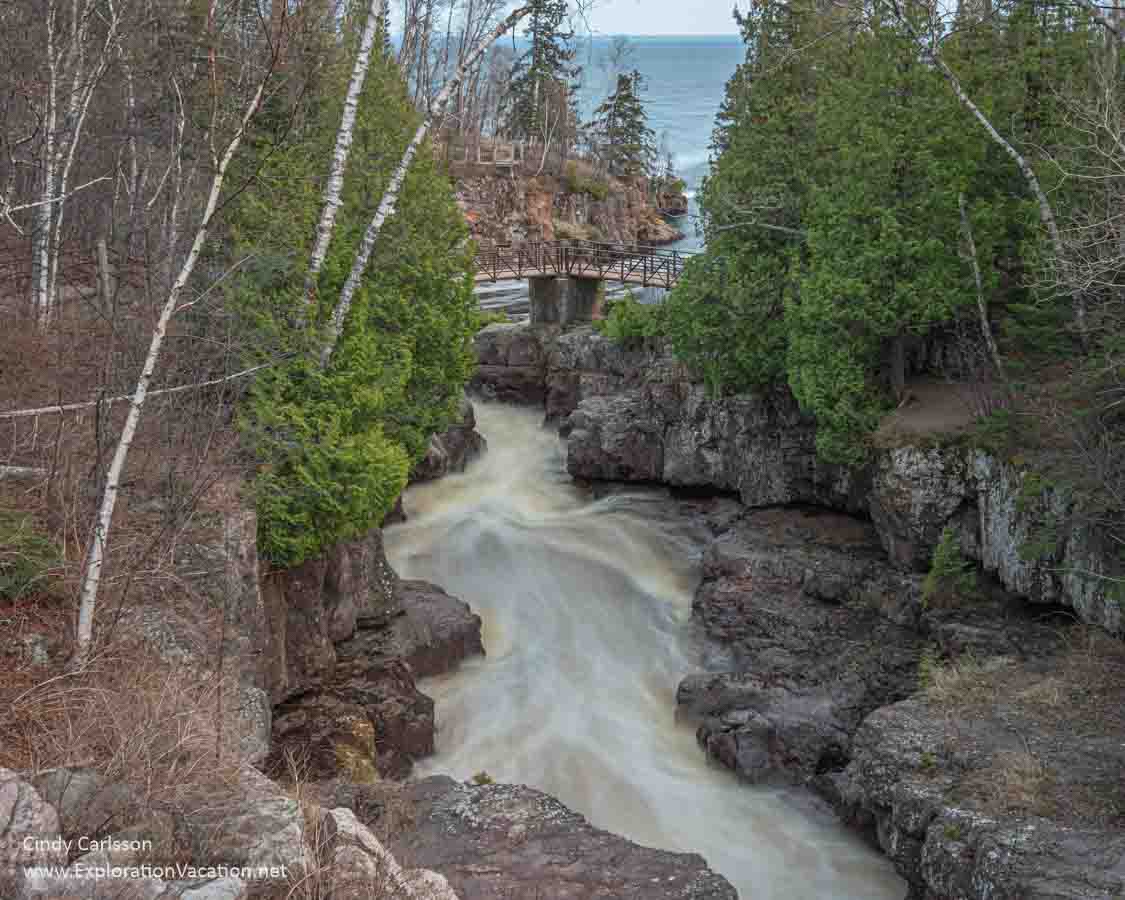
View from the Highway 61 bridge as the Temperance River as races to Lake Superior.
And, before you get to the Temperance River falls, a couple of parking areas let you connect to the Superior Hiking Trail. Or, if you aren’t up to a hike, you can just stop and wander over to the river to see what it looks like in this area.
Where is Heartbreak Hill?
You’ll find Heartbreak Hill just northeast of Temperance River State Park. That’s about half-way between Duluth and Grand Portage on Minnesota’s North Shore.
From the south, it’s about a 1½ hour drive up from Duluth. The nearest access to Heartbreak Hill is via 343 (Temperance Road) about a mile north of Schroeder. It’s just before you reach the Temperance River bridge.
Coming from the north, the nearest access to Heartbreak Hill is via highway 2 (the Sawbill Trail) out of Tofte. That’s a ½ hour drive down from Grand Marais or a little over an hour from Grand Portage and the Canadian border.
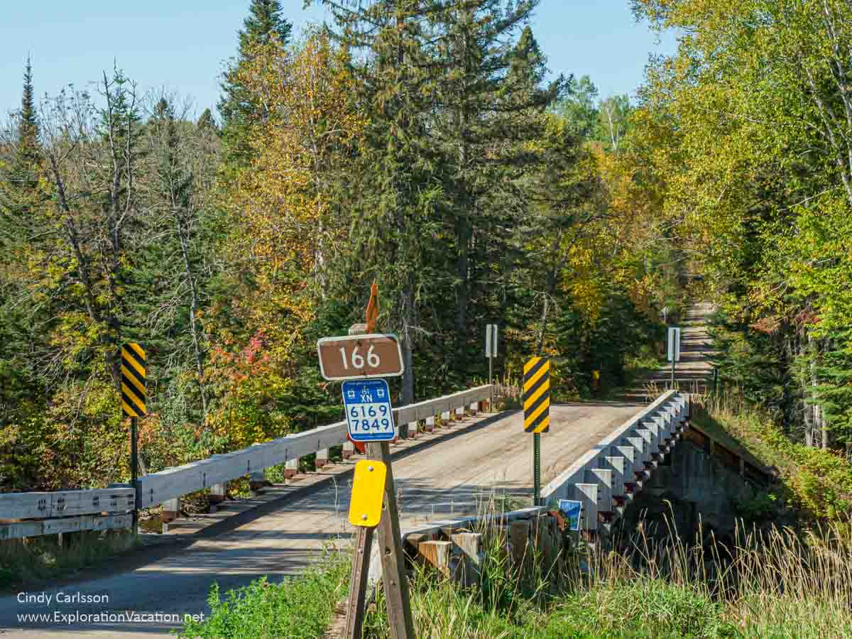
Heartbreak Hill is on Forest Road 166. This is also called the Six Hundred Road, the 600 Road, or the 6 Hundred Road. It’s all the same road.
(I’m still trying to figure out why it’s called the 600 Road. I assume it goes back to early logging days, but I’m still looking for the answer. If you know, leave a note explaining it in the comments.)
Driving the Heartbreak Hill Loop
Starting from Highway 61 along Lake Superior’s North Shore, the whole loop along Heartbreak Ridge is only about 15 miles. Of that, each segment is approximately five miles. (That’s to or from Tofte on the Sawbill Trail, along Forest Road 166, and to or from the Temperance River State Park overlook.)
While you can start at either end, we often start at the Sawbill Trail and ended in Temperance River State Park. That way we end our drive with distant views of Lake Superior.
These are unpaved roads
Both Forest Road 166 (the 600 Road) and 343 (Temperance Road) are well-maintained gravel roads. They are well-marked with brown forest road signs that have white numbers. The Forest Service also signs this as one of their fall color tour routes.
Look for brown and white signs to find forest roads.
Because the road is used by logging trucks, it doesn’t have many sharp turns or short, steep inclines/declines. (You’re moving up/down the ridge, but the change is pretty long and slow.)
We met a couple logging trucks the last time we were out here. Because the road is relatively narrow, we try to pull over and stop in a wide spot when we see a truck coming. That gives us time to admire the colorful leaves in that spot until the truck races by.
(Check the Superior National Forest’s scenic driving page for links to information on road conditions, logging traffic, and more. Or check in with the Tofte Range Station.)
Local residents also use this road. And, while you and I may be content toddling along admiring the leaves, others may really need to get somewhere else. Move over as soon as it is safe to do so and let them pass you.
When is the fall color brightest on Heartbreak Hill?
In Minnesota, fall colors begin appearing by early September and continue through most of October. But specific timing varies by location. It takes less than three hours to drive between Duluth and Grand Marais, but they might be as much as three weeks apart when it comes to fall colors!
And, of course, every year is a little different. An early frost usually brings an earlier fall peak. A dry year brings less color. Wind and rain in late September or early October can quickly strip trees of their colorful leaves.
Leaves peak earlier on Heartbreak Hill
On the North Shore, fall colors start appearing inland before you see much color along Lake Superior’s shore. Inland, you’ll usually see peak fall colors during the last half of September into the first week of October. Along the lakeshore, last week of September and first week of October is usually when you’ll see the best fall colors.
Heartbreak Hill is a bit inland, so you’ll often see color here earlier than along the lake. So, if you’re on a North Shore scenic drive in September and don’t see much color, head for the hills. Even though you aren’t very far from the lake, you’ll probably see a more color on Heartbreak Hill.
Check the Minnesota fall color map
Everyone wants to know when fall colors in Minnesota will peak, so you can find various forecasts, charts, tables, and maps that tell you what is happening where.
The statewide fall color report produced by the Minnesota Department of Natural Resources is the best of these.
The DNR Fall Color Finder is a peak fall color map of Minnesota based on information gathered weekly from parks around the state. This fall color map is an overview of the percentage of leaves that have turned throughout the state based on reports from each park. It’s a map of current conditions, not a fall color forecast. Of course, you can easily use it to make your own forecast for when you’ll find peak fall colors around the state.
But the Fall Color Finder also has notes for all 75 Minnesota state parks. These are listed in order of percent of leaves that have turned. It also includes the date of the update and links for details from each park. These links take you to information that often includes where to see the best color in each park, what trees have or have not changed color, estimates of when more leaves will change (or fall), changing colors in grasses and other plants, and other things to look for in the park this fall.
(The first fall leaf report of the season is published the first week in September.)
Other great fall drives near Heartbreak Hill
Heartbreak Hill is within the Superior National Forest, and the Forest Service’s Sawtooth Mountain Driving Tours flier (PDF) shows some of the best fall color drives within the forest. (Which is just about every road in the highlands above Lake Superior!)