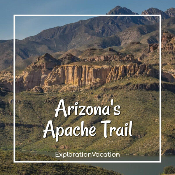

Last updated on June 15th, 2026
The Apache Trail Historic Road is open again! After being closed since 2019, you can once again fully experience one of Arizona’s best road trips.
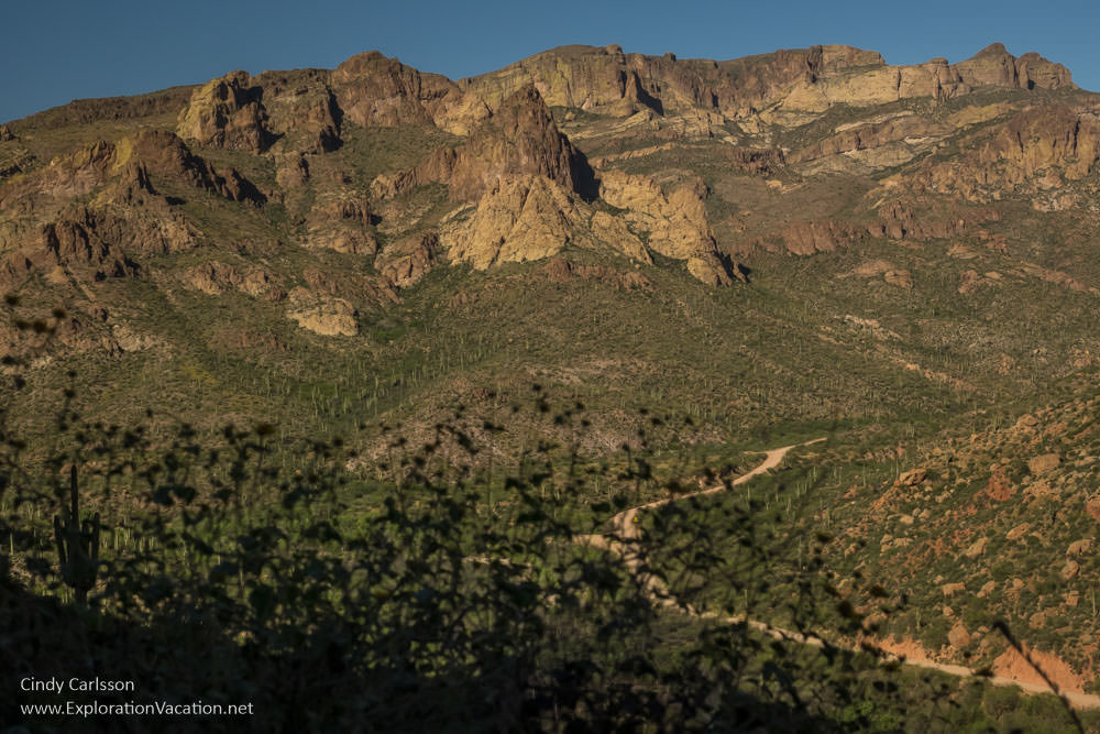
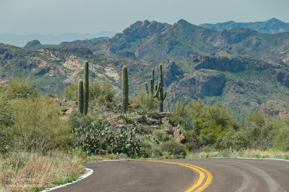
Mountain views along the Apache Trail in Arizona.
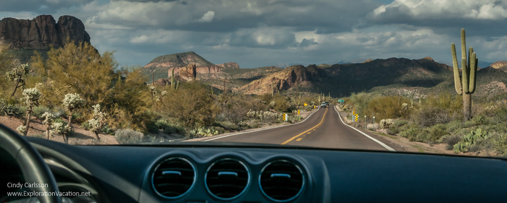
Easily accessible from Phoenix, the Apache Trail Scenic Drive is a historic road that starts near ghostly reminders of boom towns past, and quickly climbs into the rugged beauty of the Superstition Mountains. Go as far as Tortilla Flats, or take on the challenge of the more primitive section that ends at Roosevelt Lake. Along the way the sometimes-rugged road twists and turns through the spectacular landscape like a rollercoaster gone rogue.
Take your time and savor the scenery on one of America’s great road trips.
This story has affiliate links. I use links to provide additional information, but a few also pay me a small amount if you use them to make a reservation or purchase. You don’t pay extra, but it helps keep this website running without intrusive ads. To learn more, see my policies and disclosures.
I have not had a chance since drive the full Apache Trail since it reopened late in 2024. I know there are changes, including the new (or expanded) lookout I visited a few years ago. Of course, the area around Fish Creek is going to look different, as this is where the largest landslide occurred. And the fire that preceeded the landsides will also leave a mark on some areas of the road. But, in general, what I have here is here is still a pretty good guide to the road — and I’ll keep updating it as soon as I can.
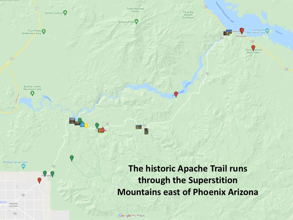
Discover the Apache Trail Historic Road
The portion of Arizona 88 designated as both the Apache Trail Historic Road and Apache Trail Scenic Drive runs for about 45 miles through the rugged landscape of the Sonoran Desert. Partially following the course of the Salt River, the road twists and turns through the Superstition Mountains, making this the most scenic and challenging section of a longer circle route (via Arizona 188 to Globe) that begins and ends on US Highway 60.
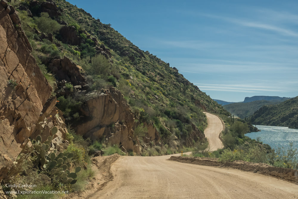
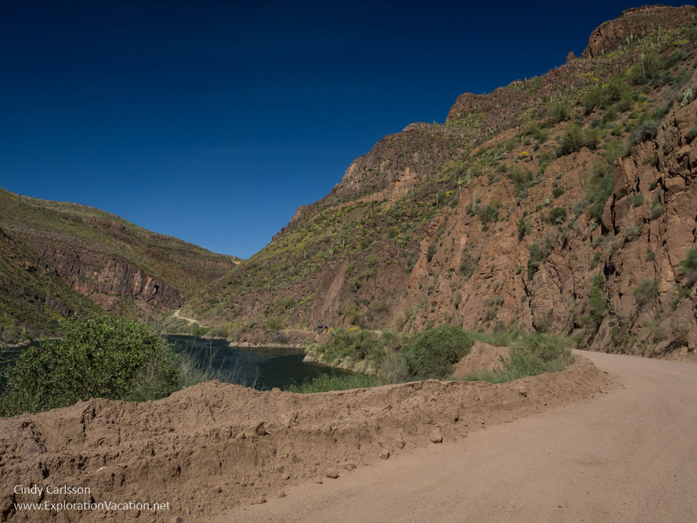
The first half of the Apache Trail Historic Road is a scenic, modern, paved roadway. However, not far beyond ghost town turned tourist stop at Tortilla Flat, the pavement ends, the road narrows, and the rollercoaster begins. You used to have to drive twenty miles and many switchbacks before the pavement resumed at Roosevelt Dam. Now it seems a longer section is paved. However, while the entire route is scenic, the narrow dirt road that winds through the upper half of the route is the most dramatic.
Timid drivers and those with a fear of hights should turn around when the pavement ends. Once the pavement ends, the Apache Trail gets a little challenging to drive. However, if you can handle taking curves on an unpaved one-lane road perched at the edge of a cliff, you are in for a spectacular drive.
Enjoy the sights along the Apache Trail
Avid hikers could spend days exploring the hiking trails in this area. However, this list focuses on stops that are accessible without walking more than a few steps from your vehicle.
(Because most people drive the Apache Trail as a day trip from the Phoenix area, this follows the trail from west to east. Advantages and disadvantages of driving the trail this direction are discussed in the driving tips below.)
Today the west end of the Apache Trail Historic Road begins at Highway 60 in Apache Junction. (The original road went further west into Mesa.) Long a small rural town along the road, Apache Junction was once a loose mix of local businesses serving local ranchers and mobile home parks filled with retirees. Most of the retirees are still there. However, the rest of the town is rapidly becoming a bland mix of big box and other fungible retail chains, coffee shops, mini-malls, and fast food outlets.
It doesn’t look much like the old west, but hang in there. The adventure begins just down the road!
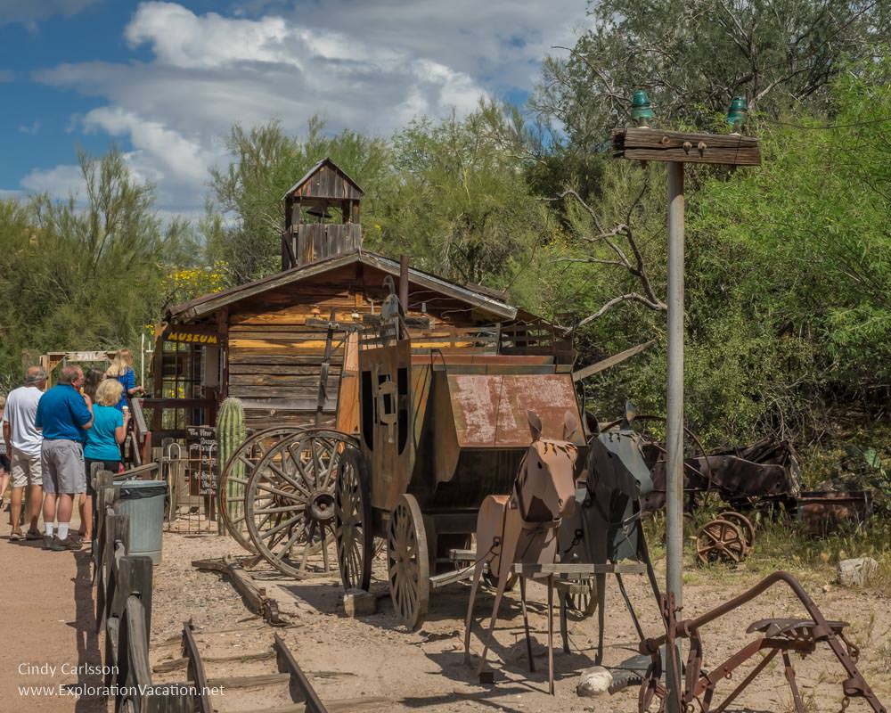
Superstition Mountain Museum
The first stop along the Apache Trail is the Superstition Mountain Museum.
Located at the foot of the Superstition Mountains, the museum preserves the myths and realities of the old west through architecture, artifacts, exhibits, and a cacti-studded landscape right out of a western movie set.
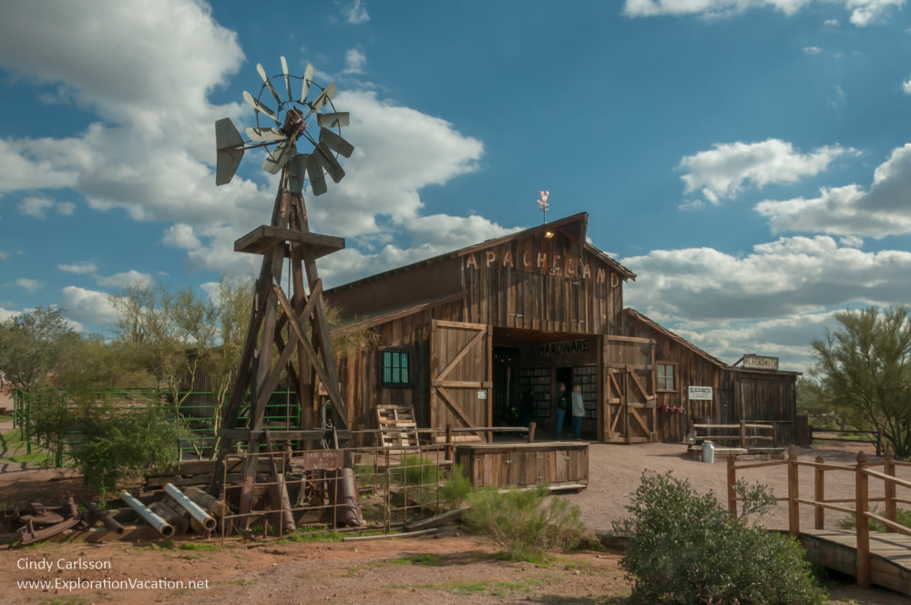
The Apacheland Barn was a well-used movie set before moving to the museum.
While the Superstition Mountain Museum looks a bit like a ghost town, all of the buildings were constructed on site or brought here from somewhere else. Each focuses on a bit of the area’s history, be it geology, native culture, the lives of prospectors and settlers, or the arrival of the film industry. Some buildings function as dioramas, while others have museums tucked inside. And some served as movie sets. It’s a fun place to soak in some history or just wander around taking pictures. (There is a fee to enter the grounds.)

Goldfield Ghost Town
One of the few places along the trail I’ve never visited, Goldfield Ghost Town recreates an old mining town, complete with simulated mine tours. There are shops, restaurants, and a variety of family-friendly attractions within the compound. Although Goldfield really was a gold rush boom town, this version was created as a tourist attraction. Still, it’s a great place to pretend you’ve stepped back in time. And the photo opportunities look fabulous. (There are fees for the various attractions, but you might be able to look around the grounds for free.)
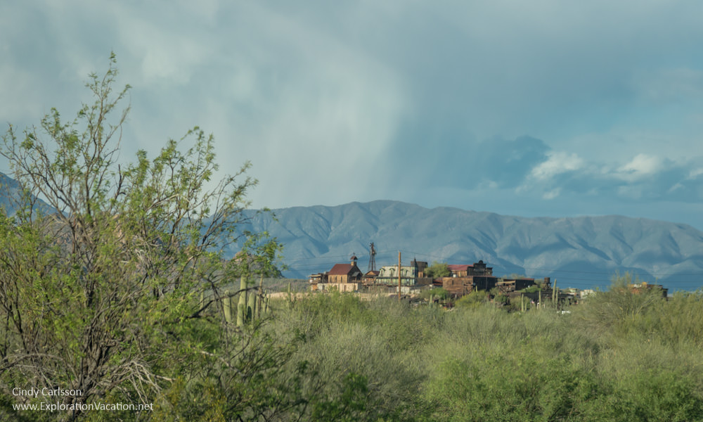
Goldfield Ghost Town also recreates the feel of an Old West town as scene in decades of Westerns.
Lost Dutchman State Park
Lovely little Lost Dutchman State Park provides access to the Superstition wilderness area. The park’s own trails link to those of the wilderness area, giving visitors a wide range of hiking (and riding) options. All of the trails have wonderful views of the Superstition Mountains and surrounding scenery. This is also a good place to look for spring wildflowers or take sunset pictures.
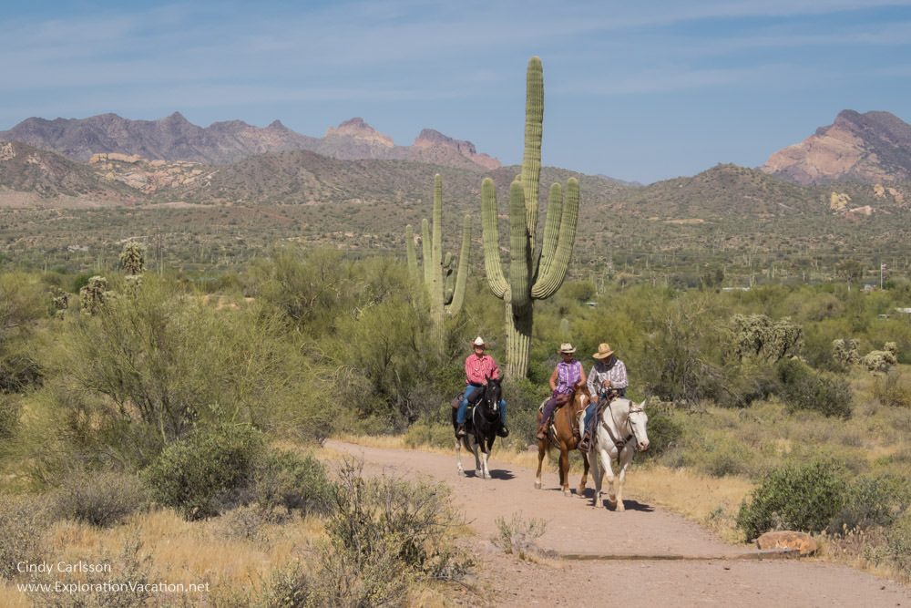
Horseback riding in Lost Dutchman State Park.
Besides trails, Lost Dutchman State Park has campgrounds and picnic areas. There is also a nice visitor center with a Sonoran Desert garden. (This park has an entrance fee.)
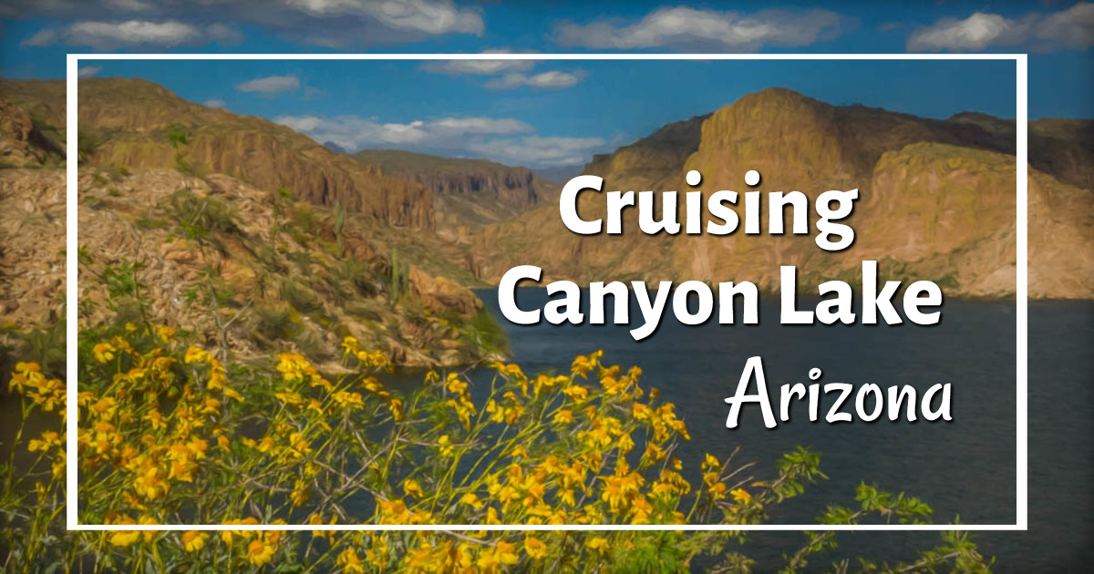
Canyon Lake
Whether viewing it from a distance or from its surface, Canyon Lake is gorgeous. Created by construction of the Mormon Flat Dam in 1925, this man-made lake twists and turns through dramatic canyon walls.
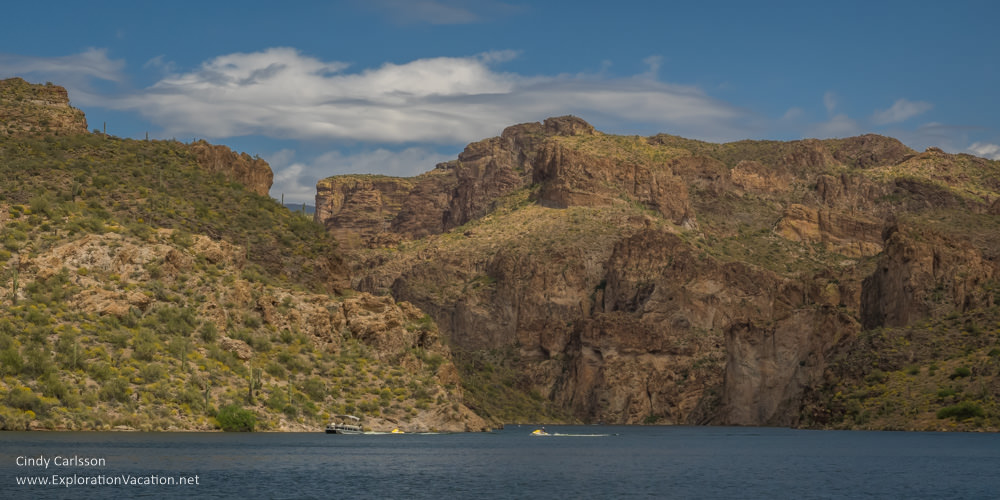
Canyon Lake scenery from aboard the Dolly.
There are a couple of places to pull off and view the lake from the road. For those seeking a closer look, several access points (including a full-service marina and campground) allow visitors to get out on the water to boat, fish, or swim. (Recreation areas require a Tonto Pass.) For those without a boat, the Dolly Steamboat offers cruises along several miles of winding canyons. There is also a full-service restaurant by the Dolly’s dock.
Tortilla Flat
Just up the road from Canyon Lake, Tortilla Flat is the only “town” along the Apache Trail Historic Road.
This was a boom town while the Roosevelt Dam was under construction. Even now, the town might have had a population of more than six if a 1942 flood hadn’t swept most of the buildings away. The few structures that survived became a popular tourist stop and were later rebuilt after a fire. (What’s left of the town is small, but tenacious.) Today there is a minuscule free museum, a general store filled with rather tacky souvenirs, and a saloon.
Tortilla Flat is totally touristy, but fun.
The saloon (a full-service bar and restaurant) is furnished in the best old west kitsch style, including saddles for bar stools and dollar bills for wallpaper. But the décor is a lot of fun and, when I last ate lunch there in 2017, the food was still first-rate. (The wait was too long to eat there in 2019.)

The thing to do here is to tack a dollar bill on the wall with your name and home state or country.
Expect a long wait at peak times, but use that time to look around. When it’s really busy, there’s sometimes live entertainment in a separate outdoor bar area.
There is also a campground (and additional parking) down the hill by the river. A few trails wind through this area as well.
The paved road ends before the next stop, so people often turn back at this point. However, it’s easy and worth the time to continue your Apache Trail road trip at least a little further.
Fish Creek Hill
The pavement used to end just outside Tortilla Flat, but it’s been extended a bit farther. (It seems to have been paved a little further out every time I visit.) Whether it is paved all the way to the Fish Creek Hill overlook now or not, this is usually an easy drive. There’s a parking lot (about mile 220) at Fish Creek Hill. Here you’ll find scenic views, walking paths, and rest rooms – all of which make it a good place to stop, wander around, and take a few pictures.
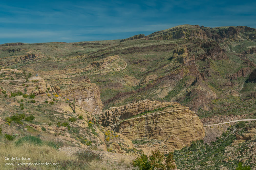
The view from the Fish Creek Hill overlook is one of the finest along the Apache Trail and the drive to get there isn’t too scary.
This is also where the thrilling (or terrifying) part of the road trip begins. Even after reopening, reports are that the road beyond this point is still challenging and may require a high-clearance vehicle if the weather has been wet. This an ideal turnaround point for timid or less-skilled drivers!
Fish Creek Canyon
Fish Creek Canyon is accessible again! But this is where a significant amount of rock came down, so it won’t look the same as in my pre-landslide photo. (But don’t worry, the scenery should still be dramatic.)
At Fish Creek Hill, the road used to both turn to dirt and more-or-less shrink down to one lane as it twists and turns back on itself as it plunges down the mountainside. (The road is said to drop 1500 feet in 3 miles.) This section of road is was steep, narrow, and made up almost entirely of blind hairpin curves. None of that seems to have changed since the road was restored through the canyong. This is a stunning area, but getting there is not for faint of heart, careless drivers, or anyone with a fear of heights.
Many people identified Fish Creek Canyon as their favorite spot on the entire Apache Trail. It’s easy to understand why, as the canyon’s dramatically sculpted walls, huge cottonwoods, caves, and boulder-strewn creek offer something for everyone.
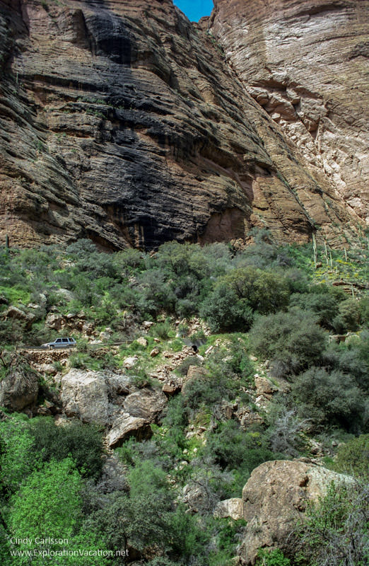
The Fish Creek Canyon area before tons of rock came crashing down.
The scenery along the creek is fabulous all year and at any time of day. However, spring and fall are particularly gorgeous, with lots of colorful flowers or shimmering leaves. The creek itself offers a bit of shade at any time of day, but it completely retreats into the shadows by late afternoon.
Unfortunately, there has never been much parking available at Fish Creek. If you want to photograph and explore here, skip breakfast to arrive before the fishermen and everyone else gets here.
Apache Lake
Created in 1927 with the construction of Horse Mesa Dam, Apache Lake is a sliver of water just off the Apache Trail. Various viewpoints offer distant views of this long thin lake. There are a few spots with space to pull-off the road, one or two of which have paths leading to a better view of the lake. A couple of rather primitive roads also lead down to forest service recreation areas along the lake. (A Tonto Pass is required to park at the recreation areas.)
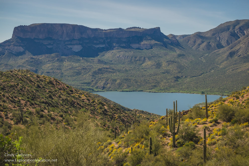
Apache Lake from one of the overhooks along the Apache Trail.
I’ve never driven down to the lake, which seems foolish. (I did make plans to book a room at the hotel here, but that was just before the Apache Trail was blocked by the landslide.) The shore of Apache Lake is supposed to be lovely and its location on the unpaved segment of the Apache Trail means it’s never very crowded.
Facilities at Apache Lake include a full-service marina with boat rentals, hotel, restaurant, and campground. After nearly going out of business while the road was closed, the resort seems to be fully back in operation.
Theodore Roosevelt Dam
When completed in 1911, Theodore Roosevelt Dam created what was at that time the largest artificial lake in the world. (It also spurred the growth of Phoenix, as a reliable source of water and electricity was necessary for both agriculture and residential development.) A viewing platform with information boards provides a good view of the dam along with its history. Note that this is not the original 1911 brick and stone block structure, as the dam was modified and raised an additional 77 feet in 1996.
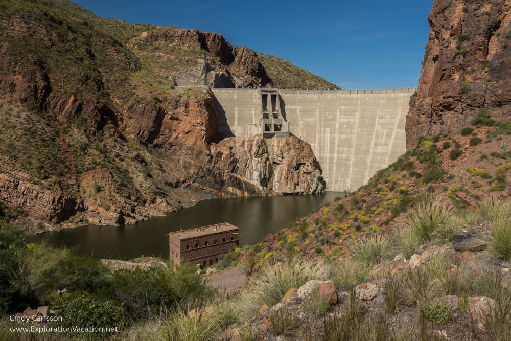
Theodore Roosevelt Dam from one of the overlooks.
A lookout on the other side of the dam provides a great view of the Roosevelt Bridge, which was also part of the dam’s 1996 upgrade. The two-lane single-span steel-arch bridge that carries vehicles over Roosevelt Lake is 1080 feet long. When constructed, it was the longest bridge of its type in North America – a record it still seems to hold.

The elegant bridge over Roosevelt Lake.
Prior to the bridge’s construction, vehicles crossed along a narrow (virtually one-lane) road along the top of the dam. That sounds really cool, but I get why traffic was moved to a separate bridge instead.
The end of the trail?
The Roosevelt Bridge also marks the end of the Apache Trail Historic Road.
Apache Trail road trippers have three options from here:
- Return back along the Apache Trail Historic Road and enjoy the scenery from the opposite direction
- Take Arizona 188 north toward Payson and destinations beyond
- Continue on the Apache Trail loop by following Arizona 188 south to US 60 (just outside Globe) and then back to Phoenix
The Apache Trail loop is a great option
Even though it’s longer, it’s probably faster to take the loop than drive back through the mountains again on the historic road. And, while the scenery is less dramatic, there are a few more worthwhile stops along the way.
- Stop at Roosevelt Lake to learn more about the area or get out on the water
- Stop at Tonto National Monument to climb into a cliff dwelling and learn how the ancient Salado lived
- In the spring, enjoy the fields of wildflowers along the way
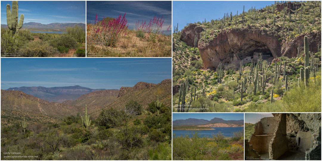
Scenes from along the Arizona 188 part of the loop.
And, if you have the time, a slight detour on US 60 runs through an absolutely stunning canyon on the way to the interesting historic mining towns of Miami and Globe.
One of my favorite canyons is just outside Globe.
US 60 also runs right past beautiful Boyce Thompson Arboretum State Park, one of my favorite spots in the Phoenix area.
Boyce Thompson is a don’t-miss destination in spring!
But doing all that makes for an extremely long day. An amazing day, but a very long one.
Development of the Apache Trail
The road we know today has a long history, but in some ways it has changed very little over the decades.
For more than a thousand years, Native Americans used the route known today as the Apache Trail to travel between the desert lowlands and the high country of the Mogollon rim.
However, the modern history of Arizona’s Apache Trail begins in 1903. That’s when Congress authorized funding for a dam on the Salt River.
👉 Read more about the development of the Apache Trail
Construction access
The site for Roosevelt Dam was selected during a survey of the Salt River — apparently without considering the difficulty of moving work crews, equipment, and tons of supplies to the remote location. Settlers in the area worried that, without road access to the site, the dam might not be built. Even if it were built, using the river for transport would leave them out of the economic bonanza the project was sure to bring.
Clearly a road was needed. And, with the ancient Indian trail already running through the area, choosing the route was probably an easy decision.
Actually constructing the road was not as easy as choosing the route. Few settlers lived in this remote, rugged country and building the road would be a long, hard job requiring many laborers. To address this problem, jobs were offered to local Native Americans, mostly Apaches from nearby San Carlos Reservation. They were an ideal workforce. Not only did the Apache work hard, but they were also good at building large walls without mortar. Even today road trippers on the Apache Trail can see remnants of their work in sturdy retaining walls along the road.
When completed in 1905, the Apache Trail (then called the Tonto Wagon Road or the Roosevelt Road) was 62 miles long, connecting the railroad in Mesa to the dam site.
Tourism begins
During construction, traffic on the Apache Trail was managed to ensure people and supplies needed for the dam moved through without delay. Even so, it’s said that the first tourists were on the road within a month of its completion in 1905.
Once the dam was completed in 1911, the road was open to the public. It was a treacherous route, but it drew plenty of traffic, including tourists looking for a scenic road trip. Enough people used it (this was the only connection between the Phoenix area and Globe) that the state improved the road’s safety and drainage in 1915.
1915 was also when the road started to become known as the Apache Trail.
The name appears to have been first used by the railroad to promote tourism. It was a good choice, as interest in the “old west” was growing. And, at the same time, more people had the ability to travel for pleasure. As the Apache Trail, the trail’s historical association with real Native Americans was linked to contemporary Romanticism about the west and “vanishing” native cultures.
Tourism along the route grew, but so did commercial traffic. The wildly twisting road may have been exciting for tourists, but it was treacherous for commercial traffic. And it was unreliable, as the road regularly closed after floods and landslides.
In 1922 a new state highway was built to connect Phoenix and Globe. It provided a safer and more reliable route for commercial traffic, removing much of this traffic from the Apache Trail.
Road improvements
With the opening of the new highway, the Apache Trail became a route for local traffic, construction vehicles and equipment (two additional dams were constructed on the Salt River during the 1920s), and tourists. It must have continued to carry a reasonable amount of traffic even after dam construction was complete, since the width was expanded to 16 feet and a gravel surface added in 1936.
In 1949 the section between Apache Junction and the Fish Creek Bridge was further widened to 22 feet and paved.
The scenery is great even if you stay on the paved sections of road.
And that was the last significant improvement to the Apache Trail until 2017, when improvements were made to the paved section at the western end of the road.
On the other hand, aside from basic maintenance (minor grading, washout repair, debris removal, and a few guardrails), the unpaved section of the road remained pretty much the same as it was in 1936 – until summer of 2019, when wildfires followed by major flooding destroyed sections of the roadway.
This is what the Apache Trail looked like in 2017. This relatively straight segment MAY be paved today.
It was truly a road from another time.
I can’t wait to see what it looks like now.
👉 Read less
Plan your Apache Trail road trip
The Apache Trail Historic Road/Senic Drive (Arizona Highway 88) runs for about 45 miles between US 60 in Apache Junction to Arizona 188 at Roosevelt Lake. The southwestern portion of the road is paved; much of the rest is not.
The Apache Trail is open! You can travel all the way through once again. (You can see some of the damage in this video.)
The very western end of the Apache Trail is pretty easy mountain driving. And the scenery is great.
The Apache Trail is open all year unless closed by a flash flood, washout, or landslide. Don’t venture out when there’s rain in the forecast.
The entire route, including the unpaved segment, is generally suitable for passenger cars. However, it’s not recommended for RVs (some RV rental companies specifically prohibit travel on it) or long trailers. Personally, I can’t imagine driving an RV or hauling a boat along the unpaved section of the Apache Trail. And you’ll hate them for it when you are stuck in the dust behind them or meeting them on a blind curve.
If you love to drive, this is a fun trip. If you aren’t excited by the thought of driving a narrow, twisting, unpaved road, there are lots of local tours available. Most include a Canyon Lake cruise on the Dolly and probably only do the Apache Trail from the Dolly to the end of the pavement. You’ll have to look harder to find a tour that takes you all the way through to Roosevelt Lake — but they are out there.
As always, book directly when you can. If you can’t find what you need or have trouble working through all options, you can always check Viator and Get Your Guide. Both usually have a number of options available.
Advice for drivers
Check the weather before you set out. Do not make the trip if rain is in the forecast.
Fill your gas tank before you head out. There are no gas stations along the Apache Trail.
The Apache Trail is a challenging road even for the best of drivers. If you are uncomfortable on the paved section, DO NOT continue on to the unpaved section. The paved road is by far the easiest and safest section to drive.
Allow plenty of time
The drive from Phoenix to Tortilla Flat/Fish Creek Hill is a nice half-day trip. This is also the paved part of the road, making it easier to drive.
Bring water just in case, as some sections of the Apache Trail are pretty remote and options for buying water and snacks along the way are limited. (And this is the desert.)
Be extra careful
It should go without saying that drivers need to watch the road (not the scenery), stay off the phone, and slow down.
Slow down!
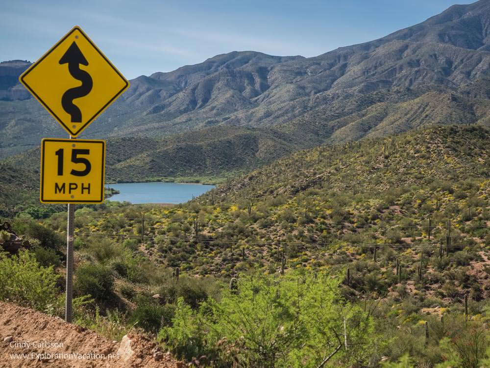
Even on paved sections of the Apache Trail, drivers need to slow down to safely navigate curves and one-lane bridges. Be even more cautious on unpaved sections, where narrow lanes, blind curves, sheer drop-offs, and loose rocks and sand make the road particularly challenging. There is a reason the speed limit on many sections is 15 mph.
The Apache Trail is not a road to race along — there are still unpaved one-lane sections on blind curves.
Many of the bridges along the Apache Trail are one-lane. Pay attention and be courteous.
Be super extra alert on curves and one-lane segments.
- Plan ahead and slow down BEFORE you actually enter a curve. You’ll have better control of your vehicle if you aren’t breaking as you turn.
- When driving in the mountains, traffic headed downhill must yield to traffic headed uphill. (It’s easier and safer to back downhill than up.)
Don’t get too close to the edge of the road, particularly on the unpaved outside lane. Some edges are very soft and the drop-off can be considerable. While there are some guardrails, they seem pretty minimal – especially along the unpaved section of the road.
Don’t block the road to look at the scenery or take pictures. Find a safe place to pull-off even if you don’t plan to get out of the car.
This is rattlesnake country, so watch where you step when you get out of the car to ogle the scenery. (I’ve never seen a snake up here, but I’m usually here in March before they come out for the season.)
Be even more careful on unpaved segments
All of the above advice applies to the full route, but it is especially true for the unpaved section of the Apache Trail.
While the road was graveled in 1936, it doesn’t appear anyone has added gravel since. That means most of the road surface is either sand or loose rock.
We last traveled the full route in March 2017. At that time the unpaved section had just been graded and was in pretty good shape. However, it was almost blindingly dusty in spots. In addition, the grading left a high strip of dirt and rock piled along the edge of the road in places, which narrowed the driving lane some and made it difficult to pull off even where there was adequate space. (At least we didn’t need to worry about getting too close to the edge and sliding off the road!)
Even before it was improved, the Trail was pretty well maintained.
Most of the blind curves are on this section of road. Naturally, a few of them are on segments that are only one lane wide. . .
Since this is essentially a dirt road in the desert, plan on using your air conditioning. And you probably don’t want to put the top down on your convertible.
Advice for photographers
Photographically, the scenery along the Apache Trail is hard to beat. But the rugged, narrow road makes it hard to find places to pull off to take pictures. So, when you do find a spot to pull over, take your time and make the most of it. (And remember to watch for snakes if the weather’s been warm.)
If you are serious about photographing the area, consider purchasing a Tonto Day Pass. The pass allows access to all of the forest service sites along the Apache Trail. These have parking and some have trail access, making it easy to stop and look around. Most also have pit toilets.
It’s best to have a driver so they can focus on the road while you look for great shots. If you don’t have someone who can drive for you, watch for pull-outs and do ALL of your scouting once you are off the road. Don’t try to look for great shots and drive at the same time!
Wait for dust from passing vehicles (and your own vehicle) to settle before getting out your camera gear. And keep your camera covered even in the car. The dust here is really fine and will seep right into your car and uncovered gear.
As noted in the driving tips, early morning and late afternoon sunlight can be blinding. However, if you have the sun mostly behind you, the light will be spectacular. If great photos are your goal, stay at Roosevelt Lake to start your morning drive from there.
Spring and fall are especially beautiful, with wildflowers along the roadway in spring and colorful bushes and trees along creeks and in shaded canyons throughout the fall.
Plan ahead to use recreation sites
Besides the sites mentioned above, there are a number of “developed” day use sites along the trail. Most of these have some combination of boat landing, picnic tables, trail head, and parking. Some have pit toilets and water. Facilities are usually pretty limited. However, no matter how primitive, all of the developed areas off the Apache Trail Historic Road (including water access on Canyon and Apache lakes) are either operated by a private concessionaire or requires a Tonto National Forest Pass.
Get your Tonto Pass before you get to the Apache Trail. Passes are available at a wide range of retail locations, ranger district offices (there’s one at Roosevelt Lake), and online. While passes are usually available at Tortilla Flat, there is no guarantee they won’t be out of them the day you need one.
See high-quality images from the Apache Trail on CindyCarlsson.com.


Nice story-always on the lookout for more good road trip options in the US. Pinned to my road trip board.
Thanks, Rose. I think you need to add a Sonoran Desert quilt to your collection, something to go with your Southwestern one. Your quilts are amazing! I especially like the Bedouin and Paris ones, but they are all great and so different. And I love that you photograph them “on location”!
Definitely an authentic Western experience beyond the usual tourist destinations! Your guide to the Apache Trail is wonderful and so complete for anyone making this journey. Great natural beauty combined with attractions along the way is the perfect combination! Thank you for sharing this look at an American road trip at its finest!
Thank you, Marilyn! It’s an area I really love, so that makes it fun to share with others!
Wow, there’s so many places to see on this route! I love the sound of Superstition Mountain and of course the ghost town, though it’s a shame it’s only a re-creation. This looks like a really helpful guide!
While there aren’t a lot of authentic artifacts for you to admire, Jessica, there are all sorts of creepy morbid stories about the Lost Dutchman Mine and what happened to the people who went searching for it. They have some of that info at the Superstition Mountain Museum.
This is so timely! We are headed to AZ for the winter. I didn’t have the Apache Trail on my to do list, but now I do. bookmarked this to use when we go. Thanks!
Wendy, it’s a great trip for the next few months now – and once the flowers bloom (if they bloom this year – it’s been pretty dry) it’s really spectacular. Not sure when we are headed down this year, but thinking we might go farther south this year.
I’d absolutely love to explore the Apache Trail. It’s so full of history and the countryside looks wonderful. Thanks for sharing!
I hope you get to see it sometime, Karen.
This is the best guide to the Apache Trail I’ve seen. When we wintered in Mesa, the Apache Trail was the number one thing we’d do with visitors – taking a half-day trip to Tortilla Flat or Fish Creek Hill and back. It is such a scenic drive! We did do the entire trail once many years ago. The part beyond Fish Creek Hill is definitely not for the faint of heart. I’m glad to hear there is road work being done. The last time we drove the route, which was a couple of years ago, I felt it needed it.
In my mind, the drive to Tortilla Flat is something everyone who visits Phoenix should do! I’ve done the whole trail three or four times over the years, but I’ve only been the driver once. It’s a lot more fun to be able to enjoy the scenery than watch for someone coming toward me too fast around a blind curve!
Thanks for sharing this informative article on the Apache Trail. Your pictures tell such a compelling tale, that we have decided to look at this for a future destination. Of course, we will probably wait until the road construction is complete. We would really like to visit the ghost town.
Thanks, Jeff. I think you’d find a lot to like in this part of Arizona. The loop takes you down to Miami (still inhabited, but about half ghost town) and the historic town of Globe – I think you would find both interesting. It’s a great area for road tripping. And there aren’t many roads quite like the Apache Trail!
I’ve never heard of this trail but it sounds like a great adventure. Appreciate the photography tips too and that Pass sounds like the way to go. Now I just need a four wheel drive vehicle!
It’s a great trip. You don’t need four wheel drive, just a decent vehicle – any SUV should be able to do it without problem. Take you time and stop to enjoy the scenery!
This sounds like an amazing road trip. So much beautiful scenery and lots of history. I’d love to eat at that saloon in Tortilla Float – what decor!
And wait until you go into the restroom. . . Let’s just say the theme continues! It’s a fun place in a gorgeous part of the country. I hope you get there sometime.