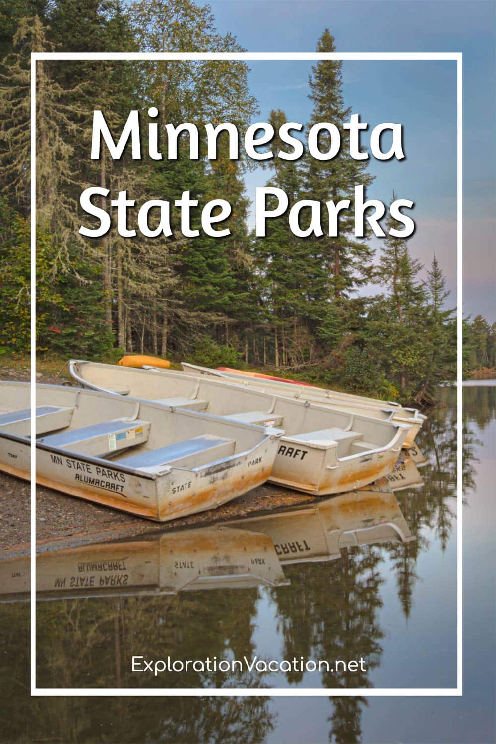
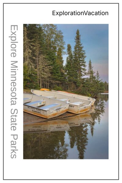
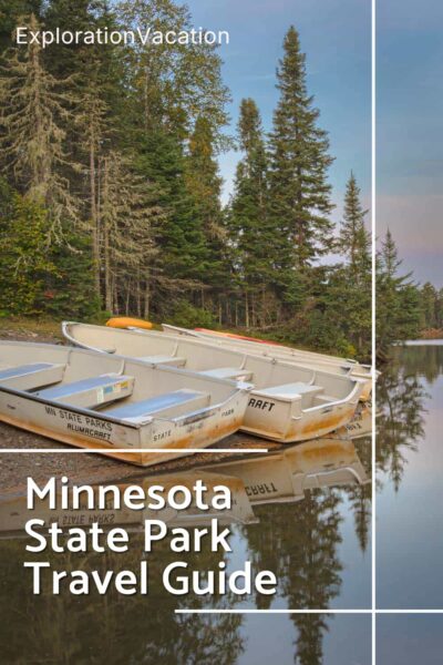
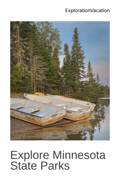

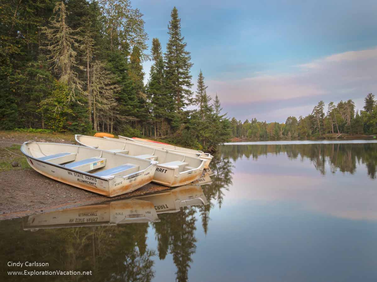
Minnesota has more than 70 state parks and recreation areas, with the largest concentration in the exceptionally scenic northeastern part of the state. However, you’ll find state parks and recreation areas throughout the state.
A quiet night along the shore in Bearhead State Park.
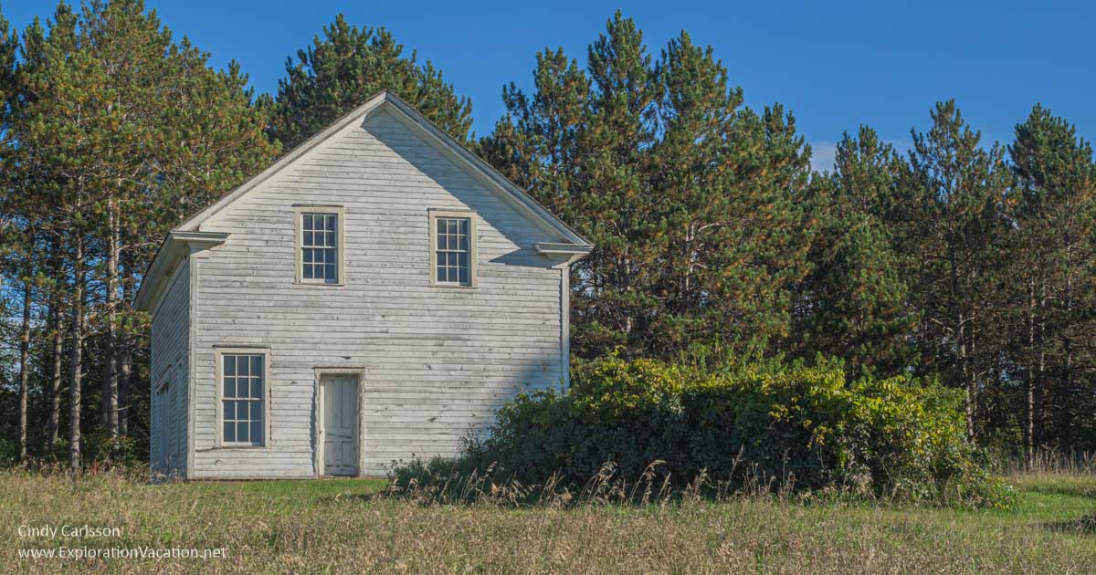
Although Minnesota’s state parks are usually thought of as recreational areas that also preserve scenic sites and natural resources like game and fish, the parks originally fulfilled a historic preservation function as well. For that reason, many parks contain historic sites or structures.
Any time of year is a great time to explore Minnesota’s parks, but late spring and fall tend to be particularly pleasant and beautiful in most parks.
Browse all parks or open the Table of Contents to get a shortcut to parks by region. (Some parks are included in multiple regions to make your searching easier.)
I use links to improve your experience using this website. Some may be affiliate links that pay me a small commission if you use them to book a room, rent a car, or purchase goods or services. You don’t pay extra, but it helps keep this website running. To learn more, see my policies and disclosures.
All Minnesota state parks by region
The following visual guide will help you decide what parks you want to fit into a single road trip, based on where you are located in Minnesota or want to visit. (Some parks fit into multiple regions and are listed in both.) I’ve also included a few State Waysides, Scientific and Natural Areas, and State Recreation Areas, as many of these function much like a state park.
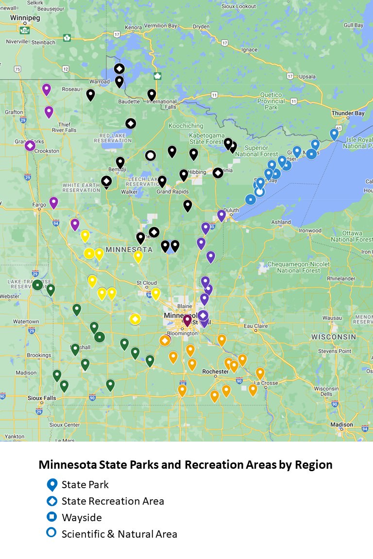
Open this map in Google and start planning your trip!
Minneapolis-Saint Paul Twin Cities metro area state parks
A few state parks are right in the Twin Cities metro area. However, several others make easy day trips.
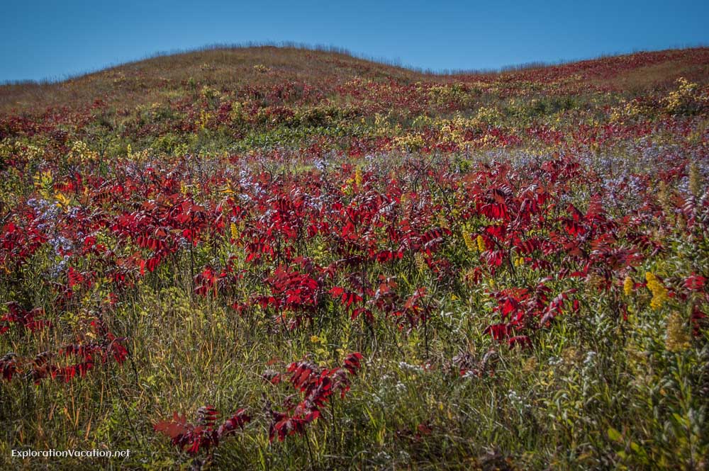
Afton State Park
Afton State Park (DNR website) is located in the rolling hills above the St. Croix River along the Minnesota/Wisconsin border at the eastern edge of the Minneapolis-Saint Paul metro area.
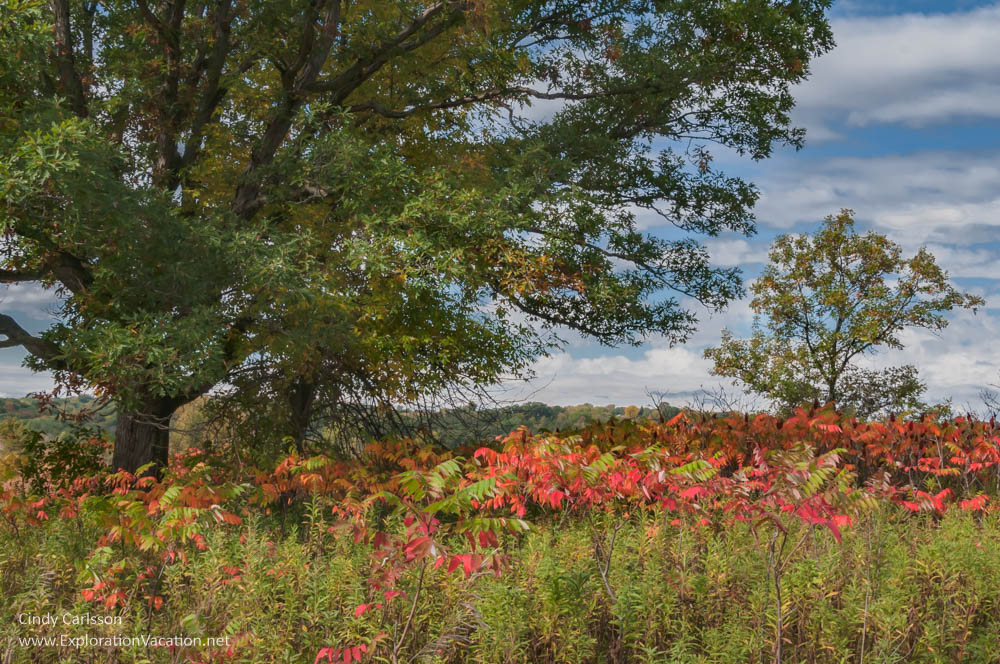
Brilliant red sumac signals the start of fall at Afton State Park in Minnesota
Most of the park is oak savanna, although there are also bits of prairie and woodland. And there’s access to the Saint Croix River. The park has many easy hiking trails with limited views of the river – except along the sandy beach!
Many of the trees in the park are oak, making it one of the later parks to reach full color in the fall and perfect for a late fall hike.
Fort Snelling State Park
Fort Snelling State Park (DNR website) combines a major historical site (which is NOT part of the state park) with a natural area along the Mississippi River in the heart of the Twin Cities. You will see major power lines and hear airplanes, but you’ll also see a floodplain, the Mississippi River, and wildlife.
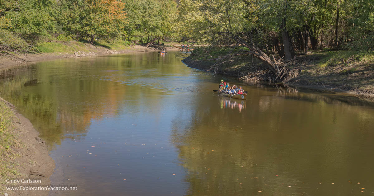
Quiet channels offer canoeing opportunities at Fort Snelling State Park.
When not flooded (the lower areas of the park generally flood in spring), hiking trails lace the lowlands in the river. I’ve been there to hike, ski, birdwatch, and attend events at the historic fort. (The fort is operated by the Minnesota Historical Society and is separate from the wooded state park below it.) Family activities are held most weekends, and a herd of not very shy white-tailed deer can be found there any time. It’s a great place to spend a day at any time of year.
Minnesota Valley State Recreation Area
Minnesota Valley State Recreation Area (DNR website), located in the southern part of the Minneapolis/St. Paul metropolitan area, includes the Minnesota Valley State Trail along the Minnesota River. (If you’ve ever flown into MSP, you’ve probably seen the MVSRA, as it covers much of the bottomlands along the river in either direction from the airport.) It’s a great spot for bird watching.
[expander_maker more=”See more state parks in the Twin Cities metro area. . . ” less=”Read less”]
Greenleaf Lake State Recreation Area
Greenleaf Lake State Recreation Area (DNR website), located between Hutchinson and Litchfield in south-central Minnesota, includes a number of lakes and wetlands. It is currently being developed, and only limited day-use activities are available.
Interstate State Park
Interstate State Park (DNR website) includes both the Minnesota and Wisconsin shores of the St. Croix River near Taylors Falls, just north of the Twin Cities metro area. It has stunning views over the river gorge, but is more famous for its cliffs and glacial potholes.
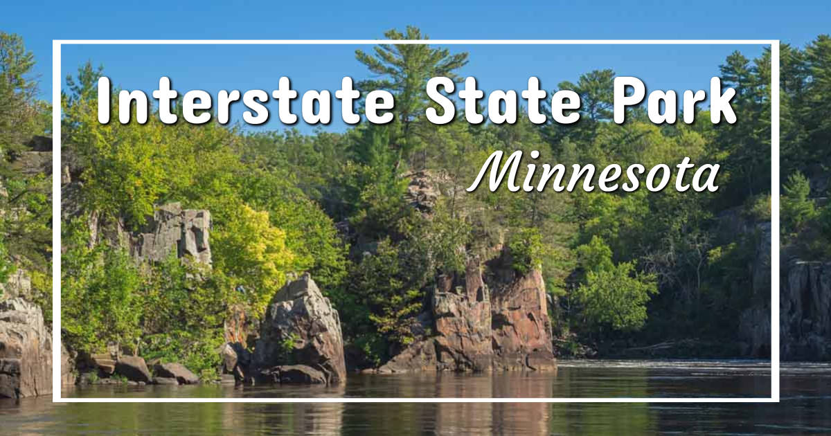
A paddlewheel boat located just outside the park also provides tours through the river gorge and downstream. This is a gem of a park and a perfect day trip from the Twin Cities. Spring is a great time to explore the park’s wildflowers and potholes. Summer is perfect for kayaking and canoeing.Then kick off fall with a late summer cruise on the Saint Croix.
Lake Maria State Park
Lake Maria State Park (DNR website) offers pleasant hiking trails through a maple and basswood forest just outside the Minneapolis/Saint Paul metro area. This is a stunningly beautiful park on a sunny fall day.
Fall at Lake Maria State Park.
Saint Croix Islands State Recreation Area
This one is a bit of a mystery. Saint Croix Islands seems to be a designated state park, but the property appears to be managed by the National Park Service as part of the Saint Croix National Scenic Riverway. Apparently there used to be campsites for boaters here, but it’s unclear whether these still exist.
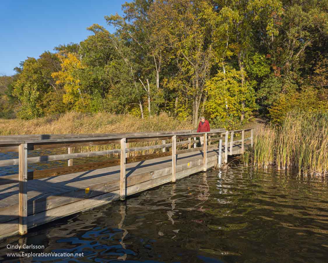
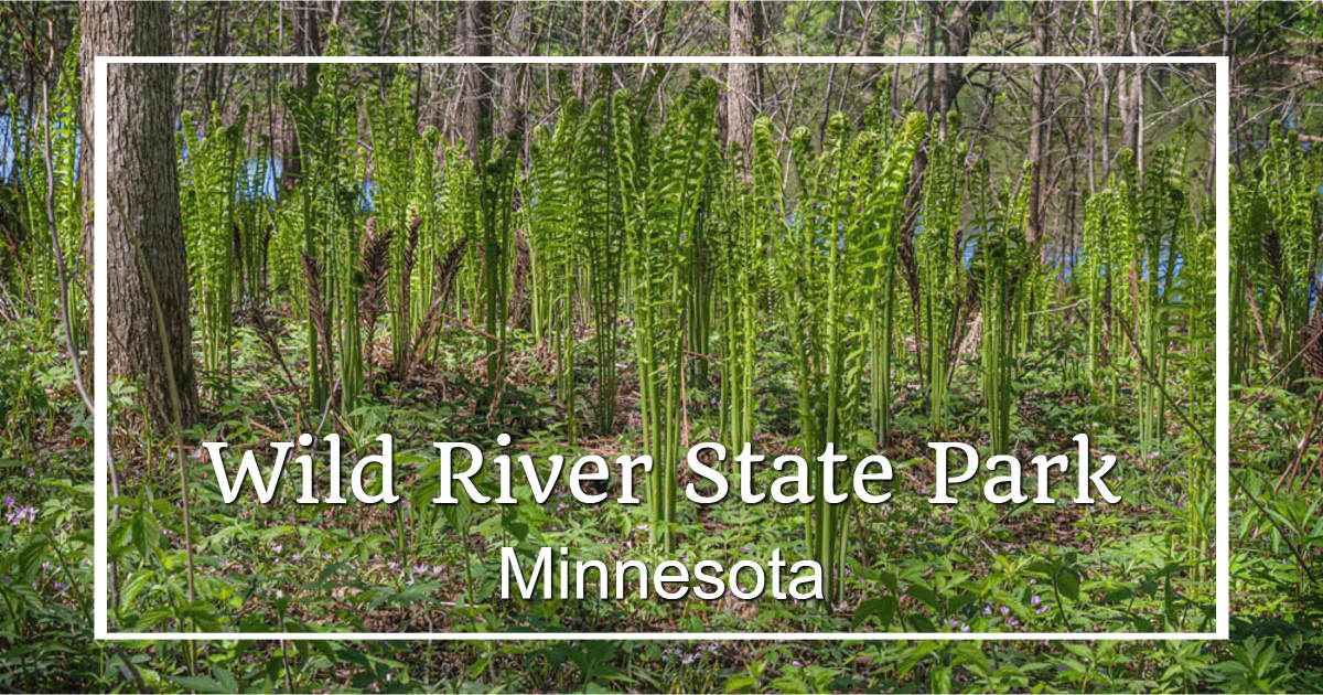
Wild River State Park
Wild River State Park (DNR website), located along the Saint Croix River north of the Minneapolis/St. Paul metro area near Center City, is a wonderful place to explore the river and surrounding woodlands.
While the park is lovely year-round, it is a fabulous place to enjoy both spring wildflowers and fall colors.
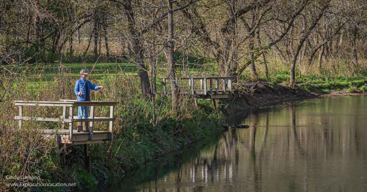
William O’Brien State Park
William O’Brien State Park (DNR website) is also located along the Saint Croix River, at the northern edge of the Minneapolis/St. Paul metro area.
A quiet morning for fishing in William O’Brien State Park.
William O’Brien State Park has a wide variety of landscapes, including shore along the St. Croix, forests, prairies, and various wetlands and small lakes.
This park has undergone a number of much-needed trail and river access updates recently. But the system supporting a lake in the park collapsed the other year, and work there is still in process as of 2026. But the rest of the park should be in good shape.
[/expander_maker]
Southeast Minnesota state parks
This part of the state includes many parks with dramatic limestone formations and woodlands. It’s a good part of the state to look for spring flowers and fall color. The Mississippi River Valley is particularly dramatic in the fall.
Southeast Minnesota has dramatic bluffs along the Mississippi River, rugged karst landscapes untouched by ancient glaciers, rolling prairies, and loads of spring flowers and colorful fall leaves.
Beaver Creek Valley State Park
Beaver Creek Valley State Park (DNR website) is located in the hills of southeastern Minnesota near Caledonia. It’s located in a narrow, steep valley with a creek flowing through it. A small park with lovely natural areas, it’s not heavily developed.
Beaver Creek Valley State Park is small but highly scenic.
We were a little late for fall leaves on our first visit, but returned in spring for the wildflowers. And got rained out. But it is a lovely, secluded spot — even in the rain.
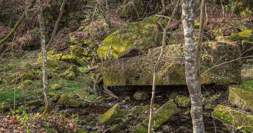
Carley State Park
Carley State Park (DNR website) is a rustic woodland park along the Whitewater River near Wabasha in southeastern Minnesota.
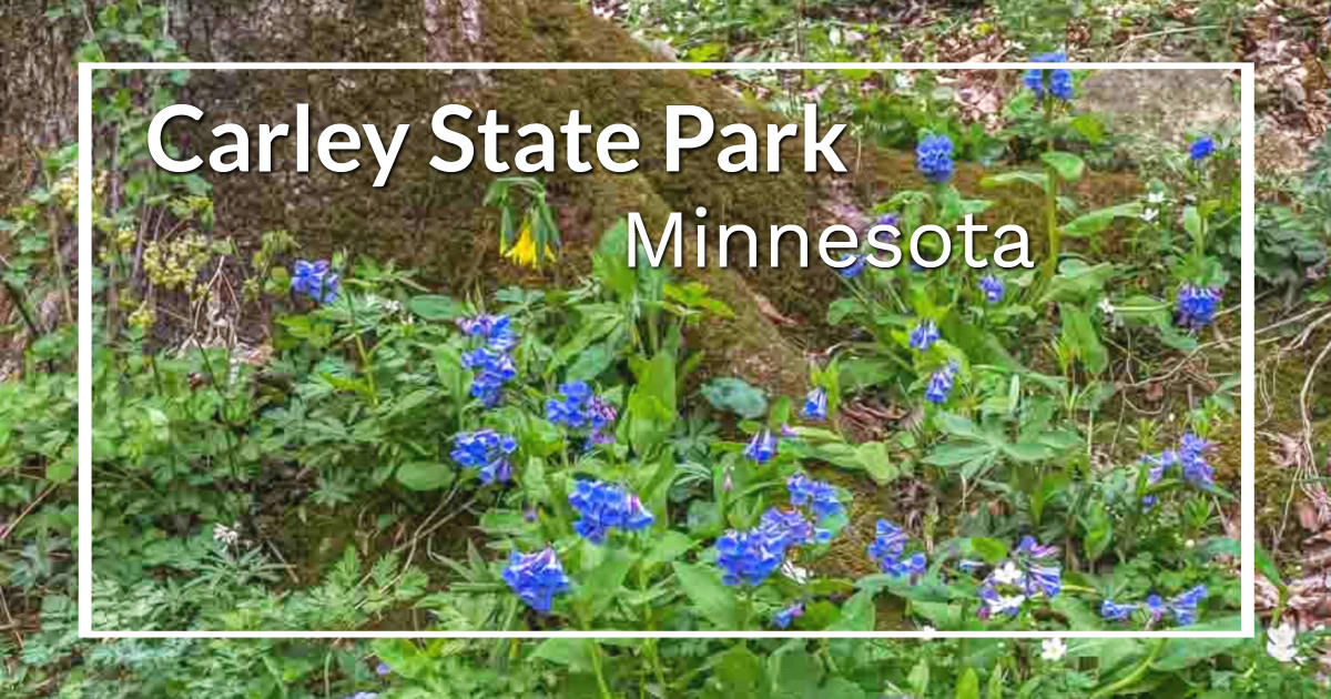
It’s best known for its spectacular spring flowers, which include a great show of Virginia bluebells. But if you miss the wildflowers, there are plenty of cool cliffs to explore along the creek.
[expander_maker more=”See more southeast Minnesota state parks. . . ” less=”Read less”]
Forestville/Mystery Cave State Park
Forestville/Mystery Cave State Park (DNR website) combines steep wooded hills, a trout stream, and a cave (guided tours are available seasonally) with a historic village. These are split into two units: Forestville and Mystery Cave.
The Forestville part of the park includes lots of hiking and horse trails, as well as a historic village.
A few of the village buildings are occasionally open to the public. But signboards explain why each building (and this place overall) was important even if you can’t go inside.
There are also miles of trails and large campgrounds for campers of all types. Those features make it a popular spot for horse camping and trail riding.
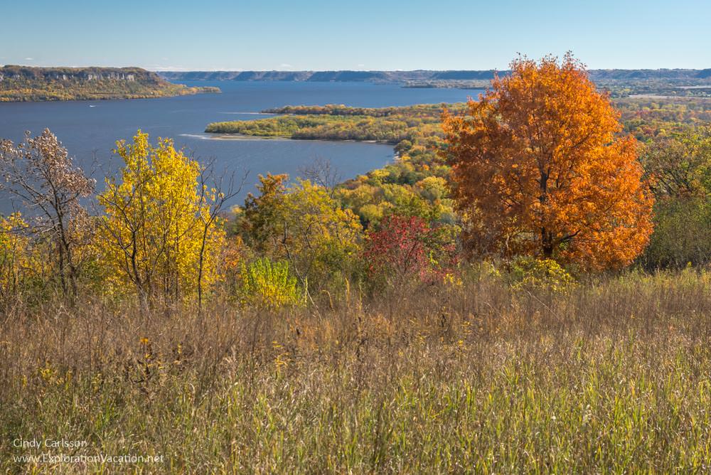
Frontenac State Park
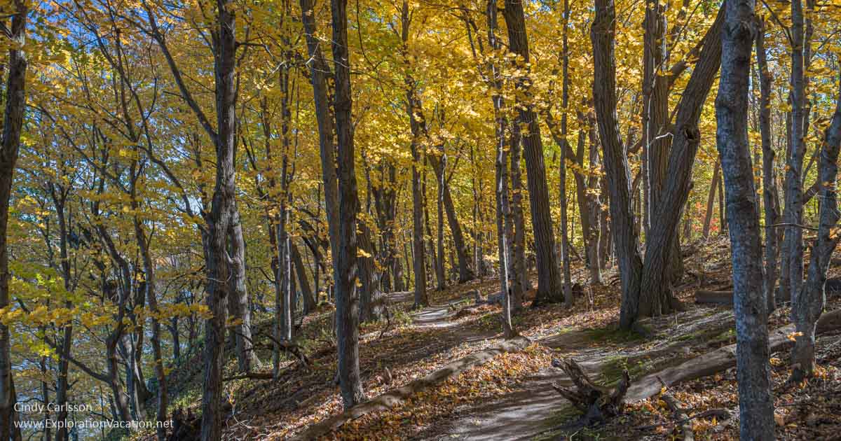
Frontenac State Park (DNR website) is located in the rugged wooded hills above Lake Pepin. The hillsides are laced with trails, and the upland prairie provides expansive views. It’s a gorgeous spot, particularly in the fall when the leaves are at their most brilliant, and one of my favorite stops along Highway 61 south.
Great River Bluffs State Park
Great River Bluffs State Park (DNR website) sits high on the bluffs overlooking the Mississippi River near Winona.
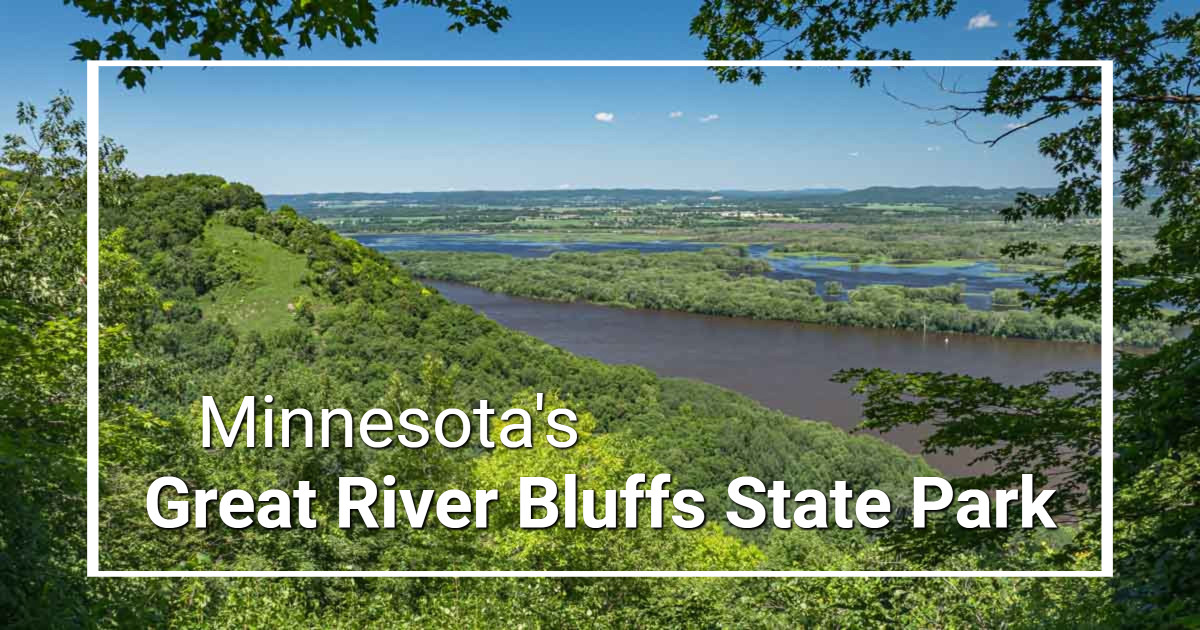
This is a gorgeous part of southeastern Minnesota, and the park has great scenic views and wonderful hiking on easy trails. It’s a new favorite of mine — I can’t wait to visit in the fall when the leaves are at full color.
It’s a great stop for anyone traveling through southeastern Minnesota on the Great River Road.
- What you’ll find at Great River Bluffs State Park: Forest hikes with views over the Mississippi River valley.
- Best time to visit: Just as the leaves first come out in spring for the best scenic views or fall when the leaves turn brilliant colors along the trail and in the river valley below.
John A. Latsch State Park
John A. Latsch State Park (DNR website), a small state park near Winona in southeastern Minnesota, provides a stopping place with views of the Mississippi River.
Lake Louise State Park
Lake Louise State Park (DNR website) centers on a mill pond at the edge of the tall grass prairie in southern Minnesota.
Myre-Big Island State Park
Myre-Big Island State Park (DNR website) consists of oak savanna, grasslands, lakeshore, and marshes near Albert Lea in southeastern Minnesota. The park’s namesake island is a maple/basswood forest.
Nerstrand Big Woods State Park
Nerstrand Big Woods State Park (DNR website), located near the tiny town of Nerstrand in southeastern Minnesota, preserves a rare remnant of the “Big Woods” that once blanketed this part of the state. This park is noted for its vegetation (carpets of spring wildflowers and brilliant fall leaves), but it also has a lovely little waterfall.
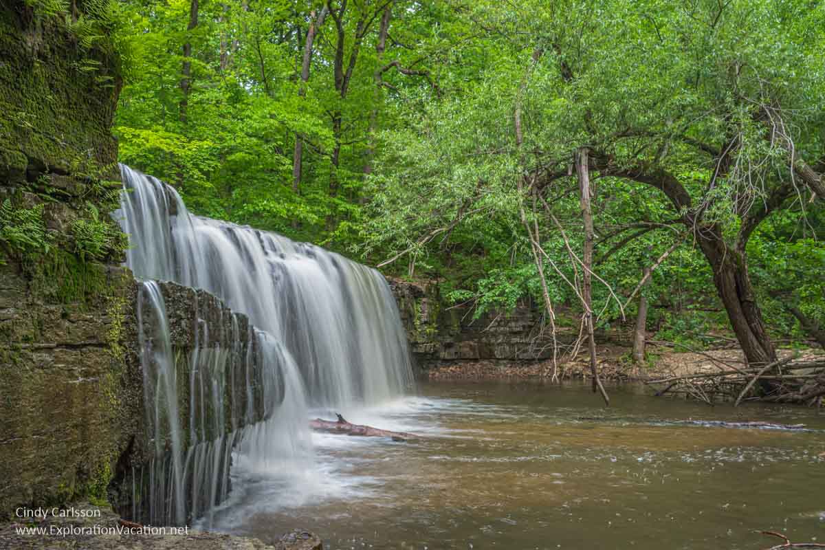
Nerstrand has a really lovely waterfall and many wildflowers.
Rice Lake State Park
Rice Lake State Park (DNR website) is located along a shallow lake where American Indians once harvested wild rice near Owatonna in southern Minnesota. It’s a popular lake for fishing, but also has a few trails.
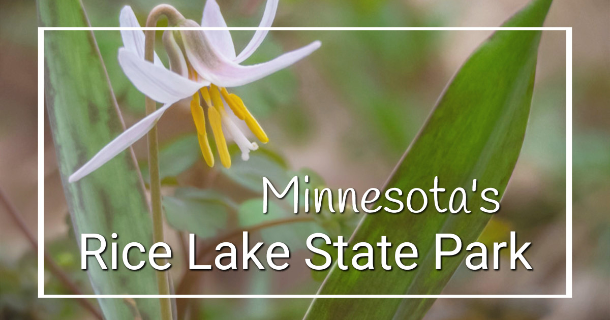
The park is heavily wooded and would be lovely any time of year, but, for me, the best time to visit is spring, when the woodland floor becomes a vast expanse of wildflowers. It’s a fantastic display.
This is also a great place to search for waterfowl during the spring and fall migration.
Sakatah Lake State Park
Sakatah Lake State Park (DNR website) is located on the Sakatah Singing Hills State Trail in southeastern Minnesota, where the Big Woods met the prairie. The park has a nicely wooded bit of lake shore.
You can find a great woodland retreat in Sakatah Lake State Park.
It’s a wonderful place for a bike trip.
Whitewater State Park
Whitewater State Park (DNR website), located in the bluff country of southeastern Minnesota, features a sometimes dramatic karst landscape, wildflowers, and streams with rainbow trout.
Trout fishing is popular in Whitewater State Park, but it’s also a great spot for hiking.
[/expander_maker]
Southwest Minnesota state parks
Originally much of this area was prairie or oak savanna, but park visitors will find a variety of landscapes. A couple of parks have bison, and many include historic sites related to Native American history and/or conflict between Native people and white settlers.
Late summer and early fall are beautiful times to visit southwestern Minnesota’s parks.
Big Stone Lake State Park
Big Stone Lake State Park (DNR website) is noted for its fishing and lakeshore apple orchards. The park is located near Ortonville in southwestern Minnesota.
Blue Mounds State Park
Blue Mounds State Park (DNR website), located in the southwestern corner of the state near Luverne, used to be one of my favorite parks. The park features purple quartzite cliffs that rise above a prairie where a small herd of buffalo may be seen grazing.
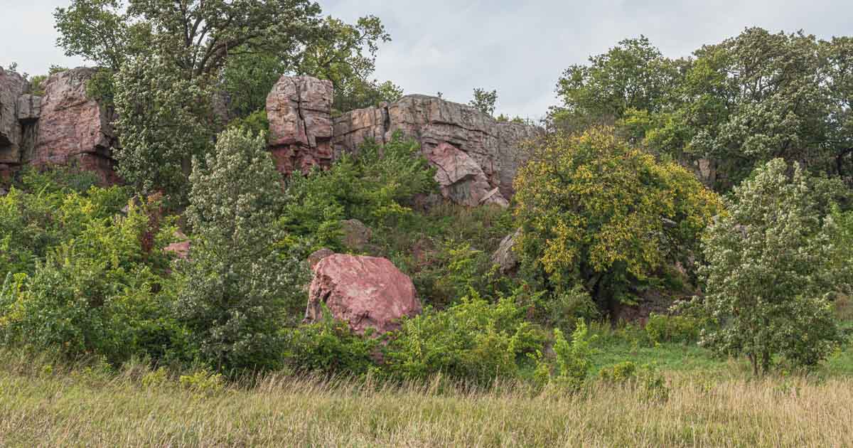
The quartzite cliffs in Blue Mounds State Park were once quarried. Now they are just part of the scenery.
Changes in the park over the years to accommodate an expanded buffalo herd and address flooding have severely reduced easy access to many of the quartzite features and boulders I loved so much. Be prepared for a hike to enjoy the best of this beautiful park. And take the bison tour!
[expander_maker more=”See more southwest Minnesota state parks. . . ” less=”Read less”]
Camden State Park
Camden State Park (DNR website), located along the Redwood River in southern Minnesota, features a mix of woodlands, prairies, and marshes.
Flandrau State Park
Flandrau State Park (DNR website) offers several different landscapes and a sand-bottom swimming pool along the Big Cottonwood River near New Ulm in south-central Minnesota.
Fort Ridgely State Park
Fort Ridgely State Park (DNR website) in southern Minnesota offers hiking and golfing along with the Fort Ridgely Historic Site.
Within the state park, a reconstructed part of Fort Ridgely tells the story of this place and the clash between those who had lived here for generations and land-hungry new-comers.
This park is only open seasonally, and the reconstructed fort is open on an even more limited basis.
Glacial Lakes State Park
Glacial Lakes State Park (DNR website) highlights a prairie landscape shaped by the movement of ancient glaciers. With a mix of rolling prairie, wooded hills, and water, this is a lovely place for easy hiking. It’s located near Starbuck, in central Minnesota.
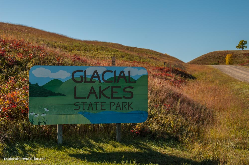
I suspect it would be lovely in mid- to late-summer, when flowers are blooming. But I know it’s a really gorgeous spot for an early fall hike.
Greenleaf Lake State Recreation Area
Greenleaf Lake State Recreation Area (DNR website), located between Hutchinson and Litchfield in south-central Minnesota, includes a number of lakes and wetlands. This is a day-use only site with no facilities.
Kilen Woods State Park
Kilen Woods State Park (DNR website) features a few miles of hiking trails along the Des Moines River near Lakefield in southern Minnesota. While created to protect the woods (and the woods are nice), the surrounding prairie is lovely when it is blooming in summer.
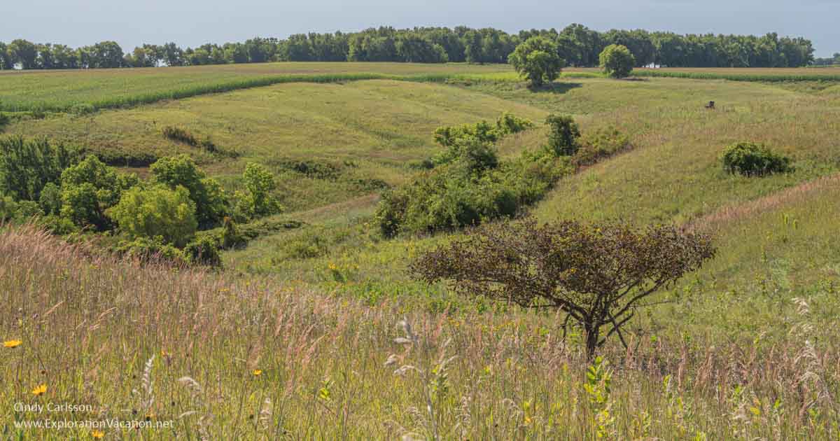
Kilen Woods State Park features a lowland woodland and the prairie’s rolling hills.
This is a small park that provides a nice outdoor experience, but without any spectacular scenery or other natural features.
Lac qui Parle State Park
Lac qui Parle State Park (DNR website) was named for the “lake that speaks” and the park largely focuses on the lake and the fish and wildlife that make this area home. There is also a swimming beach here.
Lake Shetek State Park
Lake Shetek State Park (DNR website), located in the southwestern corner of the state, features its namesake lake (perfect for swimming, boating, or fishing) and a pioneer cabin that tells a bit of the complicated story of early settlers in this area.
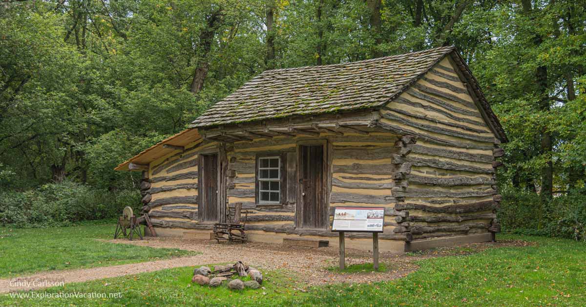
Beautiful Lake Shetek State Park was the site of some brutal history.
It has a lovely wooded lake shore and lots of deer!
Minneopa State Park
Minneopa State Park (DNR website), located just outside Mankato, features a two-tier waterfall on the Minneopa River, a herd of bison, and the remains of a mill.
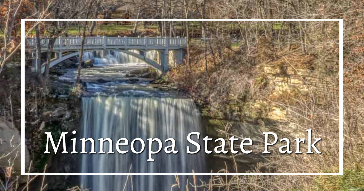
The park is split into two segments, with the visitor center and waterfall in one and the campgrounds and bison in the other. (Note that the bison and the campers are well-separated from each other.)
Take a mini-safari through the bison enclosure while you are at Minneopa.
The small but growing herd of bison is in a large fenced area that visitors are allowed to drive through. (Just stay in your car!)
Minnesota Valley State Recreation Area
Minnesota Valley State Recreation Area (DNR website), located in the southern part of the Minneapolis/St. Paul metropolitan area, includes the Minnesota Valley State Trail along the Minnesota River. (If you’ve ever flown into MSP, you’ve probably seen the MVSRA, as it covers much of the bottomlands along the river in either direction from the airport.) It’s a great spot for birdwatching.
Monson Lake State Park
Monson Lake State Park (DNR website), located in central Minnesota near Willmar, was created as a memorial to settlers killed in the US-Dakota War of 1862. The park is tiny, with fishing and bird watching as the main activities available. There is a short hiking trail and a gorgeous historic campground within the park.

Established as a memorial that hasn’t aged well, the park is a good spot for its fishing.
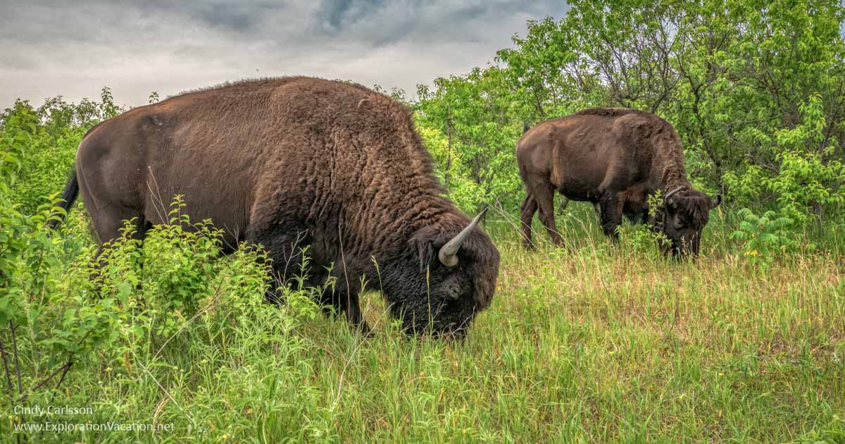
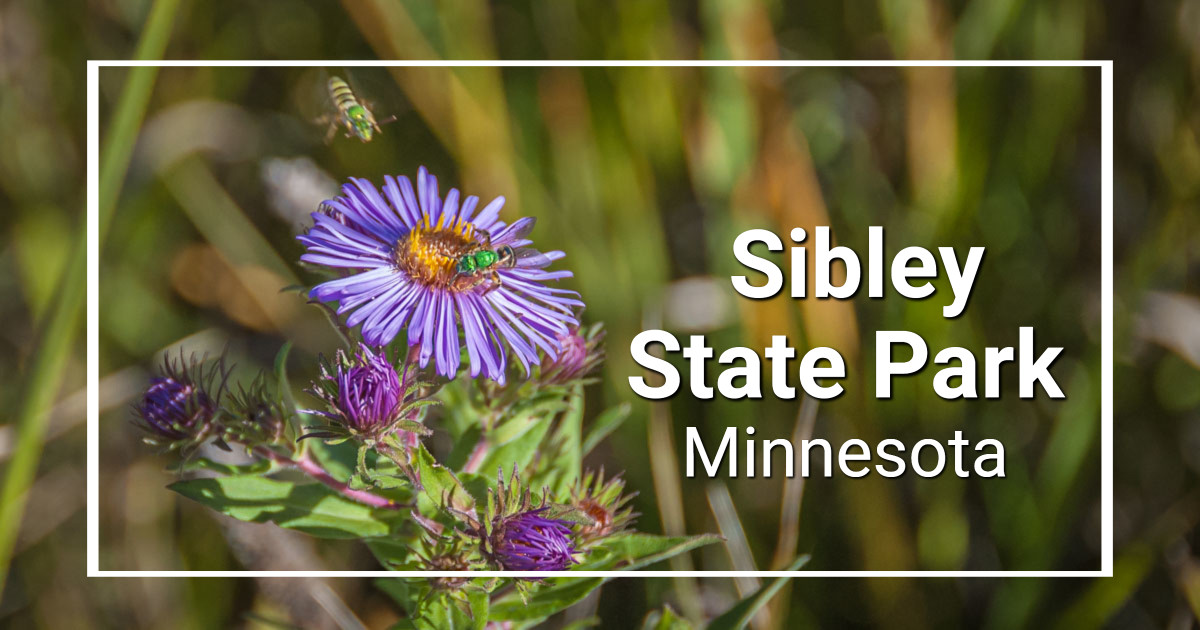
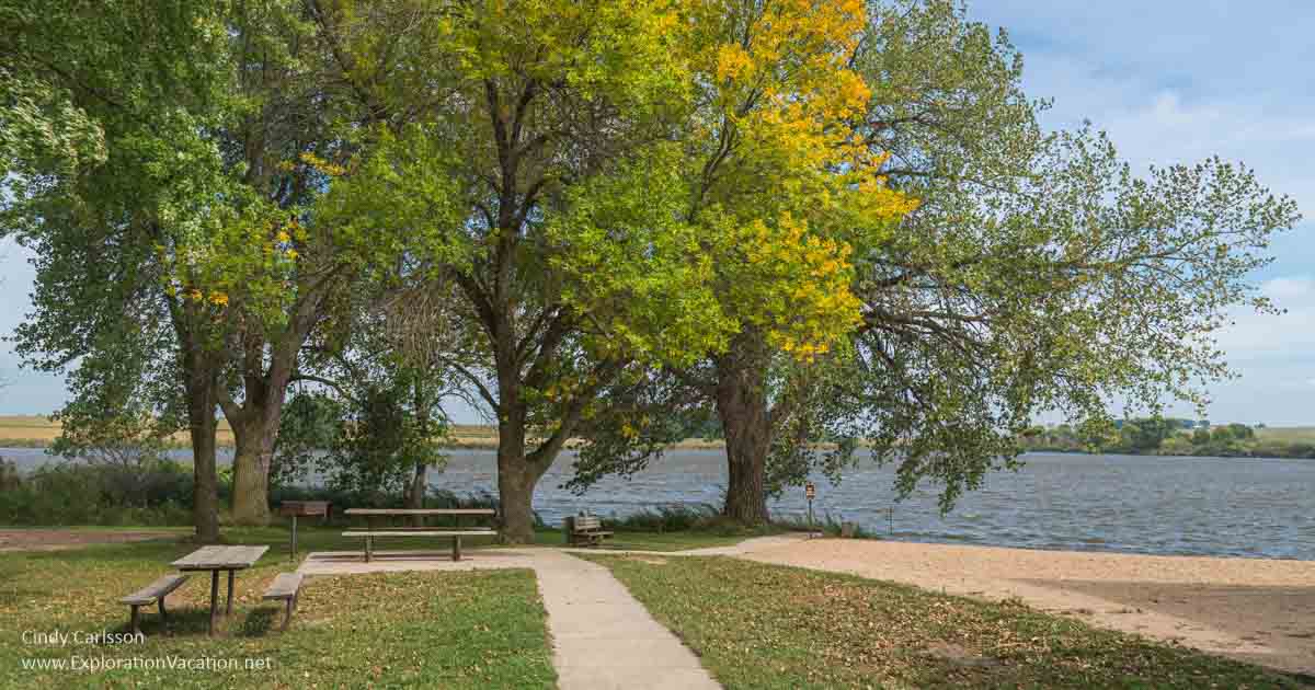
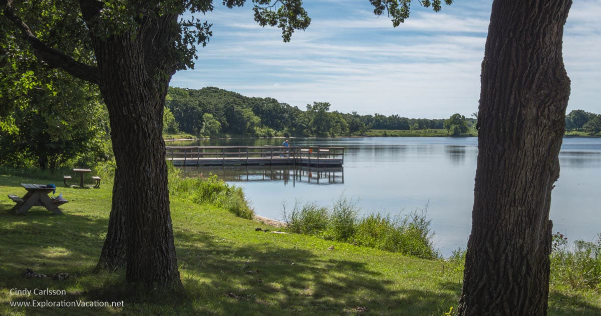
Sibley State Park
Sibley State Park (DNR website), located near Willmar in central Minnesota, has five lakes, sweeping prairies, and offers a wide range of activities. There are good fall colors here, both in the wooded areas and the prairies.
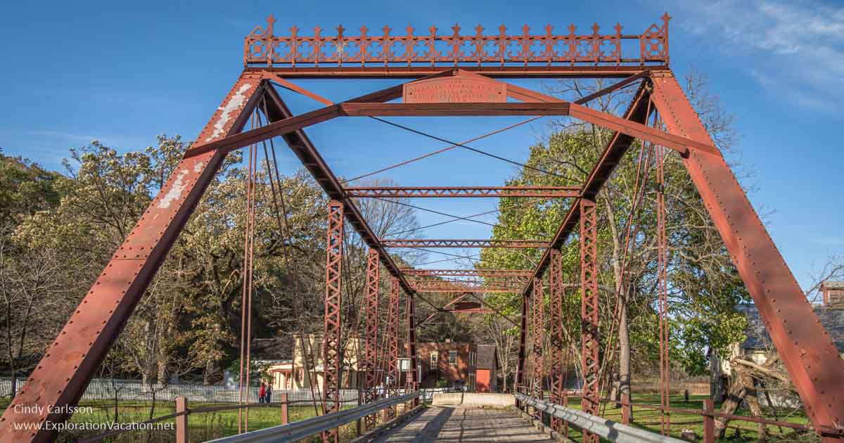
Split Rock Creek State Park
Split Rock Creek State Park (DNR website) in southwestern Minnesota features the largest lake in Pipestone County and a beach. A stone bridge here was built by the WPA in 1937.
Split Rock Creek has a nice sand beach — a rarity in this part of Minnesota.
This is a small park that mostly serves local residents. If you are in the area and looking for a beach, it’s worth stopping here. Otherwise it doesn’t warrant a special trip.
Upper Sioux Agency State Park (CLOSED)
Upper Sioux Agency State Park (DNR website) is now closed. The park was turned over to the Upper Sioux Community early in 2024. The area is no longer open to non-tribal members.
This beautiful land was the site of starvation and death for the Dakota people during the summer of 1862 when the U.S. Government failed to provide food promised to the Dakota by treaty. The property holds great significance to the Upper Sioux Community. Managing this area as a recreational site was inconsistent with this profound history.
The site includes several historic buildings from the Upper Sioux /Yellow Medicine Agency. What becomes of those buildings and the land once held as a state park is now in the hands of the people whose ancestors lived and died here.
[/expander_maker]
Central Minnesota state parks
Many parks in central Minnesota preserve prairie landscapes or lake areas.
Summer at Glendalough State Park.
Charles A. Lindbergh State Park
Charles A. Lindbergh State Park (DNR website), located along the Mississippi and across the street from the childhood home of Charles Lindbergh in Little Falls, has a couple of lovely historic buildings in the picnic area. It’s a small park, but with a nice camping area and river access.

Lindberg State Park is small, but has some interesting historic buildings.
The Lindbergh home is managed by the Minnesota State Historical Society and is open to the public on a rather limited basis.
Crow Wing State Park
Crow Wing State Park (DNR website) is located near the north-central Minnesota city of Brainerd. This park has nice wooded trails, a lovely oak savanna/prairie, and river access.
It also has an important historic component as the site of an Indian village and the abandoned pioneer town of Crow Wing. (And a really sad history that shows how different relations between white settlers and the state’s Native American population could have been.) While only one building remains from the days when Crow Wing was one of the state’s most important settlements, it’s a beautiful place to contemplate the changes time brings.
The only remaining building from the once-bustling city of Crow Wing.
The park has a mix of woodland, prairie, and wetlands along the Mississippi River. It also has a modern chapel, picnic area, interpretive center, campground, and one very, very basic seasonal camper cabin.
[expander_maker more=”See more Central Minnesota state parks. . . ” less=”Read less”]
Glacial Lakes State Park
Glacial Lakes State Park (DNR website) highlights a prairie landscape shaped by the movement of ancient glaciers. With a mix of rolling prairie, wooded hills, and water, this is a lovely place for easy hiking. It’s located near Starbuck, in central Minnesota.
I suspect it would be lovely in mid- to late-summer, when flowers are blooming. But I know it’s a really gorgeous spot for an early fall hike.
Glendalough State Park
Glendalough State Park (DNR website), located near Battle Lake in central Minnesota, is noted for its heritage fishing opportunities (no motors allowed) and the historic Glendalough Lodge.
A fall day on the prairie in Glendalough State Park.
Most of the park is prairie, with lovely late summer/early fall color.
Greenleaf Lake State Recreation Area
Greenleaf Lake State Recreation Area (DNR website), located between Hutchinson and Litchfield in south-central Minnesota, includes a number of lakes and wetlands.Only limited day-use activities are available.
Lake Carlos State Park
Lake Carlos State Park (DNR website) is located on the Alexandria chain of lakes, a popular area for boating, fishing, and other activities on the water. The park has a variety of landscapes, including a good swimming beach, rolling hills, lakes, marshes, and a tamarack bog. It also has a large conference center.
Lake Carlos State Park has a lovely site along the lake and lots of infrastructure for groups.
Lake Maria State Park
Lake Maria State Park (DNR website) offers hiking trails through a maple and basswood forest just outside the Minneapolis/Saint Paul metro area.
Fall is beautiful at Lake Maria State Park.
Maplewood State Park
Maplewood State Park (DNR website) is located near Pelican Rapids in west-central Minnesota. This large park has eight major lakes nestled between forested hills.
Monson Lake State Park
Monson Lake State Park (DNR website), located in central Minnesota near Willmar, was created as a memorial to settlers killed in the US-Dakota War of 1862. The park is tiny, with fishing and bird watching as the main activities available. There is a short hiking trail and a gorgeous historic campground within the park.
Established as a memorial that hasn’t aged well, the park is a good spot for its fishing.
Sibley State Park
Sibley State Park (DNR website), located near Willmar in central Minnesota, has five lakes, sweeping prairies, and offers a wide range of activities. There are good fall colors here, both in the wooded areas and the prairies.
[/expander_maker]
Northwest Minnesota parks
Parks in northwestern Minnesota usually feature a mix of prairie and woodlands around a lake or river.
Summer and fall are lovely seasons in western Minnesota parks.
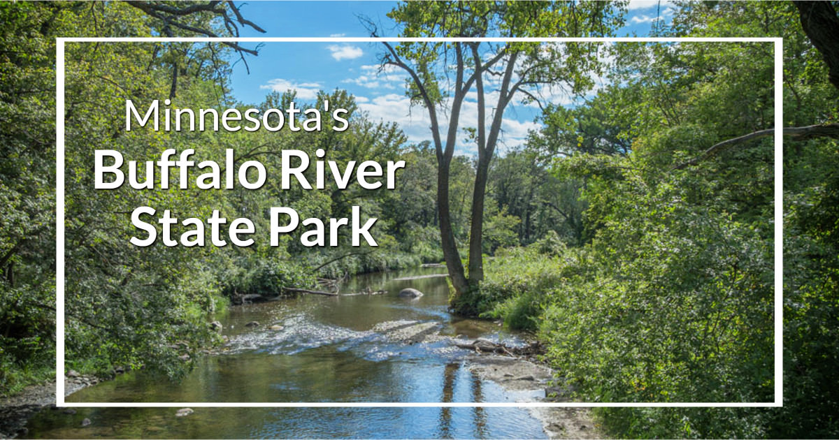
Buffalo River State Park
Buffalo River State Park (DNR website) is a prairie and mixed woodland park near Moorhead in northeastern Minnesota. The park includes land on both sides of the Buffalo River (with a few scenic views). It used to have a man-made swimming hole, but that doesn’t seem to be maintained any longer.
Lake Bronson State Park
Lake Bronson State Park (DNR website), located in northwestern Minnesota, is located where the prairie meets the woods. The park provides a wide range of water activities.
Maplewood State Park
Maplewood State Park (DNR website) is located near Pelican Rapids in west-central Minnesota. This large park has eight major lakes nestled between forested hills.
Old Mill State Park
Old Mill State Park (DNR website) preserves a bit of the past at the edge of the prairie in northwestern Minnesota. The park includes an old flour mill, log cabin, swimming beach, and trails.
Red River Valley State Recreation Area
Red River State Recreation Area (DNR website), located in East Grand Forks in northwest Minnesota, was created after the 1997 floods that destroyed portions of the city. This is land that once supported a neighborhood, the bare outlines of which can still be seen. It’s a peaceful spot along the (usually calm) Red River.
Northern Woodland parks
Minnesota’s northern woodlands are the home of some of the state’s most iconic lake and forest scenery. While the original forest was largely pine and birch, today’s woodlands include a mix of trees for spectacular fall color. And, of course, Itasca State Park is famous as the head of the Mississippi River.
A still morning at McCarthy Beach.
Discover more things to see and do in the Northwoods at Exploring Minnesota Lake Country and the Range.
Bear Head Lake State Park
Bear Head Lake State Park (DNR website) is located at the edge of the Boundary Waters Canoe Area near Ely. It’s a beautiful park in one of the most beautiful areas of the state, with both developed and rustic campgrounds.
Bear Head Lake State Park is everything you expect in a northern Minnesota park!
A friend once told me that Bear Head was his favorite Minnesota state park. I can see why, as it is beautiful, but also offers opportunities for a wide variety of state park experiences — including easy access to sites that feel very remote.
Big Bog State Recreation Area
Big Bog State Recreation Area (DNR website), located in far northern Minnesota, may be the state’s last true wilderness. A mile-long boardwalk allows visitors to enter the little visited world of a peat bog where rare plants, animals, and birds can be found.
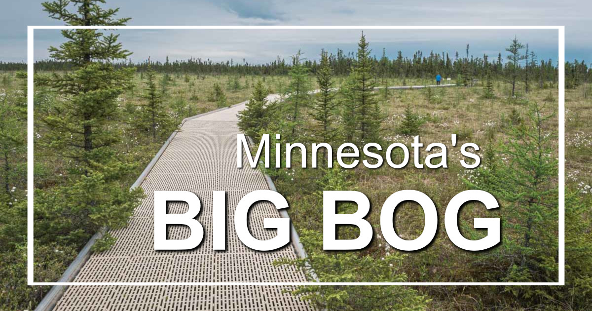
This park is home to various rare orchids and carnivorous plants, but you need good timing and sharp eyes to spot them.
For those seeking a more traditional park experience, part of the park is focused on outdoor recreation, with camping, hiking, swimming, and fishing available along Upper Red Lake and the Tamarack River.
[expander_maker more=”See more Northern woodlands state parks. . . ” less=”Read less”]
Crow Wing State Park
Crow Wing State Park (DNR website) is located near the north-central Minnesota city of Brainerd. This park has nice wooded trails, a lovely oak savanna/prairie, and river access.
It also has an important historic component as the site of an Indian village and the abandoned pioneer town of Crow Wing. (And a very sad history that shows how different relations between white settlers and the state’s Native American population could have been.) While only one building remains from the days when Crow Wing was one of the state’s most important settlements, it’s a beautiful place to contemplate the changes time brings.
The only remaining building from the once-bustling city of Crow Wing.
The park has a mix of woodland, prairie, and wetlands along the Mississippi River. It also has a modern chapel, picnic area, interpretive center, campground, and one very, very basic seasonal camper cabin.
Cuyuna Country State Recreation Area
Cuyuna Country State Recreation Area (DNR website) is a peaceful landscape of reclaimed hills and crystal-clear lakes from the days when this area was an active iron mine.
Father Hennepin State Park
Father Hennepin State Park (DNR website), located along Lake Mille Lacs in north central Minnesota, features a sandy beach and water access for boaters.
Fall along Mille Lacs at Father Hennepin State Park.
Most of the park is wooded, and there is a good chance of spotting white-tailed deer right in the campground.
Franz Jevne State Park
Franz Jevne State Park (DNR website) is located along the Rainy River if far northern Minnesota. It sits along the Rainy River and looks like a good spot for hiking. It’s pretty enough, but not spectacular and very small. It does look like a good place to fish.
Garden Island State Recreation Area
Garden Island State Recreation Area (DNR website) is about as remote as you can get, located on an island 19 miles from Zipple Bay State Park in Minnesota’s far north.
Hayes Lake State Park
Hayes Lake State Park (DNR website), located near Roseau in northwestern Minnesota, is a wilderness area that claims to have plenty of wildlife and birds.
Hill Annex Mine State Park (CLOSED)
Hill Annex Mine State Park (DNR website), located in Calumet in northern Minnesota, is closed as of May 2024. The park, which included buildings on the National Register of Historic Places, told the history of Minnesota’s iron mines and the immigrants who worked in them. The park is permanently closed, as mining resumes at this site.
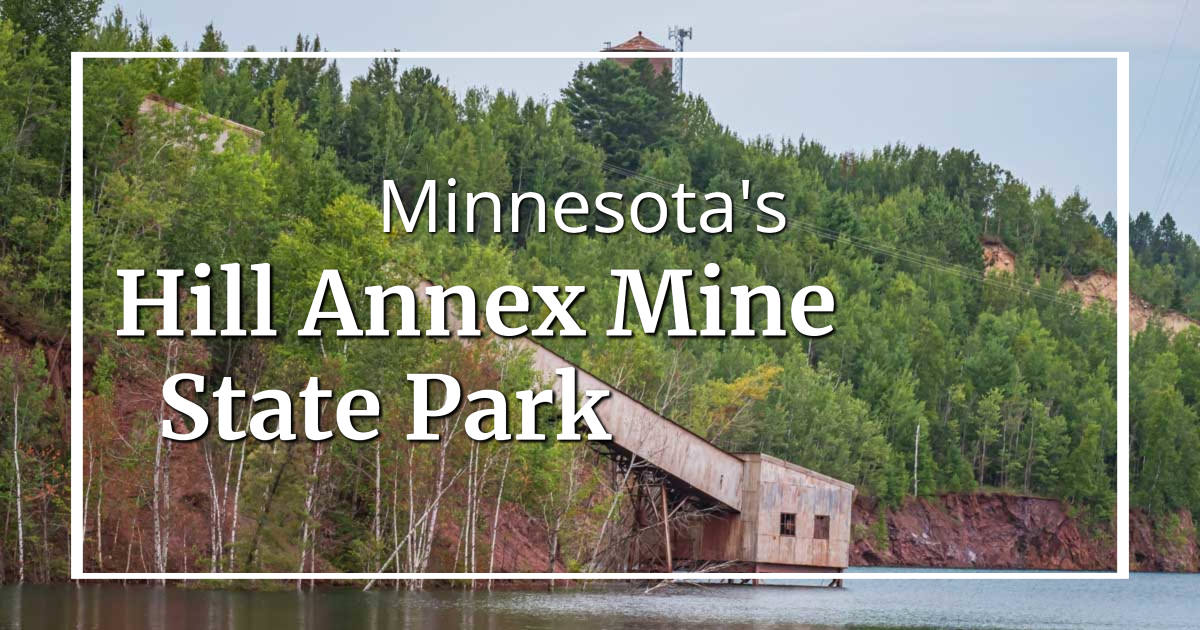
Learn more about the history of Hill Annex Mine and why it was a state park.
Hill Annex is located directly on the Mesabi State Trail.
Iron Range OHV State Recreation Area
Iron Range OHV State Recreation Area (DNR website), located near Gilbert in north-central Minnesota, is the one park I have no interest in visiting, as it was developed to serve off-road vehicles. Not my thing!
Itasca State Park
Itasca State Park (DNR website) is the headwaters of the Mississippi River. You can easily walk across the mighty Mississippi here just by walking along some stepping stones in the river.
It’s easy to cross the mighty Mississippi when you are in Itasca State Park!
It is also Minnesota’s oldest state park and the home of towering old growth forest. This northwestern Minnesota park has a classic north woods lodge, camper cabins, and plenty of space for hiking and biking when you get tired of wading in the shallow waters that become the Mighty Mississippi. This is a very busy park, so plan ahead if you are looking to stay overnight.
La Salle Lake State Recreation Area
La Salle Lake State Recreation Area (DNR website), located near Itasca State Park in northwestern Minnesota, is the state’s newest state recreation area. It features pine forests and the state’s deepest lake. It looks like it would be gorgeous in fall.
La Salle Lake State Recreation Area is a great spot for a fishing getaway on a beautiful, quiet lake.
This is a relatively new park and seems quite undiscovered. That will change, as this is a gorgeous place with modern camping facilities.
Lake Bemidji State Park
Lake Bemidji State Park (DNR website), near Bemidji in north-central Minnesota, is a popular spot for outdoor activities both on land and on the water.
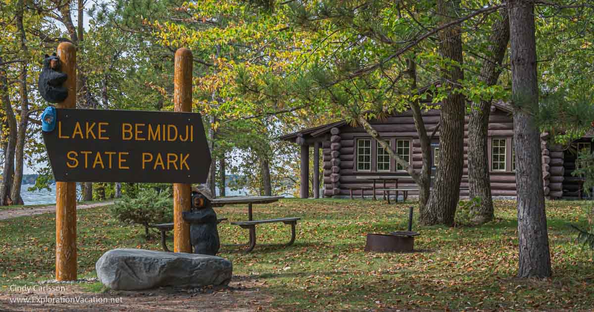
There’s plenty to do at Lake Bemidji State Park even when it’s too windy to be out on the lake.
It is also home to a tamarack and spruce bog with a variety of rare and unusual plants. I’ve only visited the developed area around the beach, so I need to get back to check out the orchids and insect-eating plants!
This park suffered severe wind damage the other year that destroyed many trees and some park facilities. It lost many of its beautiful old trees.
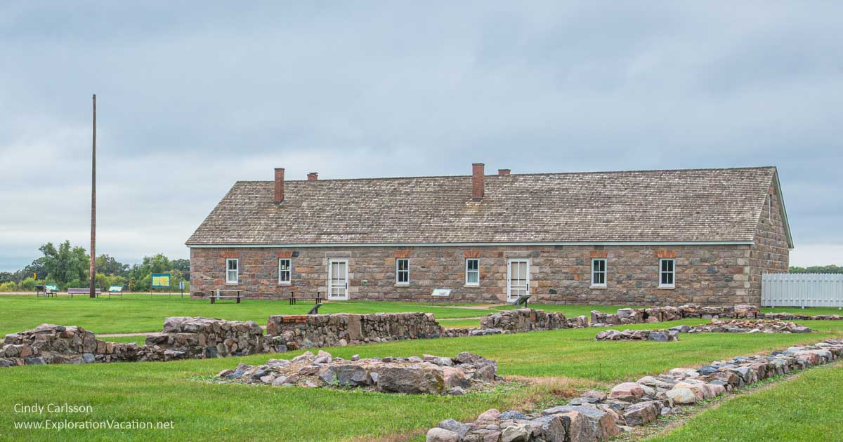
Lake Vermilion/Soudan Underground Mine State Park
Lake Vermilion/Soudan Underground Mine State Park (DNR website) was, briefly, two separate parts. And the two pieces couldn’t be more different.
- The oldest of the two is the Soudan Underground Mine, which is Minnesota’s oldest underground iron mine.
- The newer addition to Minnesota’s park system started with an inland campground and a picnic area and boat launch along a bit of shoreline along one of Minnesota’s most iconic northern lakes. Now it seems to have expanded to include an off-road area and campground. There’s a lot of land here, so there could be more coming.
The Soudan Underground Mine section of the park allows visitors to go down into the former mine (the state’s deepest) as part of a tour. The site preserves various mining facilities, but also has hiking trails. While the preserved buildings are interesting, the highlight really is the trip down into and through the mine.
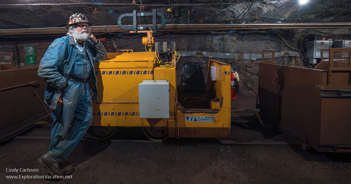
Guided tours take visitors deep under the surface of the earth at the Soudan Underground Mine.
As of 2026, underground mine tours have returned. (Flooding shut them down for a couple of years.)
Lake Vermilion connects to the Boundary Waters, and this new section of the park provides visitors with access to one of Minnesota’s most beautiful lakes. The park is still being developed, but a large modern campground (NOT along the shore) is open. There is also a picnic area with views of the lake and a shoreline picnic area with docks for boat access.
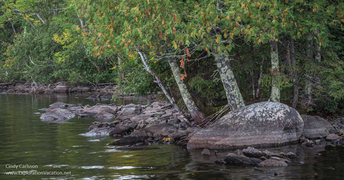
Shoreline along a cove on Lake Vermilion.
McCarthy Beach State Park
McCarthy Beach State Park (DNR website) is described as a lake-filled wonderland near Hibbing in northeastern Minnesota. It is perfect for water sports, but also includes trails for hiking, biking, horseback riding, skiing, and snowmobiling. The park has two sections with campgrounds: The main park has gorgeous sites along or near the water and beautiful beach-side day-use facilities. The rustic camping area has few facilities, but is absolutely lovely and peaceful.
While McCarthy Beach State Park is best known for its beach, heavily wooded trails and smaller lakes in the park are worth visiting.
You’ll find picnic tables along the beach and a marked swimming area.
Mille Lacs Kathio State Park
Mille Lacs Kathio State Park (DNR website) is a National Historic Landmark due to its 9,000 years of human history and archeological significance. While the park offers opportunities to learn about this rich past, it’s also a great place to simply enjoy nature near Lake Mille Lacs.
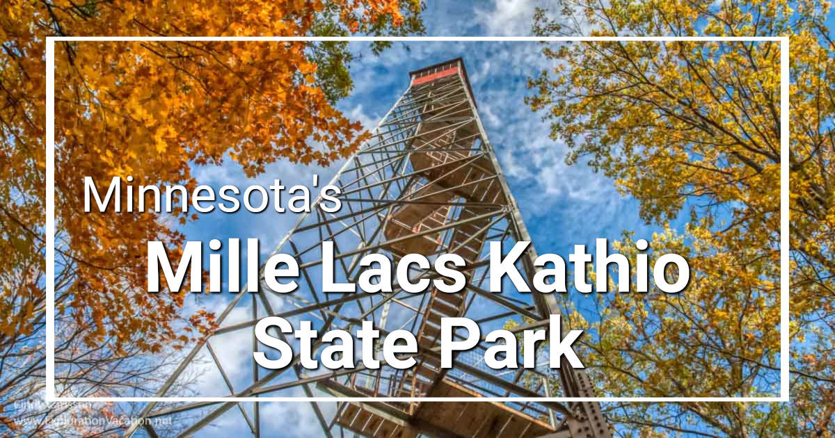
It’s particularly splendid in fall when the leaves are turning brilliant red, orange, and yellow — all of which can be viewed by climbing the lookout tower. Besides hiking trails, the park has a popular network of trails for horseback riding.
Note that park facilities are not located along the shore of Lake Mille Lacs, although it is easy enough to access the lake from other areas.
Fall colors — Observation tower
Savanna Portage State Park
Savanna Portage State Park (DNR website), located in north-central Minnesota, preserves a landscape that would be familiar to the voyageurs and American Indians who traveled the historic Savanna Portage Trail. There is also a trail along the continental divide, where water flows to Lake Superior on one side and the Mississippi River on the other.
Savanna Portage State Park is gorgeous in fall.
Scenic State Park
Scenic State Park (DNR website), located in northern Minnesota, shows why the state’s lake-studded northern woods are so popular. The park completely lives up to its name, with towering trees, gorgeous lakes, and rocky escarpments. A wide variety of hiking trails, including some easy ones, provide an eyeful of scenery.
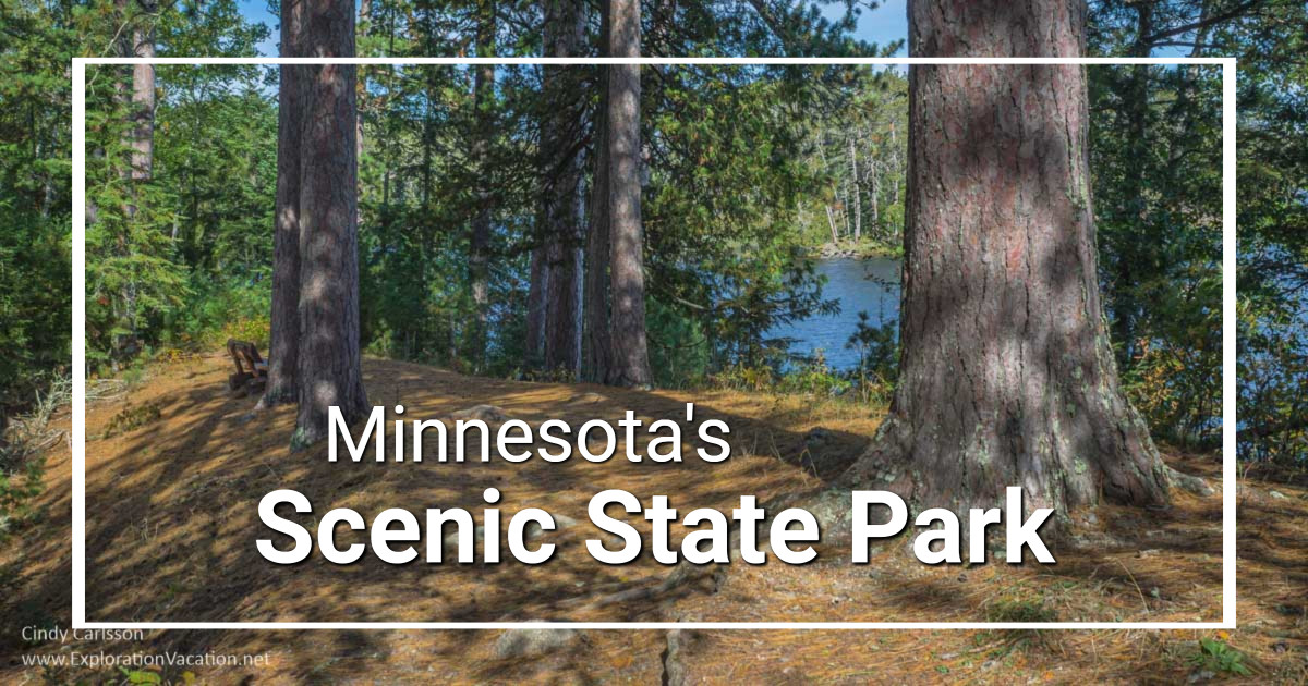
In addition, Scenic State Park’s collection of historic park buildings is listed on the National Register of Historic Places.
The park has a full range of camping options, including a historic camper cabin and several canoe campsites. Non-motorized boat rentals are also available.
Schoolcraft State Park
Schoolcraft State Park (DNR website) was named for Henry Schoolcraft, the first European to visit the headwaters of the Mississippi.
Besides its big pines, Schoolcraft State Park offers access to the Mississippi River.
This small park features a rare forest of virgin white pine (some of which are huge) along the quiet waters of the Mississippi River. A pleasant park if you are in the area, but not worth traveling for.
Zippel Bay State Park
Zippel Bay State Park (DNR website), located on the shores of Lake of the Woods in Minnesota’s far north, features a white sand beach on Minnesota’s largest lake.
[/expander_maker]
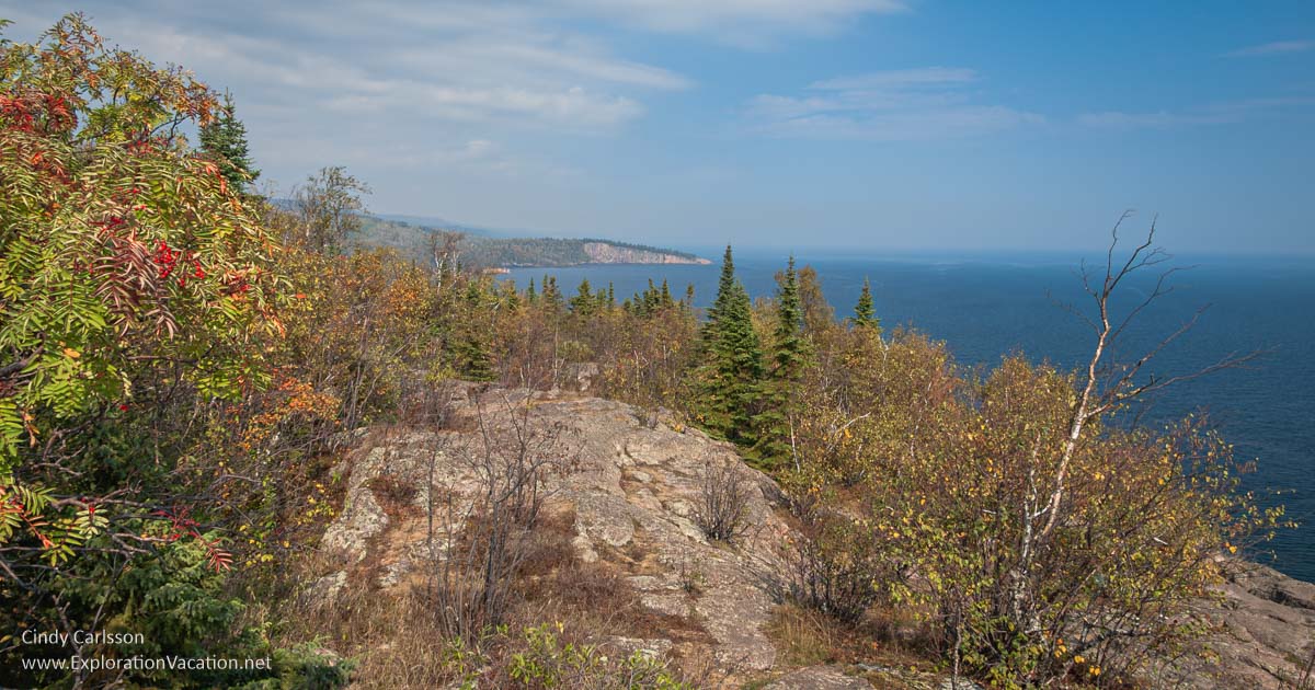
North Shore parks
Minnesota’s favorite escape, the parks along Lake Superior’s north shore feature spectacular cliffs, rocky beaches, a wealth of waterfalls, and a mixed hardwood and pine forest that dazzles visitors with its fall colors.
For more information on what to see and do on the North Shore, check Exploring Minnesota’s North Shore.
Cascade River State Park
Cascade River State Park (DNR website) is now one of my favorite parks along Lake Superior’s North Shore (although there are many great parks up here). It’s a good park for hiking, with maintained trails, plenty of small (and large) waterfalls, and loads of spring flowers (including lady slippers and other native orchids). The picnic area along the road is also worth a stop, as it includes a fabulous bit of shore perfect for a hot day.

True to its name, the Cascade River is almost all rushing water, with waterfalls both small and large.
As of 2026, I believe all the bridges have been repaired after recent storm damage.
Cascades and more — Cascade picnic area on Lake Superior
I often stay at Cascade Lodge at the edge of the park when visiting the North Shore. While not in the park itself, it’s surrounded by the park and has trails that connect to the park. And it has a nice mix of cabins, as well as hotel-style rooms in the beautifully renovated lodge. There’s even a restaurant on-site with good food and live music on weekends.
George H. Crosby Manitou State Park
George H. Crosby Manitou State Park (DNR website), located near Silver Bay on Lake Superior’s North Shore, offers a backwoods experience along the Manitou River and Benson Lake. It’s located inland some distance from Lake Superior.
There’s a lot of water to explore by canoe or kayak in Crosby Manitou State Park.
This park is in a very remote area with numerous streams, wetlands, and bugs.
[expander_maker more=”See more North Shore state parks. . . ” less=”Read less”]
Gooseberry Falls State Park
Gooseberry Falls State Park (DNR website) is home to one of Minnesota’s most iconic waterfalls. The park offers a broad range of activities, but the falls (there are two) are the key reasons to visit. Of course, there is plenty more to see, as the heavily forested park is located right along Lake Superior.
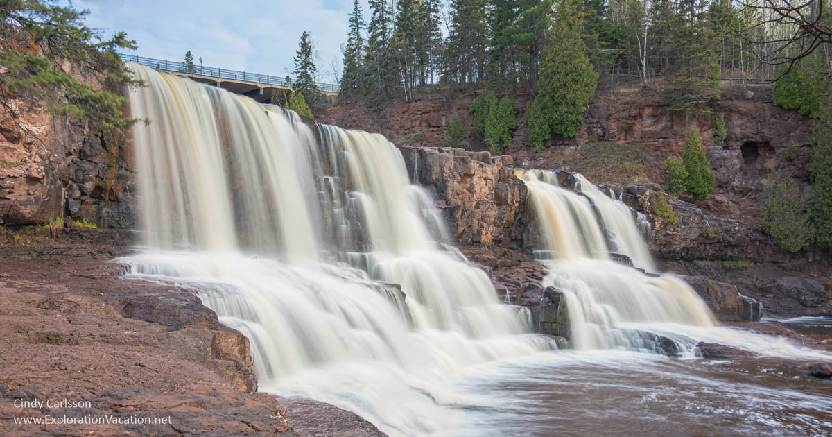
Gooseberry Falls is actually three stunning waterfalls. . . and one of Minnesota’s best-known sights.
This must-stop along Lake Superior’s North Shore is one of Minnesota’s most-loved state parks. But keep in mind that spring can bring flooding that closes all areas along the river (as is the case right now in 2026), while in summer and fall you often can wade in the river below the falls.
Spring Thaw at Gooseberry Falls
Grand Portage State Park
Grand Portage State Park (DNR website), nestled along the Canadian border just inland from Lake Superior in the Grand Portage Indian Reservation, features the 120-foot High Falls on the Pigeon River. The innovative visitor center focuses on the art and culture of the Grand Portage tribe and hosts special exhibits.
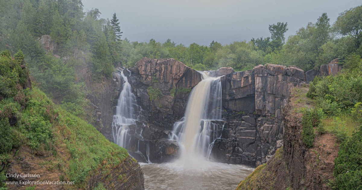
A misty day at Minnesota’s highest waterfall in Grand Portage State Park.
(There is also a Grand Portage National Monument where a Northwest Company fur trading post once stood. The two sites are completely separate stops along the North Shore.)
Judge C.R. Magney State Park
Judge C.R. Magney State Park (DNR website) located along Lake Superior north of Grand Marais in northeastern Minnesota, is the home of the Devil’s Kettle. This waterfall on the Brule River is unusual in that half of the raging water vanishes into a pothole, and no one is exactly sure where it ends up. A mystery worth investigating yourself.
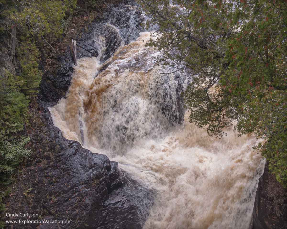
The Devil’s Kettle in Judge Magney State Park. One side drops to a lower waterfall. The other vanishes.
Split Rock Lighthouse State Park
Split Rock Lighthouse State Park (DNR website) is a beautiful park on Lake Superior, but it’s famous for one of Minnesota’s most iconic sites, the historic Split Rock Lighthouse.
The lighthouse is operated by the Minnesota Historical Society, not the DNR. It’s open for tours seasonally, as are the small but fascinating museum and visitor’s center with a large gift shop with many Minnesota-made items. Inside the lighthouse and lighthouse keeper’s house you may meet some of the characters who once lived and worked here. There are also hiking trails and rocky Lake Superior beaches.
Split Rock Lighthouse is Minnesota’s most popular historic site, so be prepared for lots of company when you visit.
Far fewer people explore the rest of the park. So, hit the trails if you want a more peaceful visit.
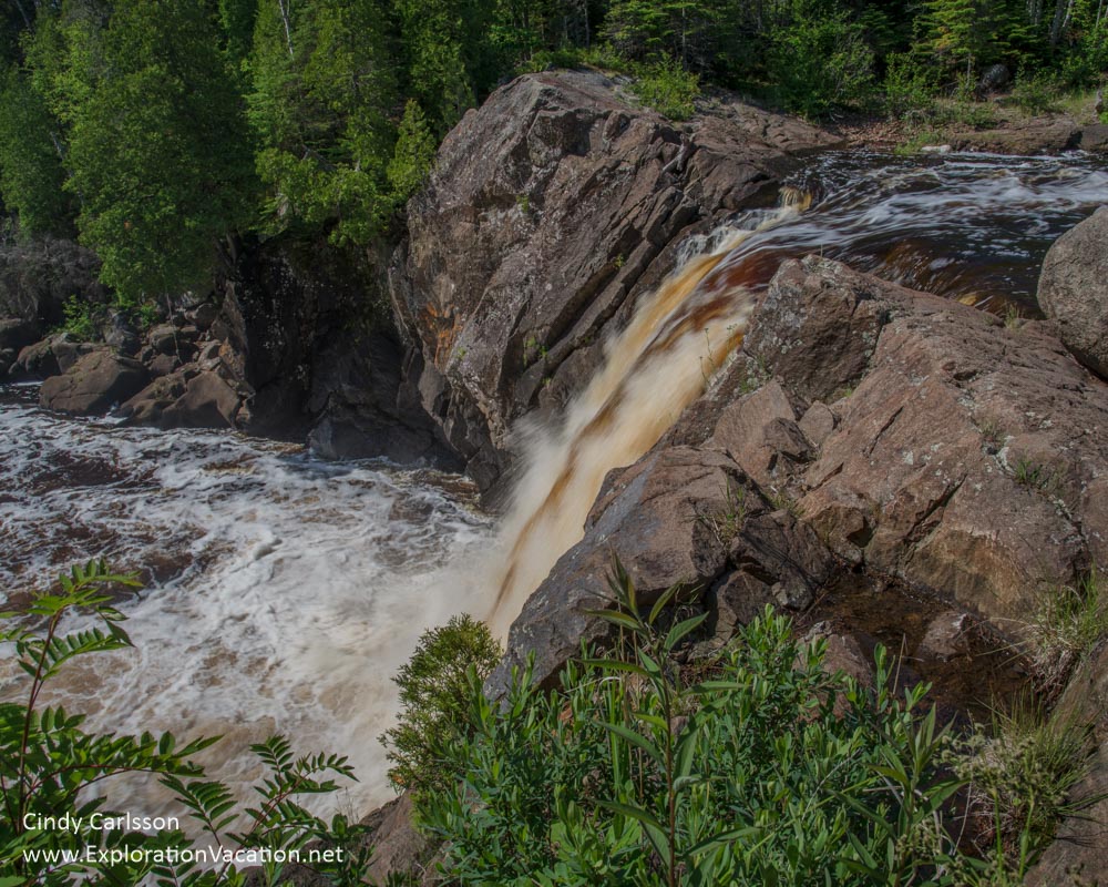
Temperance River State Park
Temperance River State Park (DNR website) is located along Highway 61 on Lake Superior’s North Shore, with the waterfall just feet from the parking area. But that’s just the most dramatic of a series of waterfalls along the Temperance River as it tumbles through the park to the lakeshore. There is also a lovely beach where the river empties into Lake Superior.
The Temperance River races under the highway bridge and over large boulders on its way to Lake Superior.
Be careful all along the Temperance River and stay out of the water above and around the falls. This is a wild section of river and it can be deadly.
Tettegouche State Park
Tettegouche State Park (DNR website), also located along Highway 61 on Lake Superior’s North Shore, is a favorite of mine. It includes a spectacular landscape along the lake and inland, including windswept Shovel Point and the High Falls on the Baptism River. It’s a gorgeous place for a leisurely stroll along the shore or a strenuous hike to one of the waterfalls or inland lakes. A beautiful new visitor’s center makes the park even more accessible.
Tettegouche State Park is known for striking features, including Shovel Point, seen here from Palisade Head, which is also part of the park.
Don’t forget to check out the other side of the park while you are there. Illgen Falls, a guest house, and a bunch of trails await on the hillsides across Highway 61.
Illgen Falls is just a short hike from a parking area in Tettegouche State Park.
[/expander_maker]
Parks along the Saint Croix River and up to Duluth
With plenty of rocks, trees, spring flowers, and rushing water, the parks between the Minneapolis-Saint Paul metro area and Duluth offer wonderful hiking opportunities.
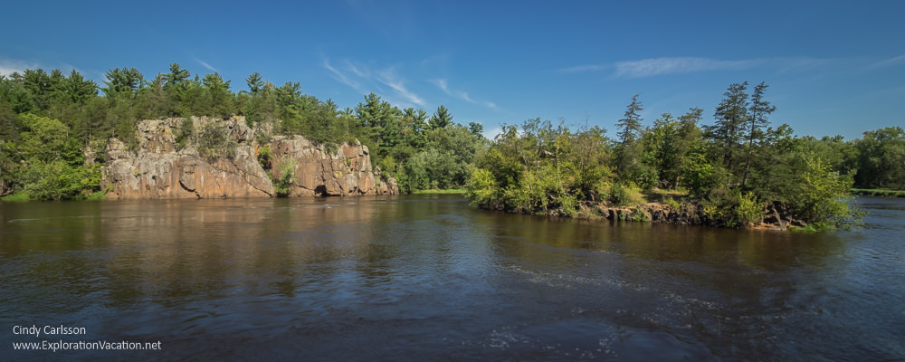
Saint Croix River view from the water near Interstate Park.
Most parks in this area are located right along the Saint Croix River.
Afton State Park
Afton State Park (DNR website) is located in the rolling hills above the St. Croix River along the Minnesota/Wisconsin border at the eastern edge of the Minneapolis-Saint Paul metro area.
Brilliant red sumac signals the start of fall at Afton State Park in Minnesota
Most of the park is oak savanna, although there are also bits of prairie and woodland. And there’s access to the Saint Croix River. The park has many easy hiking trails with limited views of the river – except along the sandy beach!
Many of the trees in the park are oak, making it one of the later parks to reach full color in the fall and perfect for a late fall hike.
Banning State Park
Banning State Park (DNR website) features easy hiking trails and challenging rapids in a gorgeous setting along the Kettle River near Sandstone. There are also ruins and a waterfall – just to provide a few more options for exploration.
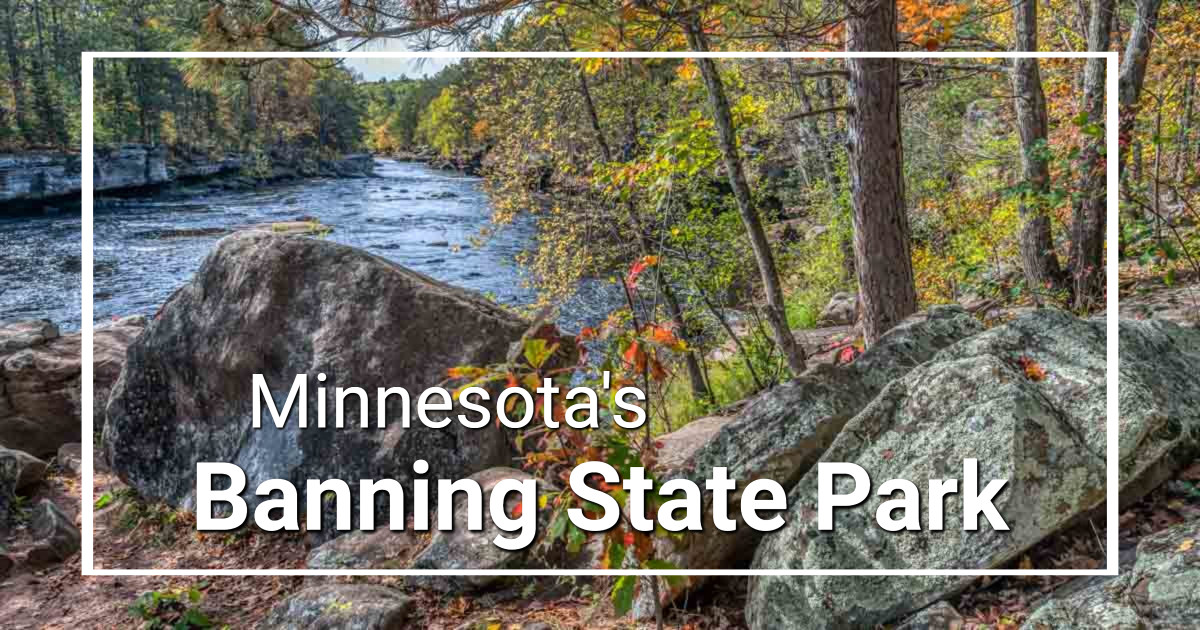
The park offers a full range of camping and activities, but it is a bit of a drive from the Twin Cities metro area. Still, it’s doable as a day trip if you don’t want to spend the night.
[expander_maker more=”See more Saint Croix River state parks. . . ” less=”Read less”]
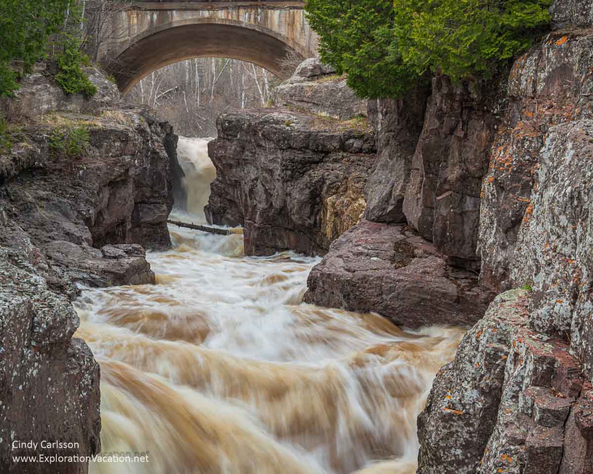
Interstate State Park
Interstate State Park (DNR website) includes both the Minnesota and Wisconsin shores of the St. Croix River near Taylors Falls, just north of the Twin Cities metro area. It has stunning views over the river gorge, but is more famous for its cliffs and glacial potholes.
A paddlewheel boat located just outside the park also provides tours through the river gorge and downstream. This is a gem of a park and a perfect day trip from the Twin Cities. Spring is a great time to explore the park’s wildflowers and potholes. Summer is perfect for kayaking and canoeing.Then kick off fall with a late summer cruise on the Saint Croix.
Jay Cooke State Park
Jay Cooke State Park (DNR website), a beautiful wooded park in northeastern Minnesota, is known for its swinging bridge, odd rock formations, spring wildflowers, and fall leaves.
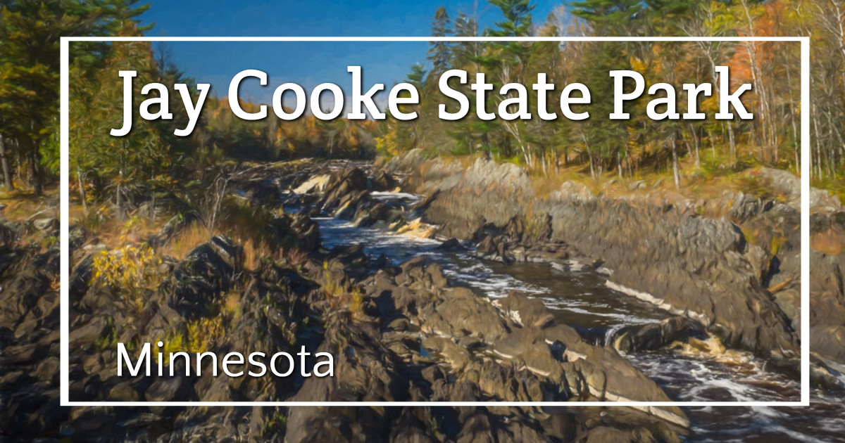
This is a geologically unique area with unusual rock outcroppings visible all along the river. There is also a historic pioneer cemetery located within the park.
Moose Lake State Park
Moose Lake State Park (DNR website), located near Moose Lake in northeastern Minnesota, has wooded hills and lakes that offer opportunities for hiking and various water sports. The Agate and Geological Interpretive Center provides information on the rocks, minerals, and geology of Minnesota – but is only open on a limited schedule.
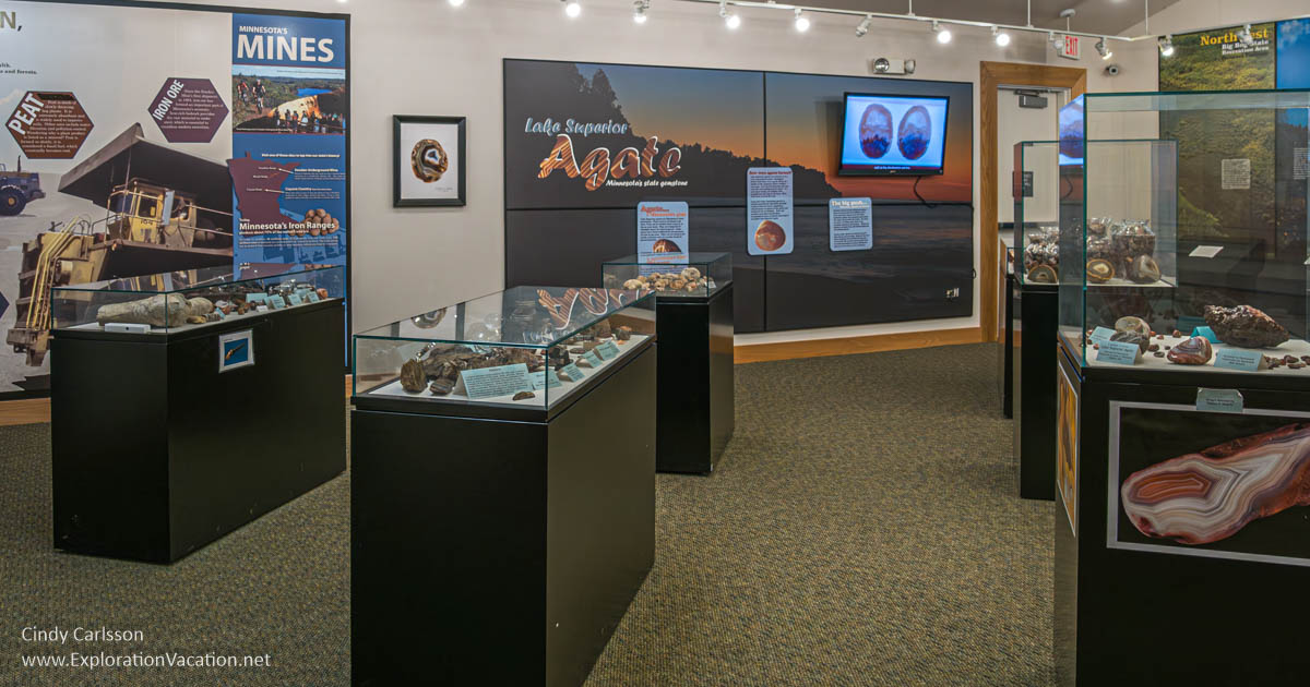
Inside the Agate and Geological Interpretive Center at Moose Lake State Park.
In winter the park has a number of trails open for winter activities.
The park also has a very attractive-looking historic camper cabin.
Saint Croix State Park
Saint Croix State Park (DNR website), located near Hinckley in northeastern Minnesota, is the state’s largest state park. Park activities focus on the St. Croix and Kettle Rivers with scenic trails for hiking, horseback riding, biking, and snowmobiling and great options for water sports. Despite a major timber blow-down in 2011, the park is largely heavily wooded — it’s absolutely lovely in fall.
The park is a bit out-of-the-way, so plan to grab a spot in the campground or one of the many seasonal camper cabins.
Saint Croix Islands State Recreation Area
This one is a bit of a mystery. Saint Croix Islands seems to be a designated state park, but the property seems to be managed by the National Park Service as part of the Saint Croix National Scenic Riverway. Apparently there used to be campsites for boaters at this location, but it’s unclear to me whether these still exist.
Wild River State Park
Wild River State Park (DNR website), located along the Saint Croix River north of the Minneapolis/St. Paul metro area near Center City, is a wonderful place to explore the river and surrounding woodlands.
While the park is lovely year-round, it is a fabulous place to enjoy spring wildflowers and fall colors.
William O’Brien State Park
William O’Brien State Park (DNR website) is also located along the Saint Croix River, at the northern edge of the Minneapolis/St. Paul metro area.
A quiet morning for fishing in William O’Brien State Park.
William O’Brien State Park has a wide variety of landscapes, including shore along the St. Croix, forests, prairies, and various wetlands and small lakes. Recent work in the park has improved trails along the Saint Croix River to increase accessibility. However, a popular fishing lake in the park collapsed and will be under construction at least for the 2026 summer season.
[/expander_maker]
Plan your visit to a Minnesota State Park
Minnesota’s state parks are open throughout the year, although some sites and structures may be closed or subject to limited hours once the summer’s peak tourist season ends. And summer isn’t always the best time to visit, as many parks are at their best when flowers bloom in spring and the leaves turn color in the fall. And, while more difficult to access in winter, a pine forest after a snowfall is enchanting.
Individual park websites once offered up-to-date information on spring flowers and fall colors. Now most of that info seems to be centralized, if available at all. (Scenic and Natural Areas often have better current condition info. So if you are looking for spring bloom or fall color info and there is an SNA near the park, check their website as well as the park’s.)
The one relatively useful resource that still exists is the DNR Fall Color Finder. I say relatively, because the color predictions are now entirely based on past averages without accounting for the realities of the current year’s weather or actual color. So the current conditions section may say an area is past peak while predicting that peak color is still two weeks away. Or the opposite. Fortunately, a few parks still have rangers providing weekly comments on what’s actually happening and what they expect in the coming weeks. Those are gold if you can find them!
Park facilities
All parks have hiking/ski trails and picnic areas, and most have campgrounds. Some have horse and snowmobile trails, docks, cabins, and interpretive centers. A full list of activities and facilities available at each park can be found on the Minnesota Department of Natural Resources website and the park links included above.
Track chair availability
To expand options for wheelchair users, DNR is purchasing all-terrain, electric track trails that can be used on designated trails that are inaccessible via a regular wheelchair. There’s no charge to use these chairs, but reservations are recommended to make sure a chair is available when you visit. Find more information on the DNR website.
Only a limited number of parks have these chairs: Big Bog, Blue Mounds, Camden, Crow Wing, Father Hennepin, Fort Snelling, Frontenac, Hayes Lake, Itasca, Jay Cooke, Lake Bemidji, Lake Bronson, Lake Carlos, Lake Shetek, McCarthy, Maplewood, Mille Lacs Kathio, Moose Lake, Myre-Big Island, Rice Lake, Split Rock Lighthouse, William O’Brien, and Zippel Bay. It’s sort of an odd list, but they seem to be adding a few more parks every year.
Maps
DNR’s park maps can be a little hit or miss both in usefulness and availability. Your best bet is to download a map before you go or try out the Avenza Maps app (available for both Apple and Android) to download GeoPDF maps for various trails, state parks and recreation areas, and the location of public water accesses. (I tried Avenza again this spring, and I can’t make it work. But it seems like a good idea.)
Park fees
Most state parks require visitors to purchase a vehicle permit to use the park. All permits and reservation fees generally should be paid online, although permits can be purchased in the park if the park office is open — but DON’T assume the office will be open when you arrive. If you can get a phone signal, you can buy your permit online from the park entrance, but don’t assume you will be able to access the internet from all parks.
Some fees, including one-day vehicle permits, firewood purchases, and state forest (not state park) camping fees, can be paid through the Yodel app. (Available for both Apple and Android phones.)
[expander_maker more=”Learn more about park fees for entry, camping, and more. . . ” less=”Read less”]
Vehicle permits
All motor vehicles are required to have a daily park permit or annual pass to enter almost any Minnesota state park or recreation area. (There are a couple of exceptions for parks that also serve as highway rest areas.)
Permits used to be available in any park at any time using a payment drop box. As of 2023, drop boxes were removed, and all payments must be made online or at a park office. Given that park offices have limited and often irregular hours (where they exist at all) and cell phone service isn’t always available in the park, visitors are STRONGLY advised to purchase permits BEFORE arriving at the park.
Vehicle day-use permits are $7 per vehicle. Annual permits are $35 per vehicle, but note that they have to be attached to the vehicle and are only valid for that vehicle. (You can’t move it from one car to another without buying a second pass, although the second pass is a little cheaper.) Annual permits are valid for one year from the date of purchase.
Fees are reduced for motorcycles, disabled visitors, and veterans.
Bicyclists do not need a park pass to enter any state park.
You can also get a state park license plate for about $15 plus an annual “donation” of $60 or more. With the license plate, you get free access to all state parks and recreation areas. Plate holders can also buy reduced-priced vehicle stickers for other vehicles. The $60 annual fee (if it’s required, it isn’t really a donation) goes to fund state parks and trails. While it’s called a donation, an annual payment of $60 or more is required. It’s not optional.
State park license plates with the same benefits, but a lower “donation” are also available.
Other fees
There are additional charges for campgrounds, boat rentals, firewood, ice, and other goods and services. Some of these can only be paid online, while others can be purchased at the park when the park office is open.
Fishing in state parks
Anyone over the age of 16 needs a license to fish in any public water in Minnesota. However, Minnesota residents can now fish in most Minnesota state parks without a license. This is limited to lakes completely within a state park (NOT a state recreation area) that do not require a trout stamp. (There’s a map at the above link that shows you which parks fall within this program.)
If the lake isn’t entirely in the park or requires a trout stamp, you’ll still need a fishing license and (if applicable) a trout stamp. Fishing license requirements and fees are listed on the DNR website.
Fishing licenses are valid for one year, running from March 1 to the end of February the following year.
Campground, cabin, and lodge reservations
Reservations are required for all state park campsites and other lodging. However, if space is available, you can make a same-day reservation either online, via phone, or at the park office. You just need to have reserved and paid for your spot before settling in. (In the old days you often could just go to the park, scout out a spot, set up camp, and then register and pay.)
Peak season campground fees begin at $20 per night and go up from there. Making an advance reservation online costs an additional $8. Making it via phone adds $10. (The booking is waived for same-day reservations.) You’ll also pay additional fees for electrical, water, and sewer hookups. Fees for group camps, seasonal reservations, cabins, and lodges are substantially higher. (Yurts and camper cabins start at $80 per night.)
All reservations must be made through Minnesota’s online reservation system. The Common Questions page answers most questions clearly.
Reservations can be made up to 120 days in advance. (Yes, they changed it again.) Once booked, reservations may be changed or canceled, although there may be a fee.
Keep in mind that many state forests also have campgrounds. There’s no fee to enter, and campsite fees tend to be lower, but sites are basic with no services. All state forest sites are available on a first-come, first-serve basis.
[/expander_maker]
Firewood
Please protect our forests by only using approved firewood in the park!! Firewood can bring pests into parks that cause terrible damage to the state’s forests and ecosystems.
- Firewood is available for sale in most parks at the ranger station or via the Yodel mobile app.
- Buy firewood certified by the Minnesota Department of Agriculture anywhere in the state. (Look for this logo.)
- Buy firewood (EXCEPT ash, which must be certified to bring into a state park) in the SAME county as the park you are visiting. (Save your receipt to show the park ranger. It will list the county on it.)
- Manufactured fake logs and some scrap lumber are allowed.
Know the rules before you go. Bringing non-approved firewood into a state park or other Department of Natural Resources land can lead to big fines.
Resources and more information
The Minnesota Department of Natural Resources home page on Minnesota State Parks provides links to all parks, a park finder, free park days, state park reservations, camping basics, and more.
Links to all DNR park and trail plans are found on this webpage, specific plans that may be of interest are listed below.
Many planning documents are also available online, including:
- Minnesota State Parks and Trails System Plan 2015 webpage and plan (PDF)
- Destination Minnesota: A New Direction for Minnesota State Parks and Trails (PDF) an undated (2013 or later) report of the State Parks and Trails Future Strategies Committee
- Division of Parks and Trails Strategic Plan: 2012-2022 webpage and plan (PDF)
- Minnesota State and Regional Parks and Trails Legacy Plan 2011 website and plan (PDF), which was developed as part of a legislative requirement that came with legacy funding provisions.
Interested in what other visitors think about Minnesota State Parks and changes they recommend? Check the 2022 State Park Visitor Survey summary (PDF) or full report (PDF). There are a ton of other state park and trail studies, reports, and research listed on the DNR’s website.
Roy Meyer’s 1991 book Everyone’s Country Estate: A History of Minnesota’s State Parks is a little opinionated and a bit dated. However, it’s an invaluable resource for anyone interested in learning the history behind Minnesota’s state parks. Copies are sometimes available at ABE Books.